National Register of Historic Places listings in Whitley County, Kentucky facts for kids
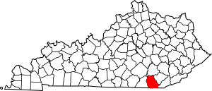
This is a list of the National Register of Historic Places listings in Whitley County, Kentucky.
This is intended to be a complete list of the properties and districts on the National Register of Historic Places in Whitley County, Kentucky, United States. The locations of National Register properties and districts for which the latitude and longitude coordinates are included below, may be seen in a map.
There are 13 properties and districts listed on the National Register in the county.
Current listings
| Name on the Register | Image | Date listed | Location | City or town | Description | |
|---|---|---|---|---|---|---|
| 1 | Bowman Site (15WH14) |
(#85002974) |
Address Restricted |
Lot | A Mississippian mound site also known as the "Bowman Mound" | |
| 2 | Carnegie Library |
(#86000603) |
E. Center St. 36°57′01″N 84°05′38″W / 36.950139°N 84.093750°W |
Corbin | ||
| 3 | Corbin Bank Building |
(#86000604) |
101 Center St. 36°56′58″N 84°05′49″W / 36.949306°N 84.096806°W |
Corbin | ||
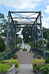
| 4 | East Main Street Bridge |
(#86000605) |
Engineer St. and Lynn Camp Creek 36°57′11″N 84°05′40″W / 36.953111°N 84.094444°W |
Corbin | ||
| 5 | First Christian Church |
(#86000693) |
S. Kentucky and W. 1st St. 36°56′48″N 84°05′51″W / 36.946667°N 84.097500°W |
Corbin | ||
| 6 | Dr. Ancil Gatliff House |
(#80001689) |
S. 5th St. 36°44′27″N 84°09′41″W / 36.740833°N 84.161389°W |
Williamsburg | ||
| 7 | J.B. Gatliff House |
(#77000663) |
10th and Main Sts. 36°44′08″N 84°10′01″W / 36.735556°N 84.166944°W |
Williamsburg | ||
| 8 | Gordon Hill Road Historic District |
(#86000692) |
309-501 Gordon Hill Rd. 36°56′53″N 84°06′02″W / 36.948056°N 84.100556°W |
Corbin | ||
| 9 | Lane Theater |
(#04001255) |
510 Main St. 36°44′28″N 84°09′43″W / 36.741111°N 84.161944°W |
Williamsburg | ||
| 10 | Louisville and Nashville Railroad Depot |
(#78001414) |
Lynn Ave. 36°56′51″N 84°05′44″W / 36.947500°N 84.095556°W |
Corbin | ||
| 11 | Mershon Building |
(#86000606) |
E. Center St. 36°56′58″N 84°05′46″W / 36.949444°N 84.096111°W |
Corbin | ||
| 12 | Williamsburg Armory |
(#02000930) |
S. 2nd St. 36°44′13″N 84°09′25″W / 36.736944°N 84.156944°W |
Williamsburg |

All content from Kiddle encyclopedia articles (including the article images and facts) can be freely used under Attribution-ShareAlike license, unless stated otherwise. Cite this article:
National Register of Historic Places listings in Whitley County, Kentucky Facts for Kids. Kiddle Encyclopedia.


