National Register of Historic Places listings in Henry County, Kentucky facts for kids
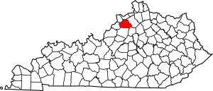
This is a list of the National Register of Historic Places listings in Henry County, Kentucky.
It is intended to be a complete list of the properties and districts on the National Register of Historic Places in Henry County, Kentucky, United States. The locations of National Register properties and districts for which the latitude and longitude coordinates are included below, may be seen in an online map.
There are 12 properties and districts listed on the National Register in the county.
Current listings
| Name on the Register | Image | Date listed | Location | City or town | Description | |
|---|---|---|---|---|---|---|
| 1 | Callaway-Goodridge-Robertson Farm |
(#09001308) |
6041 Kentucky Route 1861 38°23′00″N 85°16′03″W / 38.383222°N 85.267425°W |
Smithfield | ||
| 2 | Confederate Soldiers Martyrs Monument in Eminence |
(#97000692) |
Eminence Cemetery, 2 miles south of the junction of Kentucky Routes 22 and 55 38°21′34″N 85°10′51″W / 38.359444°N 85.180833°W |
Eminence | ||
| 3 | Crutcher House |
(#80001550) |
Mulberry Pike 38°21′36″N 85°10′15″W / 38.360000°N 85.170972°W |
Eminence | ||
| 4 | Eminence Historic Commercial District |
(#79000994) |
Broadway, Main and Penn Sts. 38°22′11″N 85°10′48″W / 38.369722°N 85.18°W |
Eminence | ||
| 5 | Isham Henderson House |
(#87000156) |
Main Cross Rd. 38°26′11″N 85°09′36″W / 38.436250°N 85.160000°W |
New Castle | ||
| 6 | Henry County Courthouse, Jail, and Warden's House |
(#77000621) |
Courthouse Sq. 38°26′02″N 85°10′09″W / 38.433889°N 85.169167°W |
New Castle | ||
| 7 | Samuel Hieatt House |
(#82001569) |
North of Smithfield on Hieatt Rd. 38°25′03″N 85°15′28″W / 38.4175°N 85.257778°W |
Smithfield | ||
| 8 | Highlands |
(#79000995) |
Southwest of Smithfield on Kentucky Route 22 38°21′59″N 85°16′47″W / 38.366389°N 85.279722°W |
Smithfield | ||
| 9 | New Castle Historic Commercial District |
(#16000495) |
Main & Main Cross Sts. 38°26′00″N 85°10′12″W / 38.433320°N 85.169911°W |
New Castle | ||
| 10 | Robert Ricketts House |
(#78001342) |
North of New Castle off U.S. Route 421 38°28′44″N 85°11′11″W / 38.478889°N 85.186389°W |
New Castle | ||
| 11 | Thomas Smith House |
(#78001343) |
524 Cross Main St. 38°25′59″N 85°10′02″W / 38.433056°N 85.167222°W |
New Castle | ||
| 12 | Thompson House |
(#87000567) |
Kentucky Route 22 and Old Giltner Rd. 38°21′58″N 85°11′54″W / 38.366111°N 85.198333°W |
Eminence |

All content from Kiddle encyclopedia articles (including the article images and facts) can be freely used under Attribution-ShareAlike license, unless stated otherwise. Cite this article:
National Register of Historic Places listings in Henry County, Kentucky Facts for Kids. Kiddle Encyclopedia.


