National Register of Historic Places listings in Lincoln County, Kentucky facts for kids
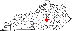
This is a list of the National Register of Historic Places listings in Lincoln County, Kentucky.
This is intended to be a complete list of the properties and districts on the National Register of Historic Places in Lincoln County, Kentucky, United States. The locations of National Register properties and districts for which the latitude and longitude coordinates are included below, may be seen in a map.
There are 22 properties and districts listed on the National Register in the county.
Current listings
| Name on the Register | Image | Date listed | Location | City or town | Description | |
|---|---|---|---|---|---|---|
| 1 | James W. Alcorn House |
(#80001649) |
409 Danville Ave. 37°31′58″N 84°40′09″W / 37.532778°N 84.669167°W |
Stanford | ||
| 2 | Arcadia |
(#76000913) |
South of Shelby City on U.S. Route 127 37°33′37″N 84°47′21″W / 37.560278°N 84.789167°W |
Shelby City | ||
| 3 | Baughman's Mill and Stanford Railroad Depot |
(#78001373) |
Depot and Mill Sts. 37°31′49″N 84°39′50″W / 37.530278°N 84.663889°W |
Stanford | ||
| 4 | John Baughman House |
(#78001374) |
South of Stanford on Kentucky Route 1247 37°30′15″N 84°38′44″W / 37.504167°N 84.645556°W |
Stanford | ||
| 5 | Samuel and Mary Logan Briggs House |
(#75000794) |
315 W. Main St. 37°31′44″N 84°39′52″W / 37.528889°N 84.664583°W |
Stanford | ||
| 6 | Confederate Monument at Crab Orchard |
(#97000682) |
Crab Orchard Cemetery, 0.5 miles east of the junction of Kentucky Routes 39 and 643 37°27′52″N 84°30′10″W / 37.464444°N 84.502778°W |
Crab Orchard | ||
| 7 | Helm-Engleman House |
(#83002808) |
North of Hubble on Engleman Lane 37°36′55″N 84°39′46″W / 37.615278°N 84.662778°W |
Hubble | ||
| 8 | Hoffman House |
(#83002809) |
U.S. Route 27 37°34′47″N 84°36′25″W / 37.579722°N 84.606944°W |
Lancaster | ||
| 9 | Nathan Huston House |
(#83002810) |
Kentucky Route 78 37°28′22″N 84°49′23″W / 37.472778°N 84.823056°W |
Hustonville | ||
| 10 | Lincoln County Courthouse |
(#76000915) |
Main and Lancaster Sts. 37°31′47″N 84°39′41″W / 37.529722°N 84.661389°W |
Stanford | ||
| 11 | John Logan House |
(#75000795) |
East of Stanford at the junction of U.S. Route 150 and Goshen Rd. (Kentucky Route 642) 37°31′50″N 84°38′34″W / 37.530694°N 84.642778°W |
Stanford | ||
| 12 | McCormack Church |
(#76000916) |
4 miles west of Stanford on Kentucky Route 1194 37°31′38″N 84°44′37″W / 37.527222°N 84.743611°W |
Stanford | ||
| 13 | Abraham Miller House |
(#00001083) |
3475 Kentucky Route 300 37°33′34″N 84°44′27″W / 37.559444°N 84.740833°W |
Stanford | ||
| 14 | Dr. Thomas Montgomery House |
(#78001375) |
Somerset St. 37°31′18″N 84°39′44″W / 37.521667°N 84.662222°W |
Stanford | ||
| 15 | Adam Pence House |
(#78001376) |
South of Stanford on Kentucky Route 1247 37°28′06″N 84°38′01″W / 37.468333°N 84.633611°W |
Stanford | ||
| 16 | Richland Farm |
(#04000792) |
5355 Kentucky Route 1194 37°31′07″N 84°47′01″W / 37.518611°N 84.783611°W |
Stanford | ||
| 17 | Stanford Commercial District |
(#86003173) |
Main St. from Somerset St. to 3rd St. 37°31′44″N 84°39′47″W / 37.528889°N 84.663056°W |
Stanford | ||
| 18 | Swope-Dudderar House and Mill Site |
(#79001020) |
East of Stanford on Goshen Rd. 37°33′24″N 84°36′03″W / 37.556667°N 84.600833°W |
Stanford | ||
| 19 | Traveler's Rest |
(#76000914) |
South of Shelby City off Kentucky Route 300 37°33′51″N 84°47′02″W / 37.564167°N 84.783889°W |
Shelby City | ||
| 20 | Walnut Meadows |
(#78001377) |
Southeast of Stanford on U.S. Route 150 37°29′26″N 84°34′05″W / 37.490556°N 84.568056°W |
Stanford | ||
| 21 | William Whitley House State Shrine |
(#73000814) |
2 miles west of Crab Orchard off U.S. Route 150 37°28′05″N 84°33′00″W / 37.468056°N 84.55°W |
Crab Orchard | ||
| 22 | Horace Withers House |
(#87002189) |
Kentucky Route 590 (Hubble Rd.) 37°32′37″N 84°39′08″W / 37.543611°N 84.652222°W |
Stanford |

All content from Kiddle encyclopedia articles (including the article images and facts) can be freely used under Attribution-ShareAlike license, unless stated otherwise. Cite this article:
National Register of Historic Places listings in Lincoln County, Kentucky Facts for Kids. Kiddle Encyclopedia.


