National Register of Historic Places listings in Meade County, Kentucky facts for kids
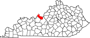
This is a list of the National Register of Historic Places listings in Meade County, Kentucky.
This is intended to be a complete list of the properties and districts on the National Register of Historic Places in Meade County, Kentucky, United States. The locations of National Register properties and districts for which the latitude and longitude coordinates are included below, may be seen in a Google map.
There are 13 properties and districts listed on the National Register in the county.
Current listings
| Name on the Register | Image | Date listed | Location | City or town | Description | |
|---|---|---|---|---|---|---|
| 1 | Brandenburg Commercial District |
(#86000523) |
Main St. 38°00′11″N 86°10′10″W / 38.003056°N 86.169444°W |
Brandenburg | ||
| 2 | Brandenburg Methodist Episcopal Church |
(#84001828) |
215 Broadway 37°59′59″N 86°10′09″W / 37.999722°N 86.169167°W |
Brandenburg | ||
| 3 | Clarkson House |
(#83002825) |
Clarkson Rd. 37°48′48″N 86°06′20″W / 37.813333°N 86.105556°W |
Flaherty | ||
| 4 | Doe Run Creek Historic District |
(#78001386) |
Southeast of Brandenburg off KY 448 37°57′09″N 86°07′34″W / 37.9525°N 86.126111°W |
Brandenburg | ||
| 5 | Doe Run Mill |
(#87002053) |
Kentucky Route 1638 on Doe Run Creek 37°57′35″N 86°07′19″W / 37.959722°N 86.121944°W |
Brandenburg | ||
| 6 | Goff-Baskett House |
(#84001832) |
550 Lawrence St. 38°00′21″N 86°10′37″W / 38.005833°N 86.176944°W |
Brandenburg | ||
| 7 | Jones-Willis House |
(#84001835) |
321 Main St. 38°00′07″N 86°10′11″W / 38.001944°N 86.169722°W |
Brandenburg | ||
| 8 | Meade County Clerk Office-Rankin House |
(#84001836) |
205 Lafayette St. 38°00′13″N 86°10′00″W / 38.003611°N 86.166667°W |
Brandenburg | ||
| 9 | Meade County Jail |
(#84001837) |
125 Main St. 38°00′16″N 86°10′05″W / 38.004444°N 86.168056°W |
Brandenburg | ||
| 10 | Payneville Petroglyphs (15MD308) |
(#89001196) |
Address Restricted |
Payneville | ||
| 11 | Richardson House |
(#84001838) |
547 Lawrence St. 38°00′18″N 86°10′38″W / 38.005°N 86.177222°W |
Brandenburg | ||
| 12 | St. Theresa Roman Catholic Church |
(#77000635) |
3 miles northwest of Rhodelia on KY 144 38°01′48″N 86°26′20″W / 38.03°N 86.438889°W |
Rhodelia | ||
| 13 | Edward Yeakel House |
(#84001839) |
116 Decatur St. 38°00′08″N 86°10′08″W / 38.002222°N 86.168889°W |
Brandenburg |

All content from Kiddle encyclopedia articles (including the article images and facts) can be freely used under Attribution-ShareAlike license, unless stated otherwise. Cite this article:
National Register of Historic Places listings in Meade County, Kentucky Facts for Kids. Kiddle Encyclopedia.


