National Register of Historic Places listings in McCreary County, Kentucky facts for kids
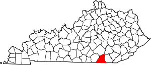
This is a list of the National Register of Historic Places listings in McCreary County, Kentucky.
It is intended to be a complete list of the properties on the National Register of Historic Places in McCreary County, Kentucky, United States. The locations of National Register properties for which the latitude and longitude coordinates are included below, may be seen in a map.
There are 3 properties listed on the National Register in the county.
Current listings
| Name on the Register | Image | Date listed | Location | City or town | Description | |
|---|---|---|---|---|---|---|
| 1 | Barren Fork Coal Camp and Mine Archeological District |
(#97001125) |
Barren Fork Rd., north of Whitley City 36°46′39″N 84°28′07″W / 36.777500°N 84.468611°W |
Whitley City | ||
| 2 | Stearns Administrative and Commercial District |
(#88002528) |
Old U.S. Route 27 36°41′55″N 84°28′36″W / 36.698611°N 84.476667°W |
Stearns | ||
| 3 | Stearns Golf Course |
(#15000654) |
131 Clubhouse Dr. 36°42′07″N 84°28′37″W / 36.7020°N 84.4770°W |
Stearns |

All content from Kiddle encyclopedia articles (including the article images and facts) can be freely used under Attribution-ShareAlike license, unless stated otherwise. Cite this article:
National Register of Historic Places listings in McCreary County, Kentucky Facts for Kids. Kiddle Encyclopedia.


