National Register of Historic Places listings in Robertson County, Kentucky facts for kids
This is a list of the National Register of Historic Places listings in Robertson County, Kentucky.
It is intended to be a complete list of the properties on the National Register of Historic Places in Robertson County, Kentucky, United States. The locations of National Register properties for which the latitude and longitude coordinates are included below, may be seen in a map.
There are 3 properties listed on the National Register in the county.
Current listings
| Name on the Register | Image | Date listed | Location | City or town | Description | |
|---|---|---|---|---|---|---|
| 1 | Johnson Creek Covered Bridge |
(#76000941) |
Northeast of Mount Olivet on Kentucky Route 1029 38°28′52″N 83°58′37″W / 38.481111°N 83.976944°W |
Mount Olivet | ||
| 2 | Thomas Metcalfe House |
(#87000187) |
Off U.S. Route 62 38°29′49″N 84°05′38″W / 38.496944°N 84.093889°W |
Mount Olivet | ||
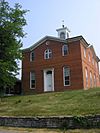
| 3 | Robertson County Courthouse |
(#78001394) |
Court St. 38°31′54″N 84°02′09″W / 38.531667°N 84.035833°W |
Mount Olivet |

All content from Kiddle encyclopedia articles (including the article images and facts) can be freely used under Attribution-ShareAlike license, unless stated otherwise. Cite this article:
National Register of Historic Places listings in Robertson County, Kentucky Facts for Kids. Kiddle Encyclopedia.


