National Register of Historic Places listings in Livingston County, Kentucky facts for kids
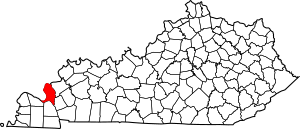
This is a list of the National Register of Historic Places listings in Livingston County, Kentucky.
It is intended to be a complete list of the properties on the National Register of Historic Places in Livingston County, Kentucky, United States. The locations of National Register properties for which the latitude and longitude coordinates are included below, may be seen in a map.
There are 7 properties listed on the National Register in the county.
Current listings
| Name on the Register | Image | Date listed | Location | City or town | Description | |
|---|---|---|---|---|---|---|
| 1 | Fort Star |
(#98000938) |
0.3 miles south of Smithland 37°08′02″N 88°24′05″W / 37.133889°N 88.401389°W |
Smithland | ||
| 2 | Gower House |
(#73000815) |
Water St. 37°08′35″N 88°24′20″W / 37.143056°N 88.405556°W |
Smithland | ||
| 3 | Thomas Lawson House |
(#78001378) |
Wabash Ave. 37°00′14″N 88°14′11″W / 37.003889°N 88.236389°W |
Grand Rivers | ||
| 4 | Livingston County Courthouse and Clerk's Offices |
(#11000794) |
351 Court St. 37°08′22″N 88°24′16″W / 37.139444°N 88.404444°W |
Smithland | ||
| 5 | Mantle Rock Archeological District |
(#04001253) |
Kentucky Route 133 37°21′10″N 88°25′41″W / 37.352778°N 88.428056°W |
Smithland | ||
| 6 | Masonic Hall-Federal Commissary Building |
(#98000939) |
Junction of Court and Charlotte Sts. 37°08′25″N 88°24′24″W / 37.140278°N 88.406667°W |
Smithland | ||
| 7 | Richard Olive House |
(#82002732) |
Court St. 37°08′22″N 88°24′15″W / 37.139444°N 88.404167°W |
Smithland |

All content from Kiddle encyclopedia articles (including the article images and facts) can be freely used under Attribution-ShareAlike license, unless stated otherwise. Cite this article:
National Register of Historic Places listings in Livingston County, Kentucky Facts for Kids. Kiddle Encyclopedia.


