National Register of Historic Places listings in Anderson County, Kentucky facts for kids
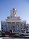
This is a list of the National Register of Historic Places listings in Anderson County, Kentucky.
This is intended to be a complete list of the properties and districts on the National Register of Historic Places in Anderson County, Kentucky, United States. The locations of National Register properties and districts for which the latitude and longitude coordinates are included below, may be seen in a map.
There are 12 properties and districts listed on the National Register in the county.
Current listings
| Name on the Register | Image | Date listed | Location | City or town | Description | |
|---|---|---|---|---|---|---|
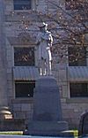
| 1 | Confederate Monument in Lawrenceburg |
(#97000716) |
Courthouse Lawn, 0.5 miles south of U.S. Route 127 and Kentucky Route 44 38°02′06″N 84°53′44″W / 38.035°N 84.895556°W |
Lawrenceburg | ||
| 2 | R.H. Crossfield House |
(#75000730) |
Southwest of Lawrenceburg off Anderson City Rd. 37°59′06″N 84°58′57″W / 37.985°N 84.9825°W |
Lawrenceburg | ||
| 3 | Dowling House |
(#79000957) |
321 S. Main St. 38°01′59″N 84°53′40″W / 38.033056°N 84.894444°W |
Lawrenceburg | ||
| 4 | Thomas H. Hanks House |
(#80001478) |
516 E. Woodford St. 38°02′21″N 84°53′11″W / 38.039167°N 84.886389°W |
Lawrenceburg | ||
| 5 | Kavanaugh Academy |
(#73000781) |
241 E. Woodford St. 38°02′19″N 84°53′32″W / 38.038611°N 84.892222°W |
Lawrenceburg | ||
| 6 | Lawrenceburg Commercial Historic District |
(#94000837) |
Roughly Main St. from North Alley to Court St. and Court from Main to the Southern Railway tracks 38°02′11″N 84°53′44″W / 38.036389°N 84.895556°W |
Lawrenceburg | ||
| 7 | Lexington Extension of the Louisville Southern Railroad |
(#04000789) |
Eastern Lawrenceburg to Milner 38°02′08″N 84°50′00″W / 38.035556°N 84.833333°W |
Lawrenceburg | Extends into Woodford County | |
| 8 | McBrayer-Clark House |
(#73000782) |
North of Lawrenceburg on Kentucky Route 326 38°04′06″N 84°54′19″W / 38.068333°N 84.905278°W |
Lawrenceburg | ||
| 9 | Rev. William Dudley Moore House |
(#79000958) |
4 miles (6.4 km) south of Lawrenceburg 37°59′00″N 84°52′31″W / 37.983333°N 84.875278°W |
Lawrenceburg | ||
| 10 | Old Prentice Distillery |
(#87000478) |
Kentucky Route 513 37°58′23″N 84°53′54″W / 37.973056°N 84.898333°W |
Lawrenceburg | ||
| 11 | Old Wash Place |
(#75000731) |
9 miles west of Lawrenceburg at the junction of U.S. Route 62 and Kentucky Route 53 37°57′36″N 85°01′28″W / 37.96°N 85.024444°W |
Lawrenceburg | ||
| 12 | T.B. Ripy House |
(#80001479) |
320 S. Main St. 38°01′58″N 84°53′44″W / 38.032778°N 84.895556°W |
Lawrenceburg |

All content from Kiddle encyclopedia articles (including the article images and facts) can be freely used under Attribution-ShareAlike license, unless stated otherwise. Cite this article:
National Register of Historic Places listings in Anderson County, Kentucky Facts for Kids. Kiddle Encyclopedia.


