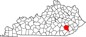
National Register of Historic Places listings in Clay County, Kentucky facts for kids
This is a list of the National Register of Historic Places listings in Clay County, Kentucky.
It is intended to be a complete list of the properties on the National Register of Historic Places in Clay County, Kentucky, United States. The locations of National Register properties for which the latitude and longitude coordinates are included below, may be seen in a map.
There are 4 properties listed on the National Register in the county. Another property was once listed but has been removed.
Current listings
| Name on the Register | Image | Date listed | Location | City or town | Description | |
|---|---|---|---|---|---|---|
| 1 | Fish Trap Rock Petroglyphs (15CY53) |
(#89001181) |
Western bank of the Red Bird River at the Hal Rogers Parkway crossing 37°10′25″N 83°35′21″W / 37.173611°N 83.589167°W |
Eriline | ||
| 2 | Peabody-Fordson Historic District |
(#89002099) |
KY 66, S of Big Creek 37°08′23″N 83°35′29″W / 37.139838°N 83.591482°W |
Big Creek vicinity | ||
| 3 | Red Bird River Shelter Petroglyphs (15CY52) |
(#89001183) |
Address Restricted |
Manchester | ||
| 4 | Sullen Possum Site |
(#93000996) |
Address Restricted |
Oneida |
Former listing
| Name on the Register | Image | Date listed | Date removed | Location | City or town | Summary | |
|---|---|---|---|---|---|---|---|
| 1 | Red Bird River Petroglyphs (15CY51) |
(#89001182) |
|
Address Restricted |
Manchester |

All content from Kiddle encyclopedia articles (including the article images and facts) can be freely used under Attribution-ShareAlike license, unless stated otherwise. Cite this article:
National Register of Historic Places listings in Clay County, Kentucky Facts for Kids. Kiddle Encyclopedia.


