National Register of Historic Places listings in Todd County, Kentucky facts for kids
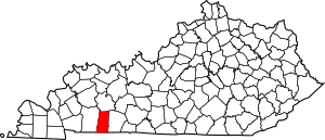
This is a list of the National Register of Historic Places listings in Todd County, Kentucky.
This is intended to be a complete list of the properties and districts on the National Register of Historic Places in Todd County, Kentucky, United States. The locations of National Register properties and districts for which the latitude and longitude coordinates are included below, may be seen in a map.
There are 15 properties and districts listed on the National Register in the county.
Current listings
| Name on the Register | Image | Date listed | Location | City or town | Description | |
|---|---|---|---|---|---|---|
| 1 | Allensville Historic District |
(#88002611) |
Kentucky Route 102/Main St. 36°42′58″N 87°04′06″W / 36.716111°N 87.068333°W |
Allensville | ||
| 2 | Bethel Baptist Church |
(#77000651) |
U.S. Route 68 36°50′37″N 87°17′55″W / 36.843611°N 87.298611°W |
Fairview | ||
| 3 | Jefferson Davis Monument |
(#73000849) |
On Kentucky Route 115 near its junction with U.S. Route 68 36°50′31″N 87°18′02″W / 36.841944°N 87.300556°W |
Fairview | ||
| 4 | Edwards Hall |
(#74000906) |
Southern side of Goebel Ave. 36°48′14″N 87°09′07″W / 36.803889°N 87.151944°W |
Elkton | ||
| 5 | Elkton Commercial Historic District |
(#89001976) |
Junction of N., S., E., and W. Main Sts. 36°48′34″N 87°09′15″W / 36.809444°N 87.154167°W |
Elkton | ||
| 6 | Gray's Inn |
(#04001254) |
88 Graysville Rd. 36°38′46″N 87°11′57″W / 36.646111°N 87.199167°W |
Guthrie | ||
| 7 | John Gray Springhouse |
(#87000146) |
U.S. Route 68 36°48′42″N 87°09′32″W / 36.811667°N 87.158889°W |
Elkton | ||
| 8 | Guthrie Historic District |
(#11000801) |
Roughly bounded by Ewing, Park & Cherry Sts. 36°38′54″N 87°09′59″W / 36.648378°N 87.166392°W |
Guthrie | ||
| 9 | Hadden Site (15TO1) |
(#85003218) |
Address Restricted |
Elkton | ||
| 10 | Idlewild |
(#80001670) |
Southeast of Trenton on U.S. Route 41 36°41′14″N 87°13′52″W / 36.687222°N 87.231111°W |
Trenton | ||
| 11 | McReynolds House |
(#76000946) |
S. Main St. 36°48′25″N 87°09′18″W / 36.806944°N 87.155°W |
Elkton | ||
| 12 | Milliken Memorial Community House |
(#90001834) |
208 W. Main St. 36°48′37″N 87°09′21″W / 36.810278°N 87.155833°W |
Elkton | ||
| 13 | W.L. Reeves House |
(#84002024) |
Kentucky Route 102 36°48′12″N 87°08′54″W / 36.803333°N 87.148333°W |
Elkton | ||
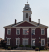
| 14 | Todd County Courthouse |
(#75000836) |
Public Sq. 36°48′34″N 87°09′15″W / 36.809444°N 87.154167°W |
Elkton | ||
| 15 | Woodstock |
(#10000904) |
6338 Clarksville Rd. 36°38′40″N 87°18′44″W / 36.644444°N 87.312222°W |
Trenton |

All content from Kiddle encyclopedia articles (including the article images and facts) can be freely used under Attribution-ShareAlike license, unless stated otherwise. Cite this article:
National Register of Historic Places listings in Todd County, Kentucky Facts for Kids. Kiddle Encyclopedia.


