Nepal facts for kids
Quick facts for kids
Federal Democratic Republic of Nepal
|
|
|---|---|
|
|
|
|
Motto: जननी जन्मभूमिश्च स्वर्गादपि गरीयसी (Sanskrit)
Janani Janmabhumishcha Swargadapi Gariyasi "Mother and Motherland are Greater Than Heaven" |
|
|
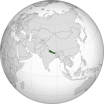
Location of Nepal in dark green; territory claimed but controlled by India shown in light green
|
|
| Capital and largest city
|
Kathmandu 28°10′N 84°15′E / 28.167°N 84.250°E |
| Official languages | Nepali |
| Recognised national languages | All mother-tongues (see Languages of Nepal) |
| Ethnic groups
(2021)
|
|
| Religion
(2021)
|
|
| Demonym(s) | |
| Government | Federal parliamentary republic |
| Ram Chandra Poudel | |
| Ram Sahaya Yadav | |
| K. P. Sharma Oli | |
| Legislature | Federal Parliament |
| National Assembly | |
| House of Representatives | |
| Formation | |
|
• Unification
|
25 September 1768 |
| 4 March 1816 | |
| 21 December 1923 | |
|
• Federal Republic
|
28 May 2008 |
|
• Current constitution
|
20 September 2015 |
| Area | |
|
• Total
|
147,516 km2 (56,956 sq mi) (93rd) |
|
• Water (%)
|
2.8% |
| Population | |
|
• 2024 estimate
|
31,122,387 (49th) |
|
• Density
|
180/km2 (466.2/sq mi) (72nd) |
| GDP (PPP) | 2023 estimate |
|
• Total
|
|
|
• Per capita
|
|
| GDP (nominal) | 2023 estimate |
|
• Total
|
|
|
• Per capita
|
|
| Gini (2010) | 32.8 medium |
| HDI (2019) | medium · 142nd |
| Currency | Nepalese rupee (Rs, रू) (NPR) |
| Time zone | UTC+05:45 (Nepal Standard Time) |
| Date format | YYYY/MM/DD |
| Driving side | left |
| Calling code | +977 |
| ISO 3166 code | NP |
| Internet TLD | .np |
Nepal (Nepali: नेपाल) is a country in South Asia bordering the Republic of India and the People's Republic of China. Mount Everest, the highest mountain in the world, is found there, as well as the Himalaya Mountains. 12 of the world's 18 highest mountain peaks are in Nepal. It is also the birthplace of Buddha. It has recently become a secular country, but it used to be the only Hindu nation in the world. Nepal is a very important pilgrimage place for both Hindus and Buddhists. The population of Nepal in 2007 was almost 29 million people. Nepali is the official language, and there are many other regional languages. English and Hindi are widely understood. The capital city of Nepal is Kathmandu which has a population of over two million people. The second largest city is Pokhara. Pokhara is a major tourist attraction of Nepal. It is rich in Natural Beauty. Pokhara includes many lakes, Phewa Tal is one of them.
Contents
History
The history of Nepal is intertwined with the history of the broader Indian subcontinent and the surrounding regions, comprising the areas of South Asia and East Asia.
It is a multi-ethnic, multiracial, multicultural, multi-religious, and multilingual country. The most spoken language of Nepal is Nepali followed by several other ethnic languages.
Nepal experienced a struggle for democracy at times in the 20th century and early 21st century. During the 1990s and until 2008, the country was in a civil strife. A peace treaty was signed in 2006 and elections were held in the same year. In a historical vote for the election of the constituent assembly, Nepalese parliament voted to oust the monarchy in June 2006. Nepal became a federal republic and was formally renamed the 'Federal Democratic Republic of Nepal' ending the 200 year old Shah dynasty.
Geography
Nepal is of roughly trapezoidal shape, 800 kilometres (500 mi) long and 200 kilometres (120 mi) wide, with an area of 147,181 km2 (56,827 sq mi). See [[List of political and geographic subdivisions by total area from 100,000 to 1,000,000 km2|List of territories by size]] for the comparative size of Nepal. It lies between latitudes 26° and 31°N, and longitudes 80° and 89°E.
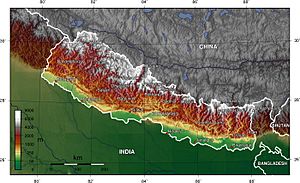
Nepal is commonly divided into three physiographic areas: Himal, Pahad and Terai. These ecological belts run east–west and are vertically intersected by Nepal's major, north to south flowing river systems.
The southern lowland plains or Terai bordering India are part of the northern rim of the Indo-Gangetic Plain. Terai is a lowland region containing some hill ranges. The plains were formed and are fed by three major Himalayan rivers: the Kosi, the Narayani, and the Karnali as well as smaller rivers rising below the permanent snowline. This region has a subtropical to tropical climate. The outermost range of foothills called Sivalik Hills or Churia Range, cresting at 700 to 1,000 metres (2,300 to 3,280 ft), marks the limit of the Gangetic Plain; however broad, low valleys called Inner Tarai Valleys (Bhitri Tarai Uptyaka) lie north of these foothills in several places.
Pahad is a mountain region that does not generally contain snow. The mountains vary from 800 to 4,000 metres (2,600 to 13,100 ft) in altitude with progression from subtropical climates below 1,200 metres (3,900 ft) to alpine climates above 3,600 metres (11,800 ft). The Lower Himalayan Range, reaching 1,500 to 3,000 metres (4,900 to 9,800 ft), is the southern limit of this region, with subtropical river valleys and "hills" alternating to the north of this range. Population density is high in valleys but notably less above 2,000 metres (6,600 ft) and very low above 2,500 metres (8,200 ft), where snow occasionally falls in winter.
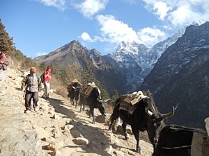
Himal is the mountain region containing snow and situated in the Great Himalayan Range; it makes up the northern part of Nepal. It contains the highest elevations in the world including 8,848 metres (29,029 ft) height Mount Everest (Sagarmāthā in Nepali) on the border with China. Seven other of the world's "eight-thousanders" are in Nepal or on its border with China: Lhotse, Makalu, Cho Oyu, Kangchenjunga, Dhaulagiri, Annapurna and Manaslu.
Climate
Nepal has five climatic zones, broadly corresponding to the altitudes. The tropical and subtropical zones lie below 1,200 metres (3,900 ft), the temperate zone 1,200 to 2,400 metres (3,900 to 7,900 ft), the cold zone 2,400 to 3,600 metres (7,900 to 11,800 ft), the subarctic zone 3,600 to 4,400 metres (11,800 to 14,400 ft), and the Arctic zone above 4,400 metres (14,400 ft).
Nepal experiences five seasons: summer, monsoon, autumn, winter and spring. The Himalaya blocks cold winds from Central Asia in the winter and forms the northern limit of the monsoon wind patterns. In a land once thickly forested, deforestation is a major problem in all regions, with resulting erosion and degradation of ecosystems.
Nepal is popular for mountaineering, having some of the highest and most challenging mountains in the world, including Mount Everest. Technically, the southeast ridge on the Nepali side of the mountain is easier to climb, so most climbers prefer to trek to Everest through Nepal.
Biodiversity
Nepal contains a disproportionately large diversity of plants and animals, relative to its size. Nepal, in its entirety, forms the western portion of the eastern Himalayan biodiversity hotspot, with notable biocultural diversity. The dramatic differences in elevation found in Nepal (60 m from sea level in the Terai plains, to 8,848 m Mount Everest) result in a variety of biomes. The Eastern half of Nepal is richer in biodiversity as it receives more rain, compared to western parts, where arctic desert-type conditions are more common at higher elevations. Nepal is a habitat for 4.0% of all mammal species, 8.9% of bird species, 1.0% of reptile species, 2.5% of amphibian species, 1.9% of fish species, 3.7% of butterfly species, 0.5% of moth species and 0.4% of spider species. In its 35 forest-types and 118 ecosystems, Nepal harbours 2% of the flowering plant species, 3% of pteridophytes and 6% of bryophytes.

Nepal's forest cover is 59,624 km2 (23,021 sq mi), 40.36% of the country's total land area, with an additional 4.38% of scrubland, for a total forested area of 44.74%, an increase of 5% since the turn of the millennium. The country had a 2019 Forest Landscape Integrity Index mean score of 7.23/10, ranking it 45th globally out of 172 countries. In the southern plains, Terai–Duar savanna and grasslands ecoregion contains some of the world's tallest grasses as well as Sal forests, tropical evergreen forests and tropical riverine deciduous forests. In the lower hills (700 m – 2,000 m), subtropical and temperate deciduous mixed forests containing mostly Sal (in the lower altitudes), Chilaune and Katus, as well as subtropical pine forest dominated by chir pine are common. The middle hills (2,000 m – 3,000 m) are dominated by oak and rhododendron. Subalpine coniferous forests cover the 3,000 m to 3,500 m range, dominated by oak (particularly in the west), Eastern Himalayan fir, Himalayan pine and Himalayan hemlock; rhododendron is common as well. Above 3,500 m in the west and 4,000 m in the east, coniferous trees give way to rhododendron-dominated alpine shrubs and meadows.
Among the notable trees, are the astringent Azadirachta indica, or neem, which is widely used in traditional herbal medicine, and the luxuriant Ficus religiosa, or peepal, which is displayed on the ancient seals of Mohenjo-daro, and under which Gautam Buddha is recorded in the Pali canon to have sought enlightenment.
Most of the subtropical evergreen broad-leaved forest of the lower Himalayan region is descended from the Tethyan Tertiary flora. As the Indian Plate collided with Eurasia forming and raising the Himalayas, the arid and semi-arid Mediterranean flora was pushed up and adapted to the more alpine climate over the next 40–50 million years. The Himalayan biodiversity hotspot was the site of mass exchange and intermingling of the Indian and Eurasian species in the neogene. One mammal species (Himalayan field mouse), two each of bird and reptile species, nine amphibia, eight fish and 29 butterfly species are endemic to Nepal.
Nepal contains 107 IUCN-designated threatened species, 88 of them animal species, 18 plant species and one species of "fungi or protist" group. These include the endangered Bengal tiger, the red panda, the Asiatic elephant, the Himalayan musk deer, the wild water buffalo and the South Asian river dolphin, as well as the critically endangered gharial, the Bengal florican, and the white-rumped vulture, which has become nearly extinct by having ingested the carrion of diclofenac-treated cattle. The pervasive and ecologically devastating human encroachment of recent decades has critically endangered Nepali wildlife. In response, the system of national parks and protected areas, first established in 1973 with the enactment of National Parks and Wildlife Conservation Act 1973, was substantially expanded. Vulture restaurants coupled with a ban on veterinary usage of diclofenac has seen a rise in the number of white-rumped vultures. The community forestry programme which has seen a third of the country's population directly participate in managing a quarter of the total forested area has helped the local economies while reducing human-wildlife conflict. The breeding programmes coupled with community-assisted military patrols, and a crackdown on poaching and smuggling, has seen poaching of critically endangered tigers and elephants as well as vulnerable rhinos, among others, go down to effectively zero, and their numbers have steadily increased. Nepal has ten national parks, three wildlife reserves, one hunting reserve, three Conservation Areas and eleven buffer zones, covering a total area of 28,959.67 km2 (11,181.39 sq mi), or 19.67% of the total land area, while ten wetlands are registered under the Ramsar Convention. Nepal has consistently been ranked as one of the most polluted countries in the world.
Politics and government
Nepal is a parliamentary republic with a multi-party system. Nepal has been referred as the 'Federal Democratic Republic of Nepal' since 2015.
The Government of Nepal has three branches:
- Executive: The form of governance is a multi-party, competitive, federal democratic republican parliamentary system based on plurality. The President appoints the parliamentary party leader of the political party with the majority in the House of Representatives as Prime Minister, who forms the Council of ministers that exercises the executive power.
- Legislature: The Legislature of Nepal, called the Federal Parliament, consists of the House of Representatives and the National Assembly. The House of Representatives consists of 275 members elected through a mixed electoral system and has a term of five years. The National Assembly, consisting of 59 members elected by provincial electoral colleges, is a permanent house; a third of its members are elected every two years for a six-year term.
- Judiciary: Nepal has a unitary three-tier independent judiciary that comprises the Supreme Court, the highest court in the land, headed by the Chief Justice, seven High Courts, one in each province, the highest court at the provincial level, and 77 district courts, one in each district. The municipal councils can convene local judicial bodies to resolve disputes and render non-binding verdicts in cases not involving actionable crime. The actions and proceedings of the local judicial bodies may be guided and countermanded by the district courts.
Administrative divisions
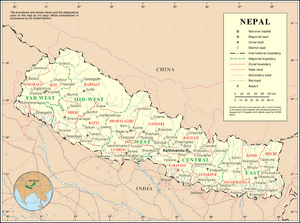
Nepal is a federal republic comprising 7 provinces. Each province is composed of 8 to 14 districts. The districts, in turn, comprise local units known as urban and rural municipalities. There is a total of 753 local units which includes 6 metropolitan municipalities, 11 sub-metropolitan municipalities and 276 municipalities for a total of 293 urban municipalities, and 460 rural municipalities. Each local unit is composed of wards. There are 6,743 wards in total.
The local governments enjoy executive and legislative as well as limited judicial powers in their local jurisdiction. The provinces have unicameral parliamentary Westminster system of governance. The local and provincial governments exercise some absolute powers and some powers shared with provincial or federal government. The district coordination committee, a committee composed of all elected officials from the local governments in the district, has a very limited role.
Largest cities
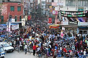
As Nepal is one of the developing or so called under developed country, like other things its cities or urban areas are also increasing day by day. More than 20% people lives in the urban area or simply in cities. Kathmandu is the largest city of Nepal. People of Kathmandu are lucky enough to travel in Aeroplane before any land transport. It is also called as the City of Temple as it has numerous temples of Hindus god and goddess and that's of Buddhism. It also have 5 UNESCO World Heritage Sites. It is one of the oldest city of South Asia. It is also the capital city of Nepal. It also have many palace and historically important sites such as Singha Durbar.
The other largest cities of Nepal are Pokhara, Biratnagar, Lalitpur, Bharatpur, Birgunj, Dharan, Hetauda and Nepalgunj.
Demographics
The citizens of Nepal are known as Nepali or Nepalese. The Nepali are descendants of three major migrations from India, Tibet and North Burma, and the Chinese province of Yunnan via Assam.
According to the 2011 census, Nepal's population was 26.5 million, almost a threefold increase from nine million in 1950. From 2001 to 2011, the average family size declined from 5.44 to 4.9. The census also noted some 1.9 million absentee people, over a million more than in 2001; most are male labourers employed overseas, predominantly in South Asia and the Middle East. This correlated with the drop in sex ratio from 94.41 as compared to 99.80 for 2001. The annual population growth rate is 1.35%.
The citizens of Nepal are known as Nepali or Nepalese. The country is home to people of many different national origins. As a result, Nepalese do not equate their nationality with ethnicity, but with citizenship and allegiance. Although citizens make up the majority of Nepalese, non-citizen residents, dual citizens, and expatriates may also claim a Nepalese identity.
Nepal is multicultural and multiethnic country because it became a country by occupying several small kingdoms such as Mustang, Videha (Mithila), Madhesh, and Limbuwan in the 18th century. The oldest settlements in Mithila and Tharuhat are Maithil. Northern Nepal is historically inhabited by Kirants Mongoloid, Rai and Limbu people. The mountainous region is sparsely populated above 3,000 m (9,800 ft), but in central and western Nepal ethnic Sherpa and Lamapeople inhabit even higher semi-arid valleys north of the Himalaya. The Nepali speaking Khas people mostly inhabit central and southern regions. Kathmandu Valley, in the middle hill region, constitutes a small fraction of the nation's area but is the most densely populated, with almost 5 percent of the nation's population.
The Nepali are descendants of three major migrations from India, Tibet, and North Burma and the Chinese state of Yunnan via Assam. Among the earliest inhabitants were the Kirat of east mid-region, Newars of the Kathmandu Valley, aboriginal Tharus of Tharuhat.
Economy
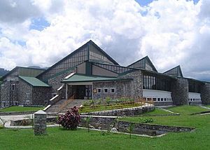
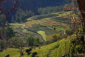
Nepal used to be an agricultural country till 1950. Since 1951 it entered the modern era and has made progress. Agriculture, however is a major economic activity, employing 80% of the population and providing 37% of GDP. Only about 20% of the total area is cultivable; another 33% is forested; most of the rest is mountainous. Rice and wheat are the main food crops. The lowland Terai region produces an agricultural surplus, part of which supplies the food-deficient hill areas.
Even though China is the 2nd largest exporter to Nepal, yet unlike India which is the largest buyer of Nepal's goods, China's imports from Nepal are zero, thus burdening Nepal's monetary stability and monetary balance. The annual monsoon rain, or lack of it, strongly influences economic growth. From 1996 to 1999, real GDP growth averaged less than 4%. The growth rate recovered in 1999, rising to 6% before slipping slightly in 2001 to 5.5%.
Transport
Nepal remains isolated from the world's major land, air and sea transport routes although, within the country, aviation is in a better state, with 47 airports, 11 of them with paved runways; flights are frequent and support a sizable traffic. The hilly and mountainous terrain in the northern two-thirds of the country has made the building of roads and other infrastructure difficult and expensive. In 2007 there were just over 10,142 km (6,302 mi) of paved roads, and 7,140 km (4,437 mi) of unpaved road, and one 59 km (37 mi) railway line in the south.
More than one-third of its people live at least a two hours walk from the nearest all-season road. Only recently all district headquarters (except for Simikot and Dunai) became reachable by road from Kathmandu. In addition, around 60% of the road network and most rural roads are not operable during the rainy season. The only practical seaport of entry for goods bound for Kathmandu is Kolkata in West Bengal state of India. Internally, the poor state of development of the road system makes access to markets, schools, and health clinics a challenge.
Education
Modern education in Nepal began with the establishment of the first school in 1853. This school was only for the members of the ruling families and their courtiers. Schooling for the general people began only after 1951 when a popular movement ended the autocratic Rana family regime and initiated a democratic system.
In the past 50 years, there has been a dramatic expansion of education facilities in the country. As a result, adult literacy (age 15+) of the country was reported to be 48.2% (female: 34.6%, male: 62.2%) in the Population Census, 2001, up from about 5% in 1952–54.
Beginning from about 300 schools and two colleges with about 10,000 students in 1951, there now are 26,000 schools (including higher secondary), 415 colleges, five universities, and two academies of higher studies. Altogether 5.5 million students are enrolled in those schools and colleges who are served by more than 150,000 teachers.
Culture
Folklore is an integral part of Nepali society. Traditional stories are rooted in the reality of day-to-day life, tales of love, affection and battles as well as demons and ghosts and thus reflect local lifestyles, culture, and beliefs. Many Nepali folktales are enacted through the medium of dance and music.
Most houses in the rural lowlands of Nepal are made up of a tight bamboo framework and walls of a mud and cow-dung mix. These dwellings remain cool in summer and retain warmth in winter. Houses in the hills are usually made of unbaked bricks with thatch or tile roofing. At high elevations construction changes to stone masonry and slate may be used on roofs.
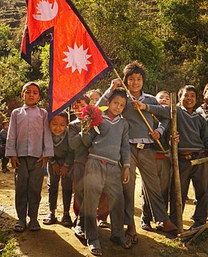
Nepal's flag is the only national flag in the world that is not rectangular in shape. The constitution of Nepal contains instructions for a geometric construction of the flag. According to its official description, the red in the flag stands for victory in war or courage, and is also the colour of the rhododendron, the national flower of Nepal. Red also stands for aggression. The flag's blue border signifies peace. The curved moon on the flag is a symbol of the peaceful and calm nature of Nepali, while the sun represents the aggressiveness of Nepali warriors.
Symbols
| Emblem | Emblem of Nepal |
|---|---|
| Anthem | Sayaun Thunga Phulka |
| Language | All mother-tongues of Nepal |
| Currency | Nepalese rupee (रू) (NPR) |
| Mammal | Cow |
| Bird | Himalayan monal |
| Flower | Rhododendron arboreum |
| Sport | Volleyball |
| Colour | Crimson |
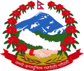
The emblem of Nepal depicts the snowy Himalayas, the forested hills, and the fertile Terai, supported by a wreath of rhododendrons, with the national flag at the crest and in the foreground, a plain white map of Nepal below it, and a man's and woman's right hands joined to signify gender equality. At the bottom is the national motto, a Sanskrit quote of patriotism attributed in Nepali folklore to Lord Rama, written in Devanagari script—"Mother and motherland are greater than heaven".
Nepal's flag is the only national flag in the world that is not rectangular in shape. The constitution contains instructions for a Geometric Construction of the double-pennant flag. According to its official description, the crimson in the flag stands for victory in war or courage, and is also the colour of the rhododendron. The flag's blue border signifies Nepali people's desire for peace. The moon on the flag is a symbol of the peaceful and calm nature of Nepalis, while the sun represents the aggressiveness of Nepali warriors.
The president is the symbol of national unity. The martyrs are the symbols of patriotism. Commanders of the Anglo-Nepalese war, Amar Singh Thapa, Bhakti Thapa, and Balbhadra Kunwar are considered war heroes. A special designation of "National hero" has been conferred to 16 people from Nepal's history for their exceptional contributions to the prestige of Nepal. Prithvi Narayan Shah, the founder of modern Nepal, is held in high regard and considered "Father of the Nation" by many.
Holidays and festivals
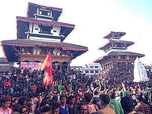
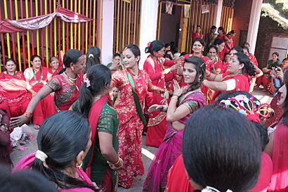
With 36 days a year, Nepal is the country that enjoys the most number of public holidays in the world. The Nepali year begins in 1st of Baisakh in official Hindu Calendar of the country, the Bikram Sambat, which falls in mid-April and is divided into 12 months. Saturday is the official weekly holiday. Main annual holidays include the Martyr's Day (18 February), and a mix of Hindu and Buddhist festivals such as Dashain in autumn, Tihar in mid-autumn and Chhath in late autumn. During Swanti, the Newars perform the Mha Puja ceremony to celebrate New Year's Day of the lunar calendar Nepal Sambat. Being a Secular country Nepal has holiday on main festivals of minority religions in the nation too.
Cuisine
Nepali cuisine consists of a wide variety of regional and traditional cuisines. With diversity in soil type, climate, culture, ethnic groups, and occupations, these cuisines vary substantially, using locally available spices, herbs, vegetables, and fruit. The Columbian exchange brought potatoes, tomatoes, maize, peanuts, cashew nuts, pineapples, guavas, and most notably, chilli peppers, to South Asia; all became staples. Cereals grown in Nepal, their times and regions of planting, correspond strongly to the timing of monsoons and variations in altitude. Rice and wheat are mostly cultivated in the terai plains and well-irrigated valleys; maize, millet, barley and buckwheat mostly in the less fertile and drier hills.
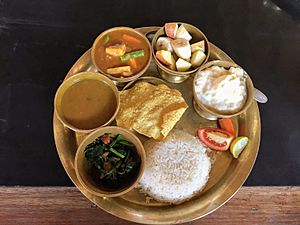
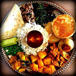
A typical Nepali meal is a cereal cooked in plain fashion, complemented with flavourful, savoury dishes. The latter include lentils, pulses and vegetables, spiced commonly with ginger and garlic, and more discerningly with combinations of coriander, cumin, turmeric, cinnamon, cardamon, jimbu and others. This is typically on a platter, or thali, with a central place for the cooked cereal and small bowls for the flavourful accompaniments. They are combined either by actual mixing—for example, rice and lentils—or in the folding of one—such as bread—around the other, such as cooked vegetables. Dal-bhat centred around steamed rice is the most common example. as well as dairy and sometimes meat. Unleavened flat bread made from wheat flour called chapati occasionally replaces rice, particularly in the Terai, while Dhindo, prepared by boiling corn, millet or buckwheat flour in water, continuously stirring and adding flour until thick, almost solid consistency is reached, is the main substitute in the hills and mountains. Tsampa, flour made from roasted barley or naked barley, is the main staple in the high himalayas. Throughout Nepal, fermented, then sun-dried, leafy greens called Gundruk, are both a delicacy and a vital substitute for fresh vegetables in the winter.
A notable feature of Nepali food is the existence of a number of distinctive vegetarian cuisines, each a feature of the geographical and cultural histories of its adherents. The appearance of ahimsa, or the avoidance of violence toward all forms of life in many religious orders early in South Asian history, especially Upanishadic Hinduism, Buddhism and Jainism, is thought to have been a notable factor in the prevalence of vegetarianism among a segment of Nepal's Hindu and Buddhist populations, as well as among Jains. Among these groups, strong discomfort is felt at thoughts of eating meat. Though per capita meat consumption is low in Nepal, the proportion of vegetarianism is not high as in India, due to the prevalence of Shaktism, of which animal sacrifice is a prominent feature.
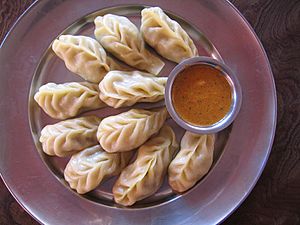
Nepali cuisines possess their own distinctive qualities to distinguish these hybrid cuisines from both their northern and southern neighbours. Nepali cuisines, with generally tomato-based, leaner curries, are lighter than their cream-based Indian counterparts, and Nepali momo dumplings are heavily spiced compared to their northern counterparts. Newar cuisine, one of the richest and most influential in Nepal, is more elaborate and diverse than most, as Newar culture developed in the highly fertile and prosperous Kathmandu valley. A typical Newar cuisine can comprise more than a dozen dishes of cereals, meat, vegetable curries, chutneys and pickles. Kwanti (sprouted beans soup), chhwela (ground beef), chatamari (rice flour crepe), bara (fried lentil cake), kachila (marinated raw minced beef), samaybaji (centred around flattened rice), lakhaamari and yomuri are among the more widely recognised. Juju dhau, a sweet yoghurt originating in Bhaktapur, is also famous. Thakali cuisine is another well-known food tradition which seamlessly melds the Tibetan and the Indian with variety in ingredients, especially the herbs and spices. In the Terai, Bagiya is a rice flour dumpling with sweets inside, popular among the Tharu and Maithil people. Various communities in the Terai make sidhara (sun-dried small fish mixed with taro leaves) and biriya (lentil paste mixed with taro leaves) to stock for the monsoon floods. Selroti, kasaar, fini and chaku are among the sweet delicacies. Rice pulau or sweet rice porridge called kheer are usually the main dish in feasts. Tea and buttermilk (fermented milk leftover from churning butter from yoghurt) are common non-alcoholic drinks.
Related pages
Images for kids
-
"Nēpāla" in the late Brahmi script, in the Allahabad Pillar inscription of Samudragupta (350-375 CE).
-
Tourists view a greater one-horned rhinoceros from an elephant in Chitwan National Park.
-
Middle Marsyangdi Hydroelectric Dam. Nepal has significant potential to generate hydropower, which it plans to export across South Asia.
-
Bhanubhakta Acharya, Nepali writer who translated the ancient Hindu epic Ramayana in the Nepali language
See also
 In Spanish: Nepal para niños


