Assam facts for kids
Quick facts for kids
Assam
অসম
|
||
|---|---|---|
|
State of India
|
||
|
||
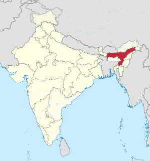
A map showing us where the location of Assam is in the Republic of India
|
||
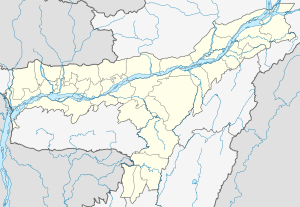
Map of Assam
|
||
| Country | ||
| Region | North-east India | |
| Area | ||
| • Total | 78,438 km2 (30,285 sq mi) | |
| Population
(2011)
|
||
| • Total | 31,169,272 | |
| Time zone | UTC+05:30 (IST) | |
| Official languages | Assamese · English | |
Assam (Assamese: অসম) is a state in the north eastern region of India. It has an area of 78,438 km² (30,285 mi²). It is bigger than Panama but smaller than the Czech Republic. There is one major river (Brahamputra) that flows through the length of the state. The state lies on the foothills of the Himalayas. There are two international borders touched by Assam: Bhutan and Bangladesh. In traditional Indian geography it falls under the North-east Indian zone.
Contents
Religion
According to a 2011 survey, about 62% of the people were Hindus. About 34% were Muslim. There is a small (3-4%) Christian minority. Others (Buddhism, Sikhism, Jainism, and Animism) account for less than 0.2% each.
Related pages
Images for kids
-
A map of the British Indian Empire in 1909 during the partition of Bengal (1905–1911), showing British India in two shades of pink (coral and pale) and the princely states in yellow. The Assam Province (initially as the Province of Eastern Bengal and Assam) can be seen towards the north-eastern side of India.
-
Showing a historical incident at Kanaklata Udyan, Tezpur
-
Basistha Temple in Guwahati.
-
A tea garden in Assam: tea is grown at elevations near sea level, giving it a malty sweetness and an earthy flavor, as opposed to the more floral aroma of highland (e.g. Darjeeling, Taiwanese) teas
-
Dakhinpat Satra of Majuli -
Girl in traditional Mekhela chador dress with a Dhol wrapped with Gamosa -
Imaginary portrait of Srimanta Sankardeva by Bishnu Prasad Rabha
-
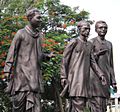
Statue of Bishnu Prasad Rabha, Jyoti Prasad Agarwala and Phani Sarma at District Library, Guwahati.
See also
 In Spanish: Assam para niños


