El Salvador facts for kids
Quick facts for kids
Republic of El Salvador
República de El Salvador (Spanish)
|
|
|---|---|
|
|
|
|
Motto: Dios, Unión, Libertad
"God, Union, Liberty" |
|
 |
|
 |
|
| Capital and largest city
|
San Salvador 13°41′56″N 89°11′29″W / 13.69889°N 89.19139°W |
| Official languages | Spanish |
| Ethnic groups |
|
| Religion
(2017)
|
|
| Demonym(s) | Salvadoran |
| Government | Unitary presidential republic |
| Nayib Bukele | |
| Félix Ulloa | |
| Legislature | Legislative Assembly |
| Independence | |
|
• Declared from Spain
|
15 September 1821 |
|
• Declared from the First Mexican Empire
|
1 July 1823 |
|
• Declared from the
Federal Republic of Central America |
30 January 1841 |
|
• International recognition
|
18 February 1841 |
| Area | |
|
• Total
|
21,041 km2 (8,124 sq mi) (148th) |
|
• Water (%)
|
1.5 |
| Population | |
|
• 2023 estimate
|
6,602,370 (109th) |
|
• Density
|
324.4/km2 (840.2/sq mi) (26th) |
| GDP (PPP) | 2023 estimate |
|
• Total
|
|
|
• Per capita
|
|
| GDP (nominal) | 2023 estimate |
|
• Total
|
|
|
• Per capita
|
|
| Gini (2022) | medium |
| HDI (2022) | medium · 127th |
| Currency |
|
| Time zone | UTC−6 (CST) |
| Driving side | right |
| Calling code | +503 |
| ISO 3166 code | SV |
| Internet TLD | .sv |
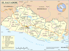
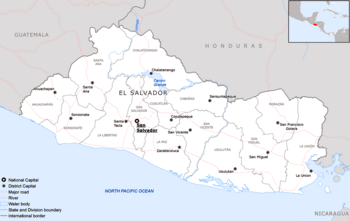
El Salvador (Spanish: República de El Salvador) is the smallest and most densely populated country in Central America. The country's capital and largest city is San Salvador. Other important cities are: Santa Ana and San Miguel. El Salvador borders the Pacific Ocean on the south, and the countries of Guatemala to the west and Honduras to the north and east.
In 2010 El Salvador ranked in the top 10 Latin American countries in terms of Human Development Index. It was in the top 3 in Central America (behind Costa Rica and Panama). Also, tropical forests and overall forests have expanded by nearly 20% from the year 1992 to 2010, making it one of the few countries experiencing reforestation.
In El Salvador there are only two seasons. The dry season starts in mid-October and it lasts until mid May. During the dry season, it hardly ever rains. The wet season starts in mid-May and ends in mid-October. In this season it rains every day. The dry season is called summer and the rainy season is called winter.
Most of the population is mestizo, a mixture of European and American people.
Contents
Geography
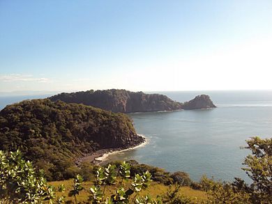
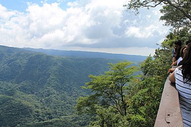
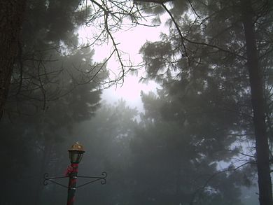
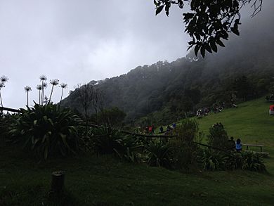
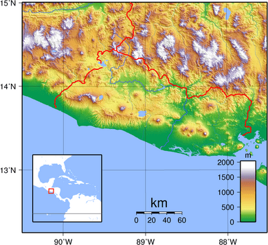
El Salvador lies in the isthmus of Central America between latitudes 13° and 15°N, and longitudes 87° and 91°W. It stretches 270 km (168 mi) from west-northwest to east-southeast and 142 km (88 mi) north to south, with a total area of 21,041 km2 (8,124 sq mi). As the smallest country in continental America, El Salvador is affectionately called Pulgarcito de America (the "Tom Thumb of the Americas"). The highest point in El Salvador is Cerro El Pital, at 2,730 metres (8,957 ft), on the border with Honduras.
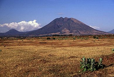
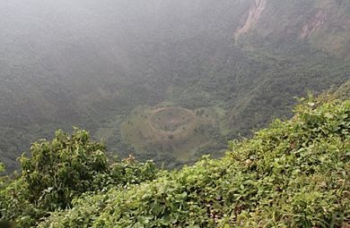
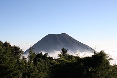
El Salvador has a long history of destructive earthquakes and volcanic eruptions. The capital San Salvador was destroyed in 1756 and 1854, and it suffered heavy damage in the 1919, 1982, and 1986 tremors. El Salvador has over twenty volcanoes, two of them, San Miguel and Izalco, active in recent years. From the early 19th century to the mid-1950s, Izalco erupted with a regularity that earned it the name "Lighthouse of the Pacific." Its brilliant flares were clearly visible for great distances at sea, and at night its glowing lava turned it into a brilliant luminous cone.
El Salvador has over 300 rivers, the most important of which is the Rio Lempa. Originating in Guatemala, the Rio Lempa cuts across the northern range of mountains, flows along much of the central plateau, and cuts through the southern volcanic range to empty into the Pacific. It is El Salvador's only navigable river. It and its tributaries drain about half of the country's area. Other rivers are generally short and drain the Pacific lowlands or flow from the central plateau through gaps in the southern mountain range to the Pacific. These include the Goascorán, Jiboa, Torola, Paz and the Río Grande de San Miguel.
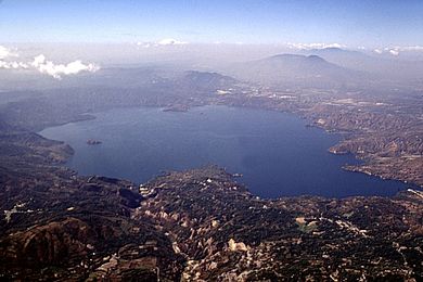
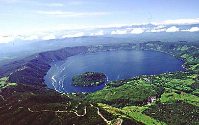
There are several lakes enclosed by volcanic craters in El Salvador, the most important of which are Lake Ilopango (70 km²) and Lake Coatepeque (26 km²). Lake Güija is El Salvador's largest natural lake (44 km²). Several artificial lakes were created by the damming of the Lempa, the largest of which is Embalse Cerrón Grande (135 km²). There are a total 320 km2 (123.6 sq mi) of water within El Salvador's borders.
El Salvador shares borders with Guatemala and Honduras, the total national boundary length is 546 km (339 mi): 126 miles (203 km) with Guatemala and 343 km (213 mi) with Honduras. It is the only Central American country that has no Caribbean coastline. The coastline on the Pacific is 307 km (191 mi) long.
Two parallel mountain ranges cross El Salvador to the west with a central plateau between them and a narrow coastal plain hugging the Pacific. These physical features divide the country into two physiographic regions. The mountain ranges and central plateau, covering 85% of the land, comprise the interior highlands. The remaining coastal plains are referred to as the Pacific lowlands.
Climate
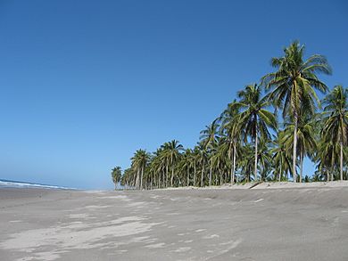
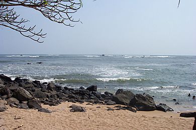
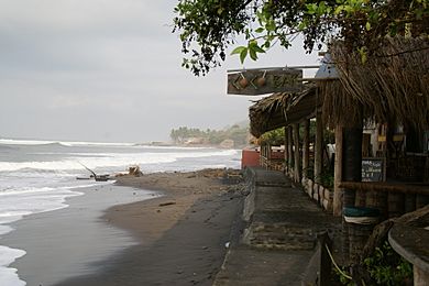
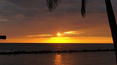
El Salvador has a Tropical climate with pronounced wet and dry seasons. Temperatures vary primarily with elevation and show little seasonal change. The Pacific lowlands are uniformly hot; the central plateau and mountain areas are more moderate. The rainy season extends from May to October; this time of year is referred to as invierno or winter. Almost all the annual rainfall occurs during this period; yearly totals, particularly on southern-facing mountain slopes, can be as high as 2170 mm.
The best time to visit El Salvador would be at the beginning or end of the dry season. Protected areas and the central plateau receive less, although still significant, amounts. Rainfall during this season generally comes from low pressure systems formed over the Pacific and usually falls in heavy afternoon thunderstorms. Hurricanes occasionally form in the Pacific with the notable exception of Hurricane Mitch, which formed in the Atlantic and crossed Central America.
From November through April, the northeast trade winds control weather patterns; this time of year is referred to as verano, or summer. During these months, air flowing from the Caribbean has lost most of its precipitation while passing over the mountains in Honduras. By the time this air reaches El Salvador, it is dry, hot, and hazy, and the country experiences hot weather, excluding the northern higher mountain ranges, where temperatures will be cool. In the extreme northeastern part of the country near Cerro El Pital, snow is known to fall during summer as well as during winter due to the high elevations (it is the coldest part of the country).
Natural disasters
Extreme weather events
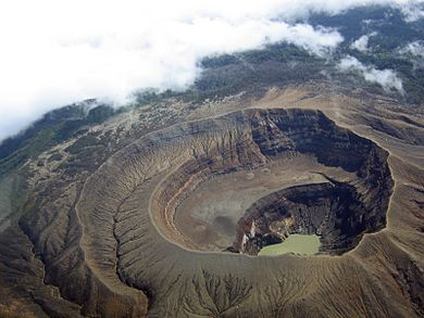
El Salvador's position on the Pacific Ocean also makes it subject to severe weather conditions, including heavy rainstorms and severe droughts, both of which may be made more extreme by the El Niño and La Niña effects. Severe deforestation and soil erosion have made the landscape vulnerable to landslides and forest fires. These characteristics, coupled with severe fiscal constraints, make the nation highly susceptible to the impacts of extreme weather events.
In the summer of 2001 a severe drought destroyed 80% of El Salvador's crops, causing famine in the countryside. On October 4, 2005, severe rains resulted in dangerous flooding and landslides, which caused a minimum of fifty deaths. In 2010, losses to agriculture from flooding exceeded USD100 million, while those resulting from drought were USD38 million.
El Salvador's location in Central America also makes it vulnerable to severe storms and hurricanes coming off the Caribbean. Since the 1990s, there has been an increase in the frequency and duration of storms, as well as a marked change in the pattern of their occurrence. Hurricanes used to strike El Salvador infrequently, only came from the Atlantic and were limited to the months of September and October. However, since the mid 1990s, such storms have occurred more frequently, originated in both the Atlantic and Pacific, and have struck in six different months of the year.
Earthquakes and volcanic activity
El Salvador lies along the Pacific Ring of Fire, and is thus subject to significant tectonic activity, including frequent earthquakes and volcanic activity. Recent examples include the earthquake on January 13, 2001 that measured 7.7 on the Richter magnitude scale and caused a landslide that killed more than 800 people; and another earthquake only a month later, on February 13, 2001, that killed 255 people and damaged about 20% of the nation's housing. Luckily, many families were able to find safety from the landslides caused by the earthquake.
The San Salvador area has been hit by earthquakes in 1576, 1659, 1798, 1839, 1854, 1873, 1880, 1917, 1919, 1965, 1986, 2001 and 2005. The 5.7 Mw-earthquake of 1986 resulted in 1,500 deaths, 10,000 injuries, and 100,000 people left homeless.
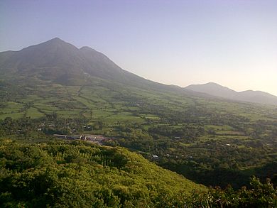
El Salvador's most recent destructive volcanic eruption took place on October 1, 2005, when the Santa Ana Volcano spewed a cloud of ash, hot mud and rocks that fell on nearby villages and caused two deaths. The most severe volcanic eruption in this area occurred in the 5th century AD when the Ilopango volcano erupted with a VEI strength of 6, producing widespread pyroclastic flows and devastating Mayan cities.
The Santa Ana Volcano in El Salvador is active; the most recent eruptions were in 1904 and 2005. Lago de Coatepeque (one of El Salvador's lakes) was created by water filling the caldera that formed after a massive eruption.
The British Imperial College's El Salvador Project aims to build earthquake-proof buildings in remote areas of the country.
Biodiversity and endangered species
There are eight species of sea turtles in the world; six of them nest on the coasts of Central America, and four make their home on the Salvadoran coast: the leatherback turtle (Dermochelys coriacea), the hawksbill (Eretmochelys imbricata), the Green Sea turtle (Chelonia agasizzii) and the olive ridley (Lepidochelys olivacea). Of these four species, the most common is the Olive Ridley turtle, followed by the brown (black) turtle. The other two species, Hawksbill and Leatherback, are much more difficult to find as they are critically endangered, while the Olive Ridley and brown (black) turtle are in danger of extinction.
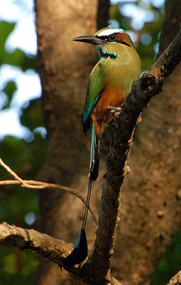
It is estimated that there are 500 species of birds, 1,000 species of butterflies, 400 species of orchids, 800 species of trees, and 800 species of marine fish in El Salvador.
Economy
El Salvador's economy has been hampered at times by natural disasters such as earthquakes and hurricanes, by government policies that mandate large economic subsidies, and by official corruption. Subsidies became such a problem that in April 2012, the International Monetary Fund suspended a $750 million loan to the central government. President Funes' chief of cabinet, Alex Segovia, acknowledged that the economy was at the "point of collapse."
Antiguo Cuscatlán has the highest per capita income of all the cities in the country, and is a center of international investment.
GDP in purchasing power parity (PPP) in 2008 was estimated at $25.895 billion USD. The service sector is the largest component of GDP at 64.1%, followed by the industrial sector at 24.7% (2008 est.). Agriculture represents only 11.2% of GDP (2010 est.)
The GDP grew after 1996 at an annual rate that averaged 3.2% real growth. The government committed to free market initiatives, and the 2007 GDP's real growth rate was 4.7%.
In December 1999, net international reserves equaled US $1.8 billion or roughly five months of imports. Having this hard currency buffer to work with, the Salvadoran government undertook a monetary integration plan beginning January 1, 2001 by which the U.S. dollar became legal tender alongside the Salvadoran colón, and all formal accounting was done in U.S. dollars. Thus, the government has formally limited the implementing of open market monetary policies to influence short-term variables in the economy. As of September 2007, net international reserves stood at $2.42 billion.
It has long been a challenge in El Salvador to develop new growth sectors for a more diversified economy. In the past, the country produced gold and silver, but recent attempts to re-open the mining sector, which were expected to add hundreds of millions of dollars to the local economy, collapsed after President Saca shut down the operations of Pacific Rim Mining Corporation.
As with other former colonies, El Salvador was considered a mono-export economy (an economy that depended heavily on one type of export) for many years. During colonial times, El Salvador was a thriving exporter of indigo, but after the invention of synthetic dyes in the 19th century, the newly created modern state turned to coffee as the main export.
San Miguel is an important economic center of El Salvador and home to the "Carnival of San Miguel", one of the biggest festivals of entertainment and food in Central America.]] The government has sought to improve the collection of its current revenues, with a focus on indirect taxes. A 10% value-added tax (IVA in Spanish), implemented in September 1992, was raised to 13% in July 1995.
Inflation has been steady and among the lowest in the region. Since 1997 inflation has averaged 3%, with recent years increasing to nearly 5%. As a result of the free trade agreements, from 2000 to 2006, total exports have grown 19% from $2.94 billion to $3.51 billion, and total imports have risen 54% from $4.95 billion to $7.63 billion. This has resulted in a 102% increase in the trade deficit, from $2.01 billion to $4.12 billion.
Tourism
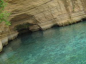
It was estimated that 1,394,000 international tourists would visit El Salvador in 2014. Tourism contributed US$855.5 million to El Salvador's GDP in 2013. This represented 3.5% of total GDP.
Tourism directly supported 80,500 jobs in 2013. This represented 3.1% of total employment in El Salvador. In 2013, tourism indirectly supported 210,000 jobs, representing 8.1% of total employment in El Salvador.
The airport serving international flights in El Salvador is Comalapa International Airport. This airport is located about 40 km (25 mi) southeast of San Salvador.
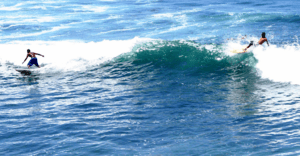
Most North American and European tourists seek out El Salvador's beaches and nightlife. Besides these two attractions, El Salvador's tourism landscape is slightly different from those of other Central American countries. Because of its geographic size and urbanization there are not many nature-themed tourist destinations such as ecotours or archaeological sites open to the public. Surfing is a natural tourism sector that has gained popularity in recent years as Salvadoran beaches have become increasingly popular.
Surfers visit many beaches on the coast of La Libertad and the east end of El Salvador, finding surfing spots that are not yet overcrowded. The use of the United States dollar as Salvadoran currency and direct flights of 4 to 6 hours from most cities in the United States are factors that attract American tourists. Urbanization and Americanization of Salvadoran culture has also led to the abundance of American-style malls, stores, and restaurants in the three main urban areas, especially greater San Salvador.
According to the El Salvadoran newspaper El Diario De Hoy, the top 10 attractions are: the coastal beaches, La Libertad, Ruta Las Flores, Suchitoto, Playa Las Flores in San Miguel, La Palma, Santa Ana (location of the country's highest volcano), Nahuizalco, Apaneca, Juayua, and San Ignacio.
Demographics
The capital city of San Salvador has a population of about 2.1 million people. An estimated 42% of El Salvador's population live in rural areas. Urbanization has expanded at a phenomenal rate in El Salvador since the 1960s, with millions moving to the cities and creating associated problems for urban planning and services.
Ethnic groups
El Salvador's population is composed of Mestizos, whites, and indigenous peoples. Eighty-six percent of Salvadorans are of mestizo ancestry, having mixed indigenous and European ancestry.
There were approximately 3.2 million Salvadorans living outside El Salvador, with the United States traditionally being the destination of choice for Salvadoran economic migrants. By 2012, there were about 2.0 million Salvadoran immigrants and Americans of Salvadoran descent in the U.S., making them the sixth largest immigrant group in the country. The second destinatation of Salvadorans living outside is Guatemala, with more than 111,000 persons, mainly in Guatemala City. Salvadorans also live in other nearby countries such as Belize, Honduras and Nicaragua. Other countries with notable Salvadoran communities include Canada, Mexico, the United Kingdom (including the Cayman Islands), Sweden, Brazil, Italy, Colombia, and Australia.
Languages
Spanish is the official language and is spoken by virtually all inhabitants. Some indigenous people speak their native tongues (such as Nawat and Maya), but indigenous Salvadorans who do not identify as mestizo constitute only 1% of the country's population. However, all of them can speak Spanish. Q'eqchi' is spoken by immigrants of Guatemalan and Belizean indigenous people living in El Salvador. There have also been recent large migrations of Hondurans and Nicaraguans into the country.
The local Spanish vernacular is called Caliche. Salvadorans use voseo, which is also used in Argentina, Costa Rica, Nicaragua and Uruguay. This refers to the use of "vos" as the second person pronoun, instead of "tú". "Caliche" is considered informal, and a few people choose not to use it. Nawat is an indigenous language that has survived, though it is only used by small communities of some elderly Salvadorans in western El Salvador.
Largest cities
Religion
The majority of the population in El Salvador is Christian. Roman Catholics (47%) and Protestants (33%) are the two major denominations in the country. Those not affiliated with any religious group amount to 17% of the population. The remainder of the population (3%) is made up of Jehovah's Witnesses, Hare Krishnas, Muslims, Jews, Buddhists, Latter-day Saints, and those adhering to indigenous religious beliefs. The number of evangelicals in the country is growing rapidly.
Presently, the Alto al Crimen or Crime Stoppers program is in operation and provides financial rewards for information leading to the capture of gang leadership. The reward often ranges between $100 and $500 US Dollars per call.
Culture
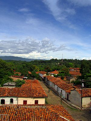
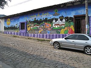
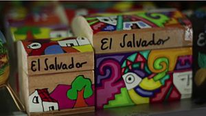
Mestizo culture dominates the country, heavy in both Native American Indigenous and European Spanish influences. A new composite population was formed as a result of intermarrying between the native Mesoamerican population of Cuzcatlan with the European settlers. The Catholic Church plays an important role in the Salvadoran culture. Archbishop Óscar Romero is a national hero for his role in resisting human rights violations that were occurring in the lead-up to the Salvadoran Civil War. Significant foreign personalities in El Salvador were the Jesuit priests and professors Ignacio Ellacuria, Ignacio Martín-Baró, and Segundo Montes.
Painting, ceramics and textiles are the principal manual artistic mediums. Writers Francisco Gavidia (1863–1955), Salarrué (Salvador Salazar Arrué) (1899–1975), Claudia Lars, Alfredo Espino, Pedro Geoffroy Rivas, Manlio Argueta, José Roberto Cea, and poet Roque Dalton are among the most important writers from El Salvador. Notable 20th-century personages include the late filmmaker Baltasar Polio, female film director Patricia Chica, artist Fernando Llort, and caricaturist Toño Salazar.
Amongst the more renowned representatives of the graphic arts are the painters Augusto Crespin, Noe Canjura, Carlos Cañas, Julia Díaz, Mauricio Mejia, Maria Elena Palomo de Mejia, Camilo Minero, Ricardo Carbonell, Roberto Huezo, Miguel Angel Cerna, (the painter and writer better known as MACLo), Esael Araujo, and many others. For more information on prominent citizens of El Salvador, check the List of Salvadorans.
Cuisine
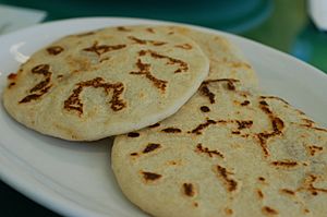
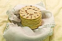
One of El Salvador's notable dishes is the pupusa. Pupusas are handmade corn tortillas (made of masa de maíz or masa de arroz, a maize or rice flour dough used in Latin American cuisine) stuffed with one or more of the following: cheese (usually a soft Salvadoran cheese such as quesillo, similar to mozzarella), chicharrón, or refried beans. Sometimes the filling is queso con loroco (cheese combined with loroco, a vine flower bud native to Central America).
Pupusas revueltas are pupusas filled with beans, cheese and pork. There are also vegetarian options. Some adventurous restaurants even offer pupusas stuffed with shrimp or spinach. The name pupusa comes from the Pipil-Nahuatl word, pupushahua. The precise origins of the pupusa are debated, although its presence in El Salvador is known to predate the arrival of the Spaniards.
Two other typical Salvadoran dishes are yuca frita and panes con pollo. Yuca frita is deep fried cassava root served with curtido (a pickled cabbage, onion and carrot topping) and pork rinds with pescaditas (fried baby sardines). The Yuca is sometimes served boiled instead of fried. Pan con pollo/pavo (bread with chicken/turkey) are warm turkey or chicken-filled submarine sandwiches. The bird is marinated and then roasted with Pipil spices and handpulled. This sandwich is traditionally served with tomato and watercress along with cucumber, onion, lettuce, mayonnaise, and mustard.
One of El Salvador's typical breakfasts is fried plantain, usually served with cream. It is common in Salvadoran restaurants and homes, including those of immigrants to the United States.
Alguashte, a condiment made from dried, ground pepitas, is commonly incorporated into savoury and sweet Salvadoran dishes.
"Maria Luisa" is a dessert commonly found in El Salvador. It is a layered cake that is soaked in orange marmalade and sprinkled with powdered sugar.
A popular drink that Salvadorans enjoy is Horchata, a drink native to the Valencian Community in Spain. Horchata is most commonly made of the morro seed ground into a powder and added to milk or water, and sugar. Horchata is drank year-round, and can be drank at any time of day. It mostly is accompanied by a plate of pupusas or fried yuca. Horchata from El Salvador has a very distinct taste and is not to be confused with Mexican horchata, which is rice-based. Coffee is also a common morning beverage.
Other popular drinks in El Salvador include Ensalada, a drink made of chopped fruit swimming in fruit juice, and Kolachampan, a sugar cane-flavored carbonated beverage.
One of the most popular desserts is the cake Pastel de tres leches (Cake of three milks), consisting of three types of milk: evaporated milk, condensed milk, and cream.
Music
Salvadoran music is a mixture of indigenous Pipil and Spanish influences. Music includes religious songs (mostly used to celebrate Christmas and other holidays, especially feast days of the saints). Satirical and rural lyrical themes are common. Cuban, Colombian, and Mexican music has infiltrated the country, especially salsa and cumbia. Popular music in El Salvador uses marimba, tehpe'ch, flutes, drums, scrapers and gourds, as well as more recently imported guitars and other instruments. El Salvador's well known folk dance is known as Xuc which originated in Cojutepeque, Cuscatlan. Other musical repertoire consists of danza, pasillo, marcha and canciones.
Sport
Soccer is the most popular sport in El Salvador. The El Salvador national football team qualified for the FIFA World Cup in 1970 and 1982. Their qualification for the 1970 tournament was marred by the Football War, a war against Honduras, whose team El Salvador's had defeated.
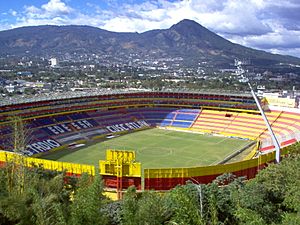
The national football team play at the Estadio Cuscatlán in San Salvador. It opened in 1976 and seats 53,400, making it the largest stadium in Central America and the Caribbean.
Images for kids
-
Excavation of a Megatherium in the Tomayate site Apopa.
-
Skull fossil of an ancient horse in the Tomayate site Apopa.
-
Spanish Conquistador Pedro de Alvarado.
-
Tazumal ruins in Santa Ana, El Salvador.
-
A painting of the First Independence Movement celebration in San Salvador. At the centre, José Matías Delgado.
-
Gen. Tomás Regalado
-
Archbishop Romero; Romero spoke out against social injustice and violence amid the escalating conflict between the military government and left-wing insurgents that led to the Salvadoran Civil War.
-
San Miguel volcano in 2013
-
The torogoz is El Salvador's national bird.
-
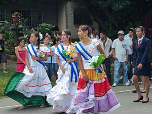
San Miguel is an important economic centre of El Salvador and home to the "Carnival of San Miguel", one of the biggest festivals of entertainment and food in Central America.
See also
 In Spanish: El Salvador para niños


