Central America facts for kids
 |
|
| Area | 523,780 km2 (202,230 sq mi) |
|---|---|
| Population | 52,700,000 (2023) |
| Population density | 100.6/km2 (261/sq mi) (2023) |
| GDP (nominal) | $362.62 billion (exchange rate) (2023) |
| GDP (PPP) | $738.8 billion (2023) |
| GDP per capita | $6,880 (exchange rate) (2023) $14,019 (PPP) (2023) |
| Demonym | Central American |
| Countries | |
| Dependencies | |
| Languages | |
| Time zones | UTC−06:00 to UTC−05:00 |
| Largest cities |
|
| UN M49 code | 013 – Central America419 – Latin America and the Caribbean019 – Americas001 – World |
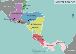
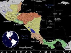
Central America is a subregion of North America. Its political boundaries are defined as bordering Mexico to the north, Colombia to the southeast, the Caribbean to the east, and the Pacific Ocean to the southwest. Central America is usually defined as consisting of seven countries: Belize, Costa Rica, El Salvador, Guatemala, Honduras, Nicaragua, and Panama. Within Central America is the Mesoamerican biodiversity hotspot, which extends from southern Mexico to southeastern Panama. Due to the presence of several active geologic faults and the Central America Volcanic Arc, there is a high amount of seismic activity in the region, such as volcanic eruptions and earthquakes, which has resulted in death, injury, and property damage.
In the pre-Columbian era, Central America was inhabited by the Indigenous peoples of Mesoamerica to the north and west and the Isthmo-Colombian peoples to the south and east. Following the Spanish expedition of Christopher Columbus' voyages to the Americas, Spain began to colonize the Americas. From 1609 to 1821, the majority of Central American territories (except for what would become Belize and Panama, and including the modern Mexican state of Chiapas) were governed by the viceroyalty of New Spain from Mexico City as the Captaincy General of Guatemala. On 24 August 1821, Spanish Viceroy Juan de O'Donojú signed the Treaty of Córdoba, which established New Spain's independence from Spain. On 15 September 1821, the Act of Independence of Central America was enacted to announce Central America's separation from the Spanish Empire and provide for the establishment of a new Central American state. Some of New Spain's provinces in the Central American region (i.e. what would become Guatemala, Honduras, El Salvador, Nicaragua and Costa Rica) were annexed to the First Mexican Empire; however in 1823 they seceded from Mexico to form the Federal Republic of Central America until 1838.
In 1838, Costa Rica, Guatemala, Honduras, and Nicaragua became the first of Central America's seven states to become independent countries, followed by El Salvador in 1841, Panama in 1903, and Belize in 1981. Despite the dissolution of the Federal Republic of Central America, countries like Costa Rica, El Salvador, Guatemala, Honduras, and Nicaragua continue to maintain a Central American identity. Belizeans are usually identified as culturally Caribbean rather than Central American, while Panamanians identify themselves more broadly with their South American neighbors.
The Spanish-speaking countries officially include both North America and South America as a single continent, América, which is split into four subregions: North America (Northern America and Mexico), Central America, South America, and Insular America (the West Indies).
Contents
Flags of modern Central America
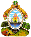
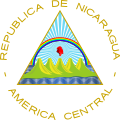
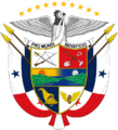
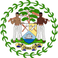
Coats of arms of modern Central America
Geography
Central America is a part of North America consisting of a tapering isthmus running from the southern extent of Mexico to the northwestern portion of South America. Central America has the Gulf of Mexico, a body of water within the Atlantic Ocean, to the north; the Caribbean Sea, also part of the Atlantic Ocean, to the northeast; and the Pacific Ocean to the southwest. Some physiographists define the Isthmus of Tehuantepec as the northern geographic border of Central America, while others use the northwestern borders of Belize and Guatemala. From there, the Central American land mass extends southeastward to the Atrato River, where it connects to the Pacific Lowlands in northwestern South America.
Central America has over 70 active volcanoes, 41 which are located in El Salvador, and Guatemala. The volcano with the most activity in Central America is Santa María. Still experiencing frequent eruptions to this day, with the last one beginning in 2013, and still is going on to this day.
Of the many mountain ranges within Central America, the longest are the Sierra Madre de Chiapas, the Cordillera Isabelia and the Cordillera de Talamanca. At 4,220 meters (13,850 ft), Volcán Tajumulco is the highest peak in Central America. Other high points of Central America are as listed in the table below:
| Country | Name | Elevation | Range |
|---|---|---|---|
| Doyle's Delight | 1,124 m (3,688 ft) | Maya Mountains | |
| Cerro Chirripó | 3,820 m (12,530 ft) | Cordillera de Talamanca | |
| Cerro El Pital | 2,730 m (8,960 ft) | Sierra Madre de Chiapas | |
| Volcán Tajumulco | 4,220 m (13,850 ft) | Sierra Madre de Chiapas | |
| Cerro Las Minas | 2,780 m (9,120 ft) | Sierra Madre de Chiapas | |
| Mogotón | 2,107 m (6,913 ft) | Cordillera Isabelia | |
| Volcán Barú | 3,474 m (11,398 ft) | Cordillera de Talamanca |
Between the mountain ranges lie fertile valleys that are suitable for the raising of livestock and for the production of coffee, tobacco, beans and other crops. Most of the population of Honduras, Costa Rica and Guatemala lives in valleys.
Trade winds have a significant effect upon the climate of Central America. Temperatures in Central America are highest just prior to the summer wet season, and are lowest during the winter dry season, when trade winds contribute to a cooler climate. The highest temperatures occur in April, due to higher levels of sunlight, lower cloud cover and a decrease in trade winds.
Biodiversity
Central American forests
-
Montecristo National Park, El Salvador
-
Maderas forest, Nicaragua
-
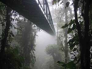
Monteverde Cloud Forest Reserve, Costa Rica.
-
Petén–Veracruz moist forests, Guatemala
Central America is part of the Mesoamerican biodiversity hotspot, boasting 7% of the world's biodiversity. The Pacific Flyway is a major north–south flyway for migratory birds in the Americas, extending from Alaska to Tierra del Fuego. Due to the funnel-like shape of its land mass, migratory birds can be seen in very high concentrations in Central America, especially in the spring and autumn. As a bridge between North America and South America, Central America has many species from the Nearctic and the Neotropical realms. However the southern countries (Costa Rica and Panama) of the region have more biodiversity than the northern countries (Guatemala and Belize), meanwhile the central countries (Honduras, Nicaragua and El Salvador) have the least biodiversity. The table below shows recent statistics:
| Country | Amphibian species |
Bird species |
Mammal species |
Reptile species |
Total terrestrial vertebrate species |
Vascular plants species |
Biodiversity |
|---|---|---|---|---|---|---|---|
| Belize | 46 | 544 | 147 | 140 | 877 | 2894 | 3771 |
| Costa Rica | 183 | 838 | 232 | 258 | 1511 | 12119 | 13630 |
| El Salvador | 30 | 434 | 137 | 106 | 707 | 2911 | 3618 |
| Guatemala | 133 | 684 | 193 | 236 | 1246 | 8681 | 9927 |
| Honduras | 101 | 699 | 201 | 213 | 1214 | 5680 | 6894 |
| Nicaragua | 61 | 632 | 181 | 178 | 1052 | 7590 | 8642 |
| Panama | 182 | 904 | 241 | 242 | 1569 | 9915 | 11484 |
Over 300 species of the region's flora and fauna are threatened, 107 of which are classified as critically endangered. The underlying problems are deforestation, which is estimated by FAO at 1.2% per year in Central America and Mexico combined, fragmentation of rainforests and the fact that 80% of the vegetation in Central America has already been converted to agriculture.
Efforts to protect fauna and flora in the region are made by creating ecoregions and nature reserves. 36% of Belize's land territory falls under some form of official protected status, giving Belize one of the most extensive systems of terrestrial protected areas in the Americas. In addition, 13% of Belize's marine territory are also protected. A large coral reef extends from Mexico to Honduras: the Mesoamerican Barrier Reef System. The Belize Barrier Reef is part of this. The Belize Barrier Reef is home to a large diversity of plants and animals, and is one of the most diverse ecosystems of the world. It is home to 70 hard coral species, 36 soft coral species, 500 species of fish and hundreds of invertebrate species. So far only about 10% of the species in the Belize barrier reef have been discovered.
National flowers
-
Lycaste skinneri, Guatemala
-
Izote flower, El Salvador
-
Plumeria, Nicaragua
-
Prosthechea cochleata, Belize
National trees
-
Enterolobium cyclocarpum, Costa Rica
-
Tabebuia rosea, El Salvador
-
Calycophyllum candidissimum, Nicaragua
-
Swietenia macrophylla, Belize
-
Ceiba, Guatemala
From 2001 to 2010, 5,376 square kilometers (2,076 sq mi) of forest were lost in the region. In 2010 Belize had 63% of remaining forest cover, Costa Rica 46%, Panama 45%, Honduras 41%, Guatemala 37%, Nicaragua 29%, and El Salvador 21%. Most of the loss occurred in the moist forest biome, with 12,201 square kilometers (4,711 sq mi). Woody vegetation loss was partially set off by a gain in the coniferous forest biome with 4,730 square kilometers (1,830 sq mi), and a gain in the dry forest biome at 2,054 square kilometers (793 sq mi). Mangroves and deserts contributed only 1% to the loss in forest vegetation. The bulk of the deforestation was located at the Caribbean slopes of Nicaragua with a loss of 8,574 square kilometers (3,310 sq mi) of forest in the period from 2001 to 2010. The most significant regrowth of 3,050 square kilometers (1,180 sq mi) of forest was seen in the coniferous woody vegetation of Honduras.
Montane forests
The Central American pine-oak forests ecoregion, in the tropical and subtropical coniferous forests biome, is found in Central America and southern Mexico. The Central American pine-oak forests occupy an area of 111,400 square kilometers (43,000 sq mi), extending along the mountainous spine of Central America, extending from the Sierra Madre de Chiapas in Mexico's Chiapas state through the highlands of Guatemala, El Salvador, and Honduras to central Nicaragua. The pine-oak forests lie between 600–1,800 metres (2,000–5,900 ft) elevation, and are surrounded at lower elevations by tropical moist forests and tropical dry forests. Higher elevations above 1,800 metres (5,900 ft) are usually covered with Central American montane forests. The Central American pine-oak forests are composed of many species characteristic of temperate North America including oak, pine, fir, and cypress.
Laurel forest is the most common type of Central American temperate evergreen cloud forest, found in almost all Central American countries, normally more than 1,000 meters (3,300 ft) above sea level. Tree species include evergreen oaks, members of the laurel family, species of Weinmannia and Magnolia, and Drimys granadensis. The cloud forest of Sierra de las Minas, Guatemala, is the largest in Central America. In some areas of southeastern Honduras there are cloud forests, the largest located near the border with Nicaragua. In Nicaragua, cloud forests are situated near the border with Honduras, but many were cleared to grow coffee. There are still some temperate evergreen hills in the north. The only cloud forest in the Pacific coastal zone of Central America is on the Mombacho volcano in Nicaragua. In Costa Rica, there are laurel forests in the Cordillera de Tilarán and Volcán Arenal, called Monteverde, also in the Cordillera de Talamanca.
The Central American montane forests are an ecoregion of the tropical and subtropical moist broadleaf forests biome, as defined by the World Wildlife Fund. These forests are of the moist deciduous and the semi-evergreen seasonal subtype of tropical and subtropical moist broadleaf forests and receive high overall rainfall with a warm summer wet season and a cooler winter dry season. Central American montane forests consist of forest patches located at altitudes ranging from 1,800–4,000 metres (5,900–13,100 ft), on the summits and slopes of the highest mountains in Central America ranging from Southern Mexico, through Guatemala, El Salvador, and Honduras, to northern Nicaragua. The entire ecoregion covers an area of 13,200 square kilometers (5,100 sq mi) and has a temperate climate with relatively high precipitation levels.
Fauna
National birds
-
Resplendent quetzal, Guatemala
-
Turquoise-browed motmot, El Salvador and Nicaragua
-
Keel-billed toucan, Belize
-
Scarlet macaw, Honduras
-
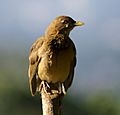
Clay-colored thrush, Costa Rica
-
Harpy eagle, Panama
Ecoregions are not only established to protect the forests themselves but also because they are habitats for an incomparably rich and often endemic fauna. Almost half of the bird population of the Talamancan montane forests in Costa Rica and Panama are endemic to this region. Several birds are listed as threatened, most notably the resplendent quetzal (Pharomacrus mocinno), three-wattled bellbird (Procnias tricarunculata), bare-necked umbrellabird (Cephalopterus glabricollis), and black guan (Chamaepetes unicolor). Many of the amphibians are endemic and depend on the existence of forest. The golden toad that once inhabited a small region in the Monteverde Reserve, which is part of the Talamancan montane forests, has not been seen alive since 1989 and is listed as extinct by IUCN. The exact causes for its extinction are unknown. Global warming may have played a role, because the development of that frog is typical for this area may have been compromised. Seven small mammals are endemic to the Costa Rica-Chiriqui highlands within the Talamancan montane forest region. Jaguars, cougars, spider monkeys, as well as tapirs, and anteaters live in the woods of Central America. The Central American red brocket is a brocket deer found in Central America's tropical forest.
Languages
The official language majority in all Central American countries is Spanish, except in Belize, where the official language is English. Mayan languages constitute a language family consisting of about 26 related languages. Guatemala formally recognized 21 of these in 1996. Xinca, Miskito, and Garifuna are also present in Central America.
| Rank | Country | Population | % Spanish | % Mayan languages |
% English | % Xinca | % Garifuna |
|---|---|---|---|---|---|---|---|
| 1 | Guatemala | 17,284,000 | 64.7% | 34.3% | 0.0% | 0.7% | 0.3% |
| 2 | Honduras | 8,447,000 | 97.1% | 2.0% | 0.0% | 0.0% | 0.9% |
| 3 | El Salvador | 6,108,000 | 99.0% | 1.0% | 0.0% | 0.0% | 0.0% |
| 4 | Nicaragua | 6,028,000 | 87.4% | 7.1% | 5.5% | 0.0% | 0.0% |
| 5 | Costa Rica | 4,726,000 | 97.2% | 1.8% | 1.0% | 0.0% | 0.0% |
| 6 | Panamá | 3,652,000 | 86.8% | 0.0% | 4.0% | 0.0% | 0.0% |
| 7 | Belize | 408,867 | 49.8% | 8.9% | 70.0% | 0.0% | 7.0% |
Culture
Art
National dishes
-
Baleada Honduras
-
Pupusa El Salvador
-
Sancocho Panama
-
Gallo pinto Costa Rica
-
Nacatamal Nicaragua
-
Rice and beans Belize
-
Pepián Guatemala
- Central American music
- Central American cuisine
- List of cuisines of the Americas – Central American cuisine
Sport
- Central American Games
- Central American and Caribbean Games
- 1926 Central American and Caribbean Games – the first time this event occurred
- Central American Football Union
- Surfing
Images for kids
-
The five rowed volcanos in the coat of arms of Central America was inspired by the Cordillera de Apaneca volcanic range of El Salvador, visible from the city of Sonsonate, which became the capital of the Federal Republic of Central America in 1834.
-
The Great Blue Hole off the coast of Belize is a prime ecotourism destination. It is a UNESCO World Heritage Site
-
Semuc Champey, Guatemala.
-
The city rail in La Ceiba, Honduras is one of the few remaining passenger train services in Central America
-
Ancient footprints of Acahualinca, Nicaragua
-
Tazumal, El Salvador
-
Tikal, Guatemala
-
Copan, Honduras
-
Montecristo National Park, El Salvador
-
Maderas forest, Nicaragua
-
Monteverde Cloud Forest Reserve, Costa Rica.
-
Parque Internacional la Amistad, Panama
-
Petén–Veracruz moist forests, Guatemala
-
Lycaste skinneri, Guatemala
-
Clay-colored thrush, Costa Rica
-
Coatepeque Caldera, El Salvador
-
Lake Atitlán, Guatemala
-
Mombacho, Nicaragua
-
Jiquilisco Bay, El Salvador
-
Roatán, Honduras
-
Tamarindo, Costa Rica
-
Cayos Zapatilla, Panama
See also
 In Spanish: América Central para niños


