Slovakia facts for kids
Quick facts for kids
Slovak Republic
Slovenská republika (Slovak)
|
|
|---|---|
|
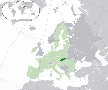
Location of Slovakia (dark green)
– on the European continent (green & dark grey) |
|
| Capital and largest city
|
Bratislava 48°09′N 17°07′E / 48.150°N 17.117°E |
| Official languages | Slovak |
| Ethnic groups
(2021)
|
|
| Religion
(2021)
|
|
| Demonym(s) | Slovak |
| Government | Unitary parliamentary republic |
| Peter Pellegrini | |
| Robert Fico | |
|
• Speaker of the National Council
|
Peter Žiga |
| Legislature | National Council |
| Establishment history | |
| 28 October 1918 | |
|
• Second Czechoslovak Republic
|
30 September 1938 |
|
• Autonomous Land of Slovakia (within Second Czechoslovak Republic)
|
23 November 1938 |
|
• First Slovak Republic
|
14 March 1939 |
| 24 October 1945 | |
|
• Fourth Czechoslovak Republic
|
25 February 1948 |
|
• Czechoslovak Socialist Republic
|
11 July 1960 |
|
• Slovak Socialist Republic (within Czechoslovak Socialist Republic, change of unitary Czechoslovak state into a federation)
|
1 January 1969 |
|
• Slovak Republic (change of name within established Czech and Slovak Federative Republic)
|
1 March 1990 |
|
• Dissolution of
Czechoslovakia |
1 January 1993 |
| Area | |
|
• Total
|
49,035 km2 (18,933 sq mi) (127th) |
|
• Water (%)
|
0.72 (2015) |
| Population | |
|
• 30 June 2024 estimate
|
|
|
• 2021 census
|
|
|
• Density
|
110/km2 (284.9/sq mi) (103rd) |
| GDP (PPP) | 2024 estimate |
|
• Total
|
|
|
• Per capita
|
|
| GDP (nominal) | 2024 estimate |
|
• Total
|
|
|
• Per capita
|
|
| Gini (2022) | ▼ 21.2 low |
| HDI (2022) | very high · 45th |
| Currency | Euro (€) (EUR) |
| Time zone | UTC+1 (CET) |
|
• Summer (DST)
|
UTC+2 (CEST) |
| Date format | d. m. yyyy |
| Driving side | right |
| Calling code | +421 |
| ISO 3166 code | SK |
| Internet TLD | .sk and .eu |
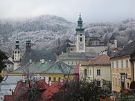
Slovakia (Slovak: Slovensko) (Official name The Slovak Republic, Slovenská republika) is a country with no access to the ocean in Central Europe. It is bordered by Austria in the southwest, Hungary in the south, Ukraine in the east, Poland in the north and Czech Republic in the northwest. Its capital city is Bratislava, the only capital of the world that borders with other two countries. Other main cities are Košice, Banská Bystrica, Žilina, Trenčín, Nitra, Prešov, Bardejov and Trnava. Slovakia is a member of the European Union since 2004 and its official currency is the Euro.
Contents
History
The Celts started to settle since 450 BC. The coins named Biatec represent the first use of writing in Slovakia. At the turn of millenniums, various Germanic tribes like Quadi and Marcomanni started to overtake the area. The Roman Empire established a series of outposts along the Danube river. They even fought Germanic tribes, with the most northern presence being in Trenčín (Laugaritio), during the Marcomannic Wars.
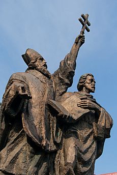
The Great Moravia was at first in constant quarrels with the Eastern Francia, and at the beginning of the 10th century, with the Magyars who arrived from Asia. The Magyars beat the Great Moravia in 906, overtook the area and established the Hungarian Principality, resulting later in the creation of the Kingdom of Hungary in year 1000. Slovak settlements continued to be in the north, while those of the Hungarians were in the south.
A huge population loss resulted from the Mongol invasions in 1241. The Hungarian kings started to invite other settlers, for example Germans in the 13th century, and many others started to arrive in the kingdom, Vlachs from Romania in the 14th century and Jews.
The expansion of the Ottoman Empire in the 16th century from the south, who occupied the two most important towns in the kingdom, Buda (capital) and Szekesfehérvár (coronation capital) and southern regions, the center shifted to Slovakia and the capitals moved to Bratislava (Pressburg, Pozsony at that time). The fights against the Ottomans and an uprising against the Habsburgs caused a lot of destruction. After the Ottomans started to retreat back from Hungary Bratislava continued to be capital until 1848, when it was moved back to Budapest.
The creation of the dual monarchy Austria-Hungary gave free hand to the Magyars, and Slovaks until 1918 were under cultural repressions from the Hungarian government, limiting the Slovak language, and promoting its Magyarisation policy.
The area was a part of Czechoslovakia from 1918 to 1992. Czechoslovakia became independent from the Austrian-Hungarian Empire in 1918. The first Czechoslovakian president was Tomáš Garrigue Masaryk. Czechoslovakia split for the first time in 1938/1939, when Slovakia, with Hitler's help, became independent, though all the time until 1945, the end of the World War II was puppet ally of the Nazi Germany. Czechoslovakia was once again created in 1945, where the Communists took rule in 1948 and ruled until 1989, when the series of events, called Velvet Revolution overthrown them. Soviet inspired Czechoslovakia peacefully split into two countries (Slovakia and Czech Republic) on January 1 1993, in what became known as the Velvet Divorce. Slovakia has been a member of the European Union since May 1, 2004.
Geography
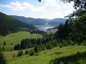
Slovakia lies between latitudes 47° and 50° N, and longitudes 16° and 23° E. The Slovak landscape is noted primarily for its mountainous nature, with the Carpathian Mountains extending across most of the northern half of the country. Among these mountain ranges are the high peaks of the Fatra-Tatra Area (including Tatra Mountains, Greater Fatra and Lesser Fatra), Slovak Ore Mountains, Slovak Central Mountains or Beskids. The largest lowland is the fertile Danubian Lowland in the southwest, followed by the Eastern Slovak Lowland in the southeast. Forests cover 41% of Slovak land surface.
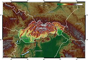
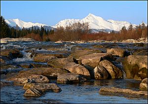
The Tatra Mountains, with 29 peaks higher than 2,500 metres (8,202 feet) AMSL, are the highest mountain range in the Carpathian Mountains. The Tatras occupy an area of 750 square kilometres (290 sq mi), of which the greater part 600 square kilometres (232 sq mi) lies in Slovakia. They are divided into several parts.
To the north, close to the Polish border, are the High Tatras which are a popular hiking and skiing destination and home to many scenic lakes and valleys as well as the highest point in Slovakia, the Gerlachovský štít at 2,655 metres (8,711 ft) and the country's highly symbolic mountain Kriváň. To the west are the Western Tatras with their highest peak of Bystrá at 2,248 metres (7,375 ft) and to the east are the Belianske Tatras, smallest by area.
Separated from the Tatras proper by the valley of the Váh river are the Low Tatras, with their highest peak of Ďumbier at 2,043 metres (6,703 ft).
The Tatra mountain range is represented as one of the three hills on the coat of arms of Slovakia.
National parks
There are 9 national parks in Slovakia, covering 6.5% of Slovak land surface.
Caves
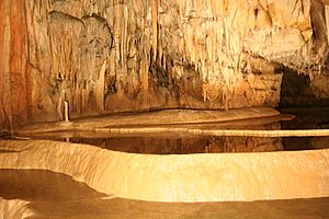
Slovakia has hundreds of caves and caverns under its mountains, of which 30 are open to the public. Most of the caves have stalagmites rising from the ground and stalactites hanging from above. There are currently five Slovak caves under UNESCO's World Heritage Site status. They are Dobšinská Ice Cave, Domica, Gombasek Cave, Jasovská Cave and Ochtinská Aragonite Cave. Other caves open to the public include Belianska Cave, Demänovská Cave of Liberty, Demänovská Ice Cave or Bystrianska Cave.
Rivers
Most of the rivers arise in the Slovak mountains. Some only pass through Slovakia, while others make a natural border with surrounding countries (more than 620 kilometres (385 mi)). For example, the Dunajec (17 kilometres (11 mi)) to the north, the Danube (172 kilometres (107 mi)) to the south or the Morava (119 kilometres (74 mi)) to the West. The total length of the rivers on Slovak territory is 49,774 kilometres (30,928 mi).
The longest river in Slovakia is the Váh (403 kilometres (250 mi)), the shortest is the Čierna voda. Other important and large rivers are the Myjava, the Nitra (197 kilometres (122 mi)), the Orava, the Hron (298 kilometres (185 mi)), the Hornád (193 kilometres (120 mi)), the Slaná (110 kilometres (68 mi)), the Ipeľ (232 kilometres (144 mi), forming the border with Hungary), the Bodrog, the Laborec, the Latorica and the Ondava.
The biggest volume of discharge in Slovak rivers is during spring, when the snow melts from the mountains. The only exception is the Danube, whose discharge is the greatest during summer when the snow melts in the Alps. The Danube is the largest river that flows through Slovakia.
Climate
The Slovak climate lies between the temperate and continental climate zones with relatively warm summers and cold, cloudy and humid winters. Temperature extremes are between −41 to 40.3 °C (−41.8 to 104.5 °F) although temperatures below −30 °C (−22 °F) are rare. The weather differs from the mountainous north to the plains in the south.
The warmest region is Bratislava and Southern Slovakia where the temperatures may reach 30 °C (86 °F) in summer, occasionally to 39 °C (102 °F) in Hurbanovo. During night, the temperatures drop to 20 °C (68 °F). The daily temperatures in winter average in the range of −5 °C (23 °F) to 10 °C (50 °F). During night it may be freezing, but usually not below −10 °C (14 °F).
In Slovakia, there are four seasons, each season (Spring, Summer, Autumn and Winter) lasts three months. The dry continental air brings in the summer heat and winter frosts. In contrast, oceanic air brings rainfalls and reduces summer temperatures. In the lowlands and valleys there is often fog, especially in winter.
Spring starts with 21 March and is characterised by colder weather with average daily temperature of 9 °C (48 °F) in the first weeks and about 14 °C (57 °F) in May and 17 °C (63 °F) in June. In Slovakia, the weather and climate in the spring is very unstable.
Summer starts on 22 June and is usually characterised by hot weather with daily temperatures exceeding 30 °C (86 °F). July is the warmest month with temperatures up to about 37 to 40 °C (99 to 104 °F), especially in regions of southern Slovakia – in the urban area of Komárno, Hurbanovo or Štúrovo. Showers or thunderstorms may occur because of the summer monsoon called Medardova kvapka (Medard drop – 40 days of rain). Summer in Northern Slovakia is usually mild with temperatures around 25 °C (77 °F) (less in the mountains).
Autumn in Slovakia starts on 23 September and is mostly characterised by wet weather and wind, although the first weeks can be very warm and sunny. The average temperature in September is around 14 °C (57 °F), in November to 3 °C (37 °F). Late September and early October is a dry and sunny time of year (so-called Indian Summer).
Winter starts on 21 December with temperatures around −5 to −10 °C (23 to 14 °F). In December and January it is usually snowing, these are the coldest months of the year. At lower altitudes, snow does not stay the whole winter, it changes into the thaw and frost. Winters are colder in the mountains, where the snow usually lasts until March or April and the night temperatures fall to −20 °C (−4 °F) and colder.
Biodiversity
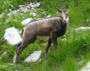
Slovakia signed the Rio Convention on Biological Diversity on 19 May 1993, and became a party to the convention on 25 August 1994. It has subsequently produced a National Biodiversity Strategy and Action Plan, which was received by the convention on 2 November 1998.
The biodiversity of Slovakia comprises animals (such as annellids, arthropods, molluscs, nematodes and vertebrates), fungi (Ascomycota, Basidiomycota, Chytridiomycota, Glomeromycota and Zygomycota), micro-organisms (including Mycetozoa), and plants. The geographical position of Slovakia determines the richness of the diversity of fauna and flora. More than 11,000 plant species have been described throughout its territory, nearly 29,000 animal species and over 1000 species of protozoa. Endemic biodiversity is also common.
Slovakia is located in the biome of temperate broadleaf and mixed forests. As the altitude changes, the vegetation associations and animal communities are forming height levels (oak, beech, spruce, scrub pine, alpine meadows and subsoil). Forests cover 44% of the territory of Slovakia. In terms of forest stands, 60% are broadleaf trees and 40% are coniferous trees. The occurrence of animal species is strongly connected to the appropriate types of plant associations and biotopes.
Fungi
Over 4000 species of fungi have been recorded from Slovakia. Of these, nearly 1500 are lichen-forming species. Some of these fungi are undoubtedly endemic, but not enough is known to say how many. Of the lichen-forming species, about 40% have been classified as threatened in some way. About 7% are apparently extinct, 9% endangered, 17% vulnerable, and 7% rare. The conservation status of non-lichen-forming fungi in Slovakia is not well documented, but there is a red list for its larger fungi.
Demographics
About 5.5 million people live in Slovakia. Most people are Slovak (86%), but in southern regions of Slovakia live Hungarians (10%), with some municipalities even being with the Hungarian majority (for example, Komárno or Dunajská Streda), Ruthenian or Ukrainian are spoken in the northeast. A minority Roma population speak versions of the Romany language and are scattered mainly in the east.
The Slovak constitution guarantees a freedom of religion. The majority of Slovaks are Roman Catholics (69%), the next are the atheists (13%). Other religions include Lutheranism, Greek Orthodox and Calvinism. There are about 5,000 Muslims in Slovakia and 2,000 Jews.
Economy
The Slovak economy is one of the fastest growing economies in Europe and 3rd fastest in eurozone (2017).
Industry
The main industry sectors are car manufacturing and electrical engineering. Since 2007, Slovakia has been the world's largest producer of cars per capita, with a total of 1,090,000 cars manufactured in the country in 2018 alone. 275,000 people are employed directly and indirectly by the automotive industry. There are currently four automobile assembly plants: Volkswagen's in Bratislava (models: Volkswagen Up, Volkswagen Touareg, Audi Q7, Audi Q8, Porsche Cayenne, Lamborghini Urus), PSA Peugeot Citroën's in Trnava (models: Peugeot 208, Citroën C3 Picasso), Kia Motors' Žilina Plant (models: Kia Cee'd, Kia Sportage, Kia Venga) and Jaguar Land Rover's in Nitra (model: Land Rover Discovery). Hyundai Mobis in Žilina is the largest suppliers for the automotive industry in Slovakia.
From electrical engineering companies, Foxconn has a factory at Nitra for LCD TV manufacturing, Samsung at Galanta for computer monitors and television sets manufacturing. Slovnaft based in Bratislava with 4,000 employees, is an oil refinery with a processing capacity of 5.5 - 6 million tonnes of crude oil, annually. Steel producer U. S. Steel in Košice is the largest employer at the east of Slovakia with 12,000 employees.
Energy
In 2012, Slovakia produced a total of 28,393 GWh of electricity while at the same time consumed 28 786 GWh. The slightly higher level of consumption than the capacity of production (- 393 GWh) meant the country was not self-sufficient in energy sourcing. Slovakia imported electricity mainly from the Czech Republic (9 961 GWh – 73.6% of total import) and exported mainly to Hungary (10 231 GWh – 78.2% of total export).
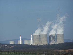
Nuclear energy accounts for 53.8% of total electricity production in Slovakia, followed by 18.1% of thermal power energy, 15.1% by hydro power energy, 2% by solar energy, 9.6% by other sources and the rest 1.4% is imported.
Transportation
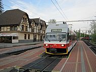
- Rail: Slovakia has 3,662 km of rails, of which 3,512 km are in standard gauge. Rail network currently undergoes a modernisation.
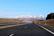
- Road: Slovakia has 42,993 km of roads, of which 316 km are motorways (2003). The motorway network is currently under construction.
- Air: Slovakia has 6 international airports, with the most important ones being in Bratislava and Košice, others are near Sliač, Poprad, Žilina and Piešťany.
- Marine: Slovakia has no direct access to the sea. The most important waterway is the Danube, with the ports in Bratislava and Komárno. The Danube and the Rhine-Main-Danube canal connects Slovakia to the North Sea and the Black Sea.
Administrative division
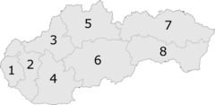
There are currently 8 regions of Slovakia:
- Bratislava Region (Bratislavský kraj) (capital Bratislava)
- Trnava Region (Trnavský kraj) (capital Trnava)
- Trenčín Region (Trenčiansky kraj) (capital Trenčín)
- Nitra Region (Nitriansky kraj) (capital Nitra)
- Žilina Region (Žilinský kraj) (capital Žilina)
- Banská Bystrica Region (Banskobystrický kraj) (capital Banská Bystrica)
- Prešov Region (Prešovský kraj) (capital Prešov)
- Košice Region (Košický kraj) (capital Košice)
These are further divided into many districts. There are currently 79 districts of Slovakia.
Government and politics
Slovakia is a parliamentary democratic republic with a multi-party system.
The Slovak head of state and the formal head of the executive is the president, though with very limited powers. The president is elected by direct, popular vote under the two-round system for a five-year term. Most executive power lies with the head of government, the prime minister, who is usually the leader of the winning party and who needs to form a majority coalition in the parliament. The prime minister is appointed by the president. The remainder of the cabinet is appointed by the president on the recommendation of the prime minister.
Slovakia's highest legislative body is the 150-seat unicameral National Council of the Slovak Republic (Národná rada Slovenskej republiky). Delegates are elected for a four-year term on the basis of proportional representation.
Slovakia's highest judicial body is the Constitutional Court of Slovakia (Ústavný súd), which rules on constitutional issues. The 13 members of this court are appointed by the president from a slate of candidates nominated by parliament.
The Constitution of the Slovak Republic was ratified 1 September 1992, and became effective 1 January 1993. It was amended in September 1998 to allow direct election of the president and again in February 2001 due to EU admission requirements.
Cuisine
Traditional Slovak cuisine is based mainly on pork, poultry (chicken is the most widely eaten, followed by duck, goose, and turkey), flour, potatoes, cabbage, and milk products. It is relatively closely related to Hungarian, Czech, Polish and Austrian cuisine. On the east it is also influenced by Ukrainian, including Lemko and Rusyn. In comparison with other European countries, "game meat" is more accessible in Slovakia due to vast resources of forest and because hunting is relatively popular. Boar, rabbit, and venison are generally available throughout the year. Lamb and goat are eaten but are not widely popular.
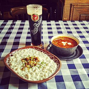
The traditional Slovak meals are bryndzové halušky, bryndzové pirohy and other meals with potato dough and bryndza. Bryndza is a salty cheese made of sheep milk, characterised by a strong taste and aroma. Bryndzové halušky especially is considered a national dish, and is very commonly found on the menu of traditional Slovak restaurants.
A typical soup is a sauerkraut soup ("kapustnica"). A blood sausage called "krvavnica", made from any parts of a butchered pig, is also a specific Slovak meal.
Wine is enjoyed throughout Slovakia. Slovak wine comes predominantly from the southern areas along the Danube and its tributaries; the northern half of the country is too cold and mountainous to grow grapevines. Traditionally, white wine was more popular than red or rosé (except in some regions), and sweet wine more popular than dry; however, in recent years tastes seem to be changing. Beer (mainly of the pilsener style, though dark lagers are also consumed) is also popular.
Related pages
- List of rivers of Slovakia
- Slovakia at the Olympics
- Slovakia national football team
- Slovakia men's national ice hockey team
Images for kids
-
Left: a Celtic Biatec coin Right: five Slovak crowns
-
A Roman inscription at the castle hill of Trenčín (178–179 AD)
-
Scire vos volumus, a letter written in 879 by Pope John VIII to Svatopluk I
-
Czechoslovak declaration of independence by Tomáš Garrigue Masaryk in the United States, 1918.
-
Adolf Hitler greeting Jozef Tiso, president of the (First) Slovak Republic, a client state of Nazi Germany during World War II, 1941.
-
Troops of Slovak anti-Nazi resistance movement in 1944.
-
The Velvet Revolution ended 41 years of authoritarian Communist rule in Czechoslovakia in 1989.
-
Slovakia became a member of the European Union in 2004 and signed the Lisbon Treaty in 2007.
-
The centre of Bardejov – a UNESCO World Heritage Site.
-
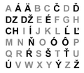
The Slovak alphabet has 46 characters, of which 3 are digraphs and 18 contain diacritics.
-
Comenius University headquarters in Bratislava
-
Wooden folk architecture can be seen in the well-preserved village of Vlkolínec, a UNESCO World Heritage Site
-
Slovaks wearing folk costumes from Eastern Slovakia
-
Ľudovít Štúr, the creator of standard Slovak
-
The Slovak national ice hockey team celebrating a victory against Sweden at the 2010 Winter Olympics
See also
 In Spanish: Eslovaquia para niños


