Middlesex County, New Jersey facts for kids
Quick facts for kids
Middlesex County
|
|||
|---|---|---|---|
|
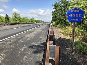
Images, from top down, left to right: The Bishop House at Rutgers New Brunswick, New Jersey's flagship for higher education and a center for the sciences, arts, and cultural activities; The Metlar–Bodine House in the Road Up Raritan Historic District in Piscataway; The historic Milltown India Rubber Factory in Milltown; Davidson Mill Pond on the Lawrence Brook in South Brunswick
|
|||
|
|||
| Nickname(s):
The Greatest County in the Land
|
|||
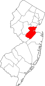
Location within the U.S. state of New Jersey
|
|||
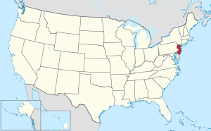 New Jersey's location within the U.S. |
|||
| Country | |||
| State | |||
| Founded | 1683 | ||
| Named for | Middlesex, England | ||
| Seat | New Brunswick | ||
| Largest municipality | Edison (population) Monroe Township (area) |
||
| Area | |||
| • Total | 322.87 sq mi (836.2 km2) | ||
| • Land | 309.22 sq mi (800.9 km2) | ||
| • Water | 13.65 sq mi (35.4 km2) 4.2% | ||
| Population
(2020)
|
|||
| • Total | 863,162 (3rd in NJ) | ||
| • Estimate
(2023)
|
863,623 |
||
| Time zone | UTC−5 (Eastern) | ||
| • Summer (DST) | UTC−4 (EDT) | ||
| Congressional districts | 6th, 12th | ||
Middlesex County is a county located in the north-central part of the U.S. state of New Jersey, extending inland from the Raritan Valley region to the northern portion of the Jersey Shore. As of the 2020 United States census, the county was the state's third-most populous county with a population of 863,162, its highest decennial count ever and an increase of 53,304 (+6.6%) from the 2010 census count of 809,858, which in turn reflected an increase of 59,696 (8.0%) from the 750,162 counted in the 2000 census. Middlesex is part of the New York metropolitan area. Many communities within the county serve as commuter towns to and from New York City and other points north. The county is part of the Central Jersey region of the state.
The county is located in the middle of the Northeast megalopolis of the U.S. Its county seat is the city of New Brunswick, a center for the sciences, arts, and cultural activities, and the headquarters of the state's flagship academic institution, Rutgers University. The county's most populous place, with 107,588 residents as of the 2020 census, is Edison, while Monroe Township covers the largest area of any municipality, at 42.19 square miles (109.3 km2). Since the 2010 census, the state's center of population is in East Brunswick; the center of population for New Jersey has been in Middlesex County since the 1900 census. Middlesex County hosts an extensive transportation network, including several rail stations along the heavily traveled Northeast Corridor Line of the New Jersey Transit commuter rail system, as well as the intersection of the New Jersey Turnpike and the Garden State Parkway, the state's two busiest motor vehicle roadways, in Woodbridge Township. Middlesex County calls itself The Greatest County in the Land.
The county was primarily settled due to its optimal location along the Raritan River. Middlesex was originally formed as one of four administrative districts within Province of East Jersey in 1675, together with Bergen, Essex and Monmouth districts. Middlesex County was formed within East Jersey on March 7, 1683. The population increased so the county was partitioned on October 31, 1693, into the townships of Piscataway, Perth Amboy, and Woodbridge. Adjacent Somerset County was established on May 14, 1688, created from portions of Middlesex County.
The county's first court met in June 1683 in Piscataway, and held session at alternating sites over the next century in Perth Amboy, Piscataway, and Woodbridge before relocating permanently to New Brunswick in 1778. Despite its status as a residential, commercial, and industrial stronghold and a centrally accessible transportation hub, Middlesex is also home to an extensive public park system with expansive greenways, totaling more than 6,300 acres (2,500 ha). Middlesex County is most demographically notable as the U.S. county with the highest concentration of Asian Indians, at nearly 20% in 2020, spanning the county's boundaries between Little India, Edison/Iselin in the north and Monroe Township at its southern tip.
Contents
Geography and climate
Middlesex has a hot-summer humid continental climate (Dfa) which borders a humid subtropical climate (Cfa) on Raritan Bay and Arthur Kill. Average monthly temperatures in downtown New Brunswick range from 31.9 °F (−0.1 °C) in January to 75.6 °F (24.2 °C) in July, while in South Amboy they range from 32.3 °F (0.2 °C) in January to 75.9 °F (24.4 °C) in July. In recent years, average temperatures in the county seat of New Brunswick have ranged from a low of 22 °F (−6 °C) in January to a high of 86 °F (30 °C) in July, although a record low of −13 °F (−25 °C) was recorded in January 1984 and a record high of 103 °F (39 °C) was recorded in July 1999. Average monthly precipitation ranged from 2.98 inches (76 mm) in February to 5.08 inches (129 mm) in July.
According to the U.S. Census Bureau, as of the 2020 Census, the county had a total area of 322.87 square miles (836.2 km2), of which 309.22 square miles (800.9 km2) was land (95.8%) and 13.65 square miles (35.4 km2) was water (4.2%). The county is named after the historic English county of Middlesex.
Bisected by the Raritan River, the county is topographically typical of Central Jersey in that it is largely flat. The majority of the county is located on the inner coastal plain, with the remainder of the county being located on the Eastern Piedmont. The elevation ranges from sea level to 300 feet (91 m) above sea level on a hill scaled by Major Road/ Sand Hill Road near Route 1 in South Brunswick Township.
Another area with higher elevation in the county is the Perth Amboy Moraine, left by the southern limit of the Laurentide Ice Sheet. Only the far northeastern area of the county was glaciated, and the Perth Amboy Moraine stretches from Perth Amboy, through Woodbridge, Edison and Metutchen, and stradles the border of Edison and South Plainfield before exiting the county. The area includes peaks of over 200 feet.
| Weather chart for New Brunswick, New Jersey | |||||||||||||||||||||||||||||||||||||||||||||||
|---|---|---|---|---|---|---|---|---|---|---|---|---|---|---|---|---|---|---|---|---|---|---|---|---|---|---|---|---|---|---|---|---|---|---|---|---|---|---|---|---|---|---|---|---|---|---|---|
| J | F | M | A | M | J | J | A | S | O | N | D | ||||||||||||||||||||||||||||||||||||
|
3.6
39
22
|
3
43
24
|
4.2
51
30
|
4.2
62
40
|
4.2
72
50
|
4.4
81
60
|
5.1
86
65
|
4.2
84
64
|
4.5
77
55
|
3.8
66
43
|
3.8
55
36
|
4.1
44
27
|
||||||||||||||||||||||||||||||||||||
| temperatures in °F precipitation totals in inches source: The Weather Channel |
|||||||||||||||||||||||||||||||||||||||||||||||
|
Metric conversion
|
|||||||||||||||||||||||||||||||||||||||||||||||
Demographics

| Historical population | |||
|---|---|---|---|
| Census | Pop. | %± | |
| 1790 | 15,956 | — | |
| 1800 | 17,890 | 12.1% | |
| 1810 | 20,381 | 13.9% | |
| 1820 | 21,470 | 5.3% | |
| 1830 | 23,157 | 7.9% | |
| 1840 | 21,893 | * | −5.5% |
| 1850 | 28,635 | 30.8% | |
| 1860 | 34,812 | 21.6% | |
| 1870 | 45,029 | 29.3% | |
| 1880 | 52,286 | 16.1% | |
| 1890 | 61,754 | 18.1% | |
| 1900 | 79,762 | 29.2% | |
| 1910 | 114,426 | 43.5% | |
| 1920 | 162,334 | 41.9% | |
| 1930 | 212,208 | 30.7% | |
| 1940 | 217,077 | 2.3% | |
| 1950 | 264,872 | 22.0% | |
| 1960 | 433,856 | 63.8% | |
| 1970 | 583,813 | 34.6% | |
| 1980 | 595,893 | 2.1% | |
| 1990 | 671,780 | 12.7% | |
| 2000 | 750,162 | 11.7% | |
| 2010 | 809,858 | 8.0% | |
| 2020 | 863,162 | 6.6% | |
| 2023 (est.) | 863,623 | 6.6% | |
| Historical sources: 1790-1990 1970-2010 2000 2010 2020 * = Lost territory in previous decade. |
|||
Indian community
Middlesex County is prominently known for its significant concentration of Indians. The growing Little India is a Desi-focused commercial strip in Middlesex County, the U.S. county with the highest concentration of Indians. The Oak Tree Road strip runs for about one-and-a-half miles through Edison and neighboring Iselin in Woodbridge Township, near the area's sprawling Chinatown and Koreatown, running along New Jersey Route 27. It is the largest and most diverse Desi cultural hub in the United States. Monroe Township in Middlesex County has experienced a particularly rapid growth rate in its Indian American population, with an estimated 5,943 (13.6%) as of 2017, which was 23 times the 256 (0.9%) counted as of the 2000 Census; and Diwali is celebrated by the township as a Hindu holiday. Carteret's Punjabi Sikh community, variously estimated at upwards of 3,000, is the largest concentration of Sikhs in New Jersey. In Middlesex County, election ballots are printed in English, Spanish, Gujarati, Hindi, and Punjabi.
Jewish community
Along with other counties in New Jersey, Middlesex is also home to a large Jewish community, especially Orthodox. The world's largest Jewish gathering outside of Israel occurred in Edison on December 1, 2024.
2020 census
As of the Census of 2020, the county had 863,162 people, 285,906 households, and 209,808 families. The population density was 2,794 inhabitants per square mile (1,078.8/km2). There were 315,521 housing units at an average density of 1,021.4 per square mile (394.4/km2). The county's racial makeup was 41.9% White, 9.8% African American, 0.53% Native American, 26.5% Asian, and 9.06% from two or more races. Hispanic or Latino of any race were 22.4% of the population.
There were 285,906 households, of which 34.6% had children under the age of 18 living with them, 56.9% were married couples living together, 24.2% had a female householder with no husband present, 14.2% had a male householder with no wife present and 26.6% were non-families. 14.8% of all households were made up of individuals, and 10.8% had someone living alone who was 65 years of age or older. The average household size was 2.80 and the average family size was 3.32.
About 21.6% of the county's population was under age 18, 9.3% was from age 18 to 24, 40.1% was from age 15 to 44, and 15.5% was age 65 or older. The median age was 39.3 years. The gender makeup of the county was 49.4% male and 50.5% female. For every 100 females, there were 97.8 males.
The county's median household income was $93,418, and the median family income was $107,149. About 8.8% of the population were below the poverty line, including 11.1% of those under age 18 and 8.8% of those age 65 or over.
2010 census
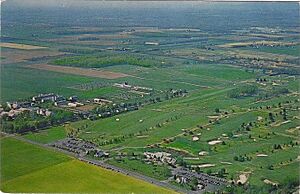
The 2010 United States census counted 809,858 people, 281,186 households, and 203,016 families in the county. The population density was 2,621.6 per square mile (1,012.2/km2). There were 294,800 housing units at an average density of 954.3 per square mile (368.5/km2). The racial makeup was 58.60% (474,589) White, 9.69% (78,462) Black or African American, 0.34% (2,777) Native American, 21.40% (173,293) Asian, 0.03% (251) Pacific Islander, 6.99% (56,569) from other races, and 2.95% (23,917) from two or more races. Hispanic or Latino of any race were 18.40% (148,975) of the population.
Of the 281,186 households, 34.4% had children under the age of 18; 55.9% were married couples living together; 11.8% had a female householder with no husband present and 27.8% were non-families. Of all households, 22.5% were made up of individuals and 8.9% had someone living alone who was 65 years of age or older. The average household size was 2.8 and the average family size was 3.29.
22.9% of the population were under the age of 18, 10.2% from 18 to 24, 28.3% from 25 to 44, 26.3% from 45 to 64, and 12.3% who were 65 years of age or older. The median age was 37.2 years. For every 100 females, the population had 96.4 males. For every 100 females ages 18 and older there were 94 males.
Economy
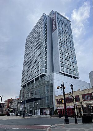
The Bureau of Economic Analysis calculated that the county's gross domestic product was $59.0 billion in 2021, which was ranked second in the state and was a 6.8% increase from the prior year.
Major non-governmental employers in Middlesex County include the following, grouped by ranges of employees:
- 9,010: Rutgers University
- 5,000 – 5,249: Robert Wood Johnson University Hospital
- 3,500 – 3,749: Bristol-Myers Squibb, Wakefern Food Corporation
- 3,000 – 3,249: Merrill Lynch, Novo Nordisk
- 2,750 – 2,999: Johnson & Johnson, Prudential Insurance Company, Silverline Building Products, St. Peter's University Hospital, Telcordia Technologies
- 2,500 – 2,749: JFK Medical Center, Raritan Bay Medical Center
- 2,000 – 2,249: Pathmark
- 1,750 – 1,999: Home Depot, United Parcel Service
- 1,500 – 1,749: Hess Corporation, Dow Jones & Company, Siemens
- 1,250 – 1,499: AT&T, BASF (formerly Engelhard)
- 1,000 – 1,249: Aetna, Fujitsu, Prudential
- Undisclosed: Canon, Japanese company specializing in imaging products.
History
Etymology
Middlesex County is named after the county of the same name in England.
Education
Higher education
- Middlesex County College (Edison – main campus; New Brunswick, Perth Amboy)
- Rutgers University New Brunswick Campus (New Brunswick, Piscataway)
- Rutgers Biomedical and Health Sciences (New Brunswick)
- Princeton University – Forrestal Campus (Plainsboro)
- DeVry University (North Brunswick)
- Chamberlain University (North Brunswick)
- New Brunswick Theological Seminary (New Brunswick Campus)
K-12 schools
School districts, all PreK/K-12 (except as indicated), include:
- Carteret School District
- Cranbury School District (K-8)
- Dunellen Public Schools
- East Brunswick Public Schools
- Edison Township Public Schools
- Highland Park Public Schools
- Jamesburg Public Schools (K-8)
- Metuchen School District
- Middlesex Board of Education
- Milltown Public Schools (K-8)
- Monroe Township School District
- New Brunswick Public Schools
- North Brunswick Township Public Schools
- Old Bridge Township Public Schools
- Perth Amboy Public Schools
- Piscataway Township Schools
- Sayreville Public Schools
- South Amboy Public Schools
- South Brunswick Public Schools
- South Plainfield Public Schools
- South River Public Schools
- Spotswood Public Schools
- West Windsor-Plainsboro Regional School District
- Woodbridge Township School District
Infrastructure
Transportation
Roads and Highways
Middlesex County hosts various county roads, state routes, US routes, and interstate highways, as well as toll highways. As of May 2010[update], the county had a total of 2,584.38 miles (4,159.16 km) of roadways, of which 2,118.08 miles (3,408.72 km) were maintained by the municipality, 292.16 miles (470.19 km) by Middlesex County and 131.48 miles (211.60 km) by the New Jersey Department of Transportation, 41.49 miles (66.77 km) by the New Jersey Turnpike Authority and 1.17 miles (1.88 km) by the Port Authority of New York and New Jersey.
County roads include CR 501, CR 514, CR 516 (only in Old Bridge), CR 520 (only in Old Bridge), CR 522, CR 527, CR 529, CR 531, CR 535, and CR 539 (only in Cranbury).
The state routes are: Route 18, Route 26 (only in North Brunswick – entirely concurrent with Livingston Avenue), Route 27, Route 28, Route 32, Route 33 (only in Monroe Township), Route 34 (only in Old Bridge), Route 35, Route 91 (concurrent with Jersey Avenue in North Brunswick and entering New Brunswick), Route 171, Route 172 (only in New Brunswick), Route 184 and Route 440.
U.S. Routes include: Route 1, Route 9, Route 1/9 (only in Woodbridge) and Route 130.

The county also includes some limited access highways and Interstates as well. Middlesex County hosts the southern end of I-287 which turns into Route 440 that connects to the Outerbridge Crossing. The Garden State Parkway passes through the eastern part of the county, which features nine interchanges and the northern start/end of the split-roadways (Express & Local Lanes). The New Jersey Turnpike carries I-95 through the center of the county. The Turnpike has five interchanges in Middlesex County: Exit 12 in Carteret, Exit 11 in Woodbridge, Exit 10 in Edison, Exit 9 in East Brunswick and Exit 8A in Monroe Township.
The New Jersey Department of Transportation is upgrading the Route 18 "avenue" to a freeway between the Route 1 interchange all the way up to the new 18 Extension in Piscataway.
The Turnpike Authority planned to build Route 92, which was to start near the intersection of Ridge Road & Route 1 in South Brunswick to Interchange 8A in Monroe Township. This plan was cancelled on December 1, 2006.
The southern end of the "dual-dual" configuration (inner car lanes and outer truck lanes) used to be one mile south of Interchange 8A at the border of Cranbury and Monroe Township. It was relocated to Exit 6 in Mansfield Township in Burlington County after the Turnpike widening project was completed in early November 2014.
Public transportation
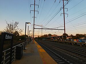
NJ Transit provides Middlesex County with frequent commuter rail service along the North Jersey Coast Line, Northeast Corridor Line, and Raritan Valley Line. The North Jersey Coast Line runs through the eastern part of the county. The Northeast Corridor Line runs through the northern and central part of the county. The Raritan Valley Line serves Dunellen and is accessible to other communities along the county's northern border with Union and Somerset counties.
Intercity rail service is provided by Amtrak. The routes that run through Middlesex County are the Acela Express, Keystone, Northeast Regional, and Vermonter services, although only the Keystone and Northeast Regional have regular stops within Middlesex County, at either New Brunswick or Metropark station. The Acela service also occasionally stops at Metropark.
Bus service in Middlesex County is provided by New Jersey Transit, Coach USA's Suburban Transit, the extensive Rutgers Campus bus network, the MCAT shuttle system, and DASH buses. There are bus routes that serve all townships in the county on weekdays, and studies are being conducted to create the New Brunswick Bus Rapid Transit system.
Healthcare
The county offers more than 1,900 inpatient beds among five major hospitals.
| Hospital | Town | Type | Beds | Health Network |
|---|---|---|---|---|
| JFK Medical Center | Edison | Acute | 498 | Hackensack Meridian Health |
| PSE&G Children's Specialized Hospital | New Brunswick | Pediatric Rehabilitation | 140 | RWJBarnabas Health |
| Raritan Bay Medical Center (Old Bridge) | Old Bridge | Acute | 113 | Hackensack Meridian Health |
| Raritan Bay Medical Center (Perth Amboy) | Perth Amboy | Acute | 388 | Hackensack Meridian Health |
| Robert Wood Johnson University Hospital | New Brunswick | Major Teaching | 465 | RWJBarnabas Health |
| The Bristol-Myers Squibb Children's Hospital | New Brunswick | Acute Pediatric | 105 | RWJBarnabas Health |
| Rutgers Cancer Institute of New Jersey | New Brunswick | Research, Cancer | RWJBarnabas Health | |
| St. Peter's University Hospital | New Brunswick | Acute Teaching | 478 | Saint Peters HCS |
| Penn Medicine Princeton Medical Center | Plainsboro | Acute Teaching | 305 | Penn Medicine |
Municipalities
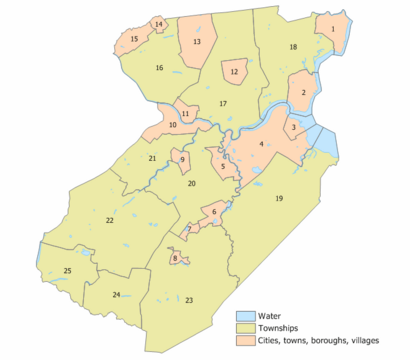
The 25 municipalities in Middlesex County (with 2010 Census data for population, housing units and area in square miles) are: Other, unincorporated communities in the county are listed next to their parent municipality. Many of these areas are census-designated places that have been defined by the United States Census Bureau for enumeration purposes within a Township and for which 2010 population data is included in parentheses.
| Municipality | Map key |
Municipal type |
Population | Housing units |
Total area |
Water area |
Land area |
Pop. density |
Housing density |
School District | Unincorporated communities |
|---|---|---|---|---|---|---|---|---|---|---|---|
| Carteret | 1 | Borough | 25,326 | 8,148 | 5.00 | 0.58 | 4.42 | 5,171.1 | 1,844.4 | Carteret | Chrome West Carteret |
| Cranbury | 24 | Township | 3,842 | 1,371 | 13.40 | 0.15 | 13.25 | 291.2 | 103.5 | Princeton (9-12) (S/R) Cranbury (PK-8) |
Cranbury CDP (2,400) Cranbury Station Wyckoffs Mills |
| Dunellen | 14 | Borough | 7,637 | 2,683 | 1.05 | 0.00 | 1.05 | 6,894.8 | 2,559.7 | Dunellen | |
| East Brunswick | 20 | Township | 49,715 | 17,367 | 22.27 | 0.57 | 21.70 | 2,189.6 | 800.4 | East Brunswick | Brookview Dunhams Corner Fairview Knolls Farrington Lake Heights Gillilandtown Halls Corner Herberts Jamesburg Park Lawrence Brook Manor Newton Heights Old Bridge Orchard Heights Patricks Corner Paulas Corner Tanners Corner Washington Heights Westons Mills |
| Edison | 17 | Township | 107,588 | 36,302 | 30.64 | 0.70 | 29.94 | 3,339.0 | 1,212.5 | Edison Township | Bonhamtown Clara Barton Greensand Haven Homes Lahiere Lincoln Park Lindenau Martins Landing Menlo Park New Dover New Durham Nixon North Edison Oak Tree Phoenix Potters Pumptown Raritan Manor
|
| Helmetta | 7 | Borough | 2,455 | 920 | 0.91 | 0.06 | 0.85 | 2,562.9 | 1,082.6 | Spotswood | |
| Highland Park | 11 | Borough | 15,072 | 6,203 | 1.82 | 0.01 | 1.81 | 7,728.1 | 3,428.5 | Highland Park | |
| Jamesburg | 8 | Borough | 5,783 | 2,267 | 0.88 | 0.01 | 0.88 | 6,741.8 | 2,583.9 | Monroe Township (9-12) (S/R) Jamesburg (PK-8) |
|
| Metuchen | 12 | Borough | 15,049 | 5,440 | 2.77 | 0.00 | 2.76 | 4,910.4 | 1,967.9 | Metuchen | Jefferson Park Robinvale |
| Middlesex | 15 | Borough | 14,636 | 5,148 | 3.54 | 0.02 | 3.52 | 3,876.2 | 1,463.5 | Middlesex | |
| Milltown | 9 | Borough | 7,037 | 2,698 | 1.60 | 0.04 | 1.55 | 4,443.0 | 1,739.0 | Spotswood (9-12) (S/R) Milltown (PK-8) |
|
| Monroe Township | 23 | Township | 48,594 | 18,002 | 42.23 | 0.26 | 41.97 | 932.3 | 428.9 | Monroe Township | Applegarth Clearbrook Clearbrook CDP (2,909) Concordia CDP (2,445) Encore at Monroe CDP (625) Forsgate CDP (2,056) Gravel Hill Half Acre Hoffman Jamesburg Gardens Matchaponix Middlesex Downs Monroe Manor CDP (2,178) Mounts Mills Old Church Outcalt The Ponds CDP (941) Prospect Plains Regency at Monroe CDP (2,036) Renaissance at Monroe CDP (637) Rossmoor CDP (2,992) Shore Road Estates Spotswood Manor Stonebridge CDP (1,616) Texas Tracy Union Valley Whittingham CDP (2,348) Wyckoffs Mills |
| New Brunswick | 10 | City | 55,266 | 15,053 | 5.79 | 0.56 | 5.23 | 10,556.4 | 2,879.7 | New Brunswick | Edgebrook Feaster Park Lincoln Park Raritan Gardens Westons Mills |
| North Brunswick | 21 | Township | 43,905 | 15,045 | 12.27 | 0.27 | 12.00 | 3,396.2 | 1,254.1 | North Brunswick Township | Adams Berdines Corner Black Horse Franklin Park Georges Road Maple Meade Patricks Corner Red Lion |
| Old Bridge | 19 | Township | 66,876 | 24,638 | 40.78 | 2.72 | 38.06 | 1,717.7 | 647.3 | Old Bridge Township | Browntown Brownville CDP (2,383) Brunswick Gardens Cheesequake Cottrell Corners Laurence Harbor CDP (6,635) Madison Park CDP (8,050) Matchaponix Moerls Corner Morristown Old Bridge CDP (27,210) Parlin Redshaw Corner Runyon Sayerwood South South Old Bridge Texas |
| Perth Amboy | 2 | City | 55,436 | 16,556 | 5.96 | 1.26 | 4.70 | 10,806.8 | 3,521.0 | Perth Amboy | Barber Harbor Terrace John J Delaney Homes Maurer William Dunlap Homes |
| Piscataway | 16 | Township | 60,804 | 17,777 | 19.03 | 0.19 | 18.83 | 2,975.5 | 943.8 | Piscataway Township | Fieldville New Market Newtown North Stelton Possumtown Randolphville Raritan Landing Riverview Manor Rutgers University-Busch Campus CDP (4,586) Rutgers University-Livingston Campus CDP (part; 3,545) Society Hill CDP (3,829) |
| Plainsboro | 25 | Township | 24,084 | 10,089 | 12.21 | 0.42 | 11.78 | 1,951.6 | 856.1 | West Windsor-Plainsboro |
Plainsboro Center CDP (2,760) |
| Sayreville | 4 | Borough | 45,345 | 16,393 | 18.70 | 2.86 | 15.84 | 2,695.7 | 1,034.8 | Sayreville | Crossmans Ernston Gillespie Laurel Park MacArthur Manor Melrose Morgan Morgan Heights Parlin Phoenix Runyon Sayre Woods Sayreville Junction Sayreville Station |
| South Amboy | 3 | City | 9,411 | 3,576 | 2.69 | 1.15 | 1.55 | 5,577.1 | 2,310.7 | South Amboy | Mechanicsville Thomas J Dohany Homes |
| South Brunswick | 22 | Township | 47,043 | 15,708 | 41.04 | 0.39 | 40.65 | 1,068.1 | 386.4 | South Brunswick | Cottageville Dayton CDP (8,138) Deans CDP (1,615) Franklin Park Fresh Ponds Heathcote CDP (7,154) Kendall Park CDP (9,989) Kingston CDP (1,222) Little Rocky Hill Monmouth Junction CDP (8,895) Sand Hills South Brunswick Terrace |
| South Plainfield | 13 | Borough | 24,338 | 8,093 | 8.36 | 0.03 | 8.33 | 2,808.5 | 971.9 | South Plainfield | Avon Park Samptown |
| South River | 5 | Borough | 16,118 | 5,957 | 2.92 | 0.15 | 2.77 | 5,781.4 | 2,151.4 | South River | Newton Heights |
| Spotswood | 6 | Borough | 8,163 | 3,242 | 2.47 | 0.20 | 2.27 | 3,642.2 | 1,430.1 | Spotswood | East Spotswood Outcalt |
| Woodbridge | 18 | Township | 103,639 | 36,124 | 24.51 | 1.29 | 23.21 | 4,290.0 | 1,556.2 | Woodbridge Township | Avenel CDP (16,920) Boynton Beach Colonia CDP (18,609) Edgars Fords CDP (12,941) Hazelton Hopelawn CDP (2,603) Iselin CDP (20,088) Keasbey CDP (3,027) Lynn Woodoaks Menlo Park Terrace CDP (2,806) Port Reading CDP (3,921) Sand Hills Sewaren CDP (2,885) Shore View Woodbridge CDP (19,839) Woodbridge Oaks |
Parks and recreation
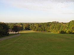
- Donaldson Park
- Carteret Park
- Carteret Waterfront Park
- Edison Park
- Fords Park
- Johnson Park
- Medwick Park
- Merrill Park
- Raritan Bay Waterfront Park
- Roosevelt Park
- Spring Lake Park
- Thompson Park
- Warren Park
- Old Bridge Waterfront Walkway
- Alvin P. Williams Memorial Park
- Ambrose & Doty's Brooks Park
- Davidson's Mill Pond Park
- Ireland Brook Park
- Jamesburg Park Conservation Area
- John A. Phillips Open Space Preserve
- John A. Phillips Park
- Catherine Von Ohlen Park
See also
 In Spanish: Condado de Middlesex (Nueva Jersey) para niños


