Jamesburg, New Jersey facts for kids
Quick facts for kids
Jamesburg, New Jersey
|
||
|---|---|---|
|
Borough
|
||

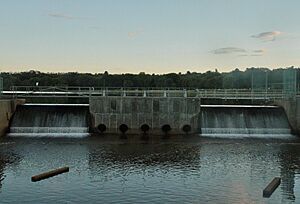
Jamesburg as seen across Lake Manalapan from Thompson County Park
|
||
|
||
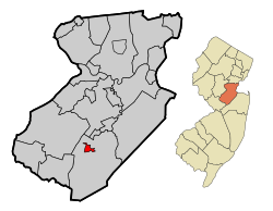
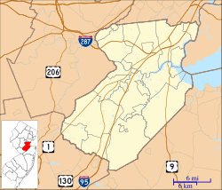
Location of Jamesburg in Middlesex County highlighted in red (left). Inset map: Location of Middlesex County in New Jersey highlighted in orange (right).
|
||
| Country | ||
| State | ||
| County | Middlesex | |
| Incorporated | March 19, 1887 | |
| Named for | James Buckelew | |
| Government | ||
| • Type | Borough | |
| • Body | Borough Council | |
| Area | ||
| • Total | 0.89 sq mi (2.31 km2) | |
| • Land | 0.88 sq mi (2.29 km2) | |
| • Water | 0.01 sq mi (0.02 km2) 0.90% | |
| Area rank | 517th of 565 in state 24th of 25 in county |
|
| Elevation | 85 ft (26 m) | |
| Population
(2020)
|
||
| • Total | 5,783 | |
| • Estimate
(2023)
|
5,735 | |
| • Rank | 358th of 565 in state 23rd of 25 in county |
|
| • Density | 6,556.7/sq mi (2,531.6/km2) | |
| • Density rank | 80th of 565 in state 5th of 25 in county |
|
| Time zone | UTC−05:00 (Eastern (EST)) | |
| • Summer (DST) | UTC−04:00 (Eastern (EDT)) | |
| ZIP Code |
08831
|
|
| Area code(s) | 732 exchanges 521,605 and 656 | |
| FIPS code | 3402334890 | |
| GNIS feature ID | 0885263 | |
| Website | ||
Jamesburg is a borough in Middlesex County, in the U.S. state of New Jersey. As of the 2020 United States census, the borough's population was 5,783, a decrease of 132 (−2.2%) from the 2010 census count of 5,915, which in turn reflected a decline of 110 (−1.8%) from the 6,025 counted in the 2000 census.
Contents
History
Jamesburg was formed as a borough by an act of the New Jersey Legislature on March 19, 1887, when it was created from portions of Monroe Township, based on the results of a referendum held on March 15, 1887. Jamesburg's incorporation was confirmed on April 15, 1915.
The borough was named for James Buckelew, who established a mill that became the nucleus of what is now Jamesburg. After Monroe Township officials refused to admit an African-American student into one of its schools, Buckelew funded the construction of a school located at the corner of Church Street and Gatzmer Avenue that would be open to all children. The school was named in his honor and became the derivation of the borough's name.
On July 17, 2005, approximately 7 to 8 inches (18 to 20 cm) of rain fell in Jamesburg, flooding areas on West Railroad Avenue, East Church Street, Pergola Avenue, Willow Street, Forsgate Drive, and Gatzmer Avenue. Roughly 75 to 100 families were evacuated from their homes and housed at the John F. Kennedy Elementary School.
Geography
According to the United States Census Bureau, the borough had a total area of 0.89 square miles (2.31 km2), including 0.88 square miles (2.29 km2) of land and 0.01 square miles (0.02 km2) of water (0.90%).
The borough is the older and more urban core area located in the center of and completely surrounded by Monroe Township, making it part of 21 pairs of "doughnut towns" in the state, where one municipality entirely surrounds another.
Demographics
| Historical population | |||
|---|---|---|---|
| Census | Pop. | %± | |
| 1880 | 681 | — | |
| 1890 | 887 | 30.2% | |
| 1900 | 1,063 | 19.8% | |
| 1910 | 2,075 | 95.2% | |
| 1920 | 2,053 | −1.1% | |
| 1930 | 2,048 | −0.2% | |
| 1940 | 2,128 | 3.9% | |
| 1950 | 2,307 | 8.4% | |
| 1960 | 2,853 | 23.7% | |
| 1970 | 4,584 | 60.7% | |
| 1980 | 4,114 | −10.3% | |
| 1990 | 5,294 | 28.7% | |
| 2000 | 6,025 | 13.8% | |
| 2010 | 5,915 | −1.8% | |
| 2020 | 5,783 | −2.2% | |
| 2023 (est.) | 5,735 | −3.0% | |
| Population sources: 1880–1890 1890–1920 1890–1910 1910–1930 1940–2000 2000 2010 2020 |
|||
2010 census
The 2010 United States census counted 5,915 people, 2,172 households, and 1,492 families in the borough. The population density was 6,741.8 per square mile (2,603.0/km2). There were 2,267 housing units at an average density of 2,583.9 per square mile (997.6/km2). The racial makeup was 73.90% (4,371) White, 8.84% (523) Black or African American, 0.85% (50) Native American, 4.53% (268) Asian, 0.00% (0) Pacific Islander, 9.42% (557) from other races, and 2.47% (146) from two or more races. Hispanic or Latino of any race were 22.38% (1,324) of the population.
Of the 2,172 households, 36.0% had children under the age of 18; 51.0% were married couples living together; 12.3% had a female householder with no husband present and 31.3% were non-families. Of all households, 25.8% were made up of individuals and 7.1% had someone living alone who was 65 years of age or older. The average household size was 2.72 and the average family size was 3.26.
25.3% of the population were under the age of 18, 8.4% from 18 to 24, 31.7% from 25 to 44, 26.1% from 45 to 64, and 8.5% who were 65 years of age or older. The median age was 35.9 years. For every 100 females, the population had 102.2 males. For every 100 females ages 18 and older there were 100.7 males.
The Census Bureau's 2006–2010 American Community Survey showed that (in 2010 inflation-adjusted dollars) median household income was $52,169 (with a margin of error of +/− $10,781) and the median family income was $69,531 (+/− $13,862). Males had a median income of $49,615 (+/− $9,412) versus $50,164 (+/− $5,717) for females. The per capita income for the borough was $28,668 (+/− $3,584). About 4.9% of families and 8.1% of the population were below the poverty line, including 5.7% of those under age 18 and 8.8% of those age 65 or over.
Parks and recreation
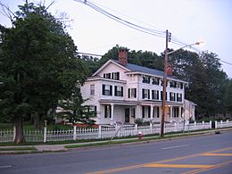
Thompson Park, covering 675 acres (2.73 km2), is located on the south western edge of Jamesburg and is also partially located in neighboring Monroe Township. The 30-acre (120,000 m2) Manalapan Lake is located on the eastern edge of the park. The park in total has four tennis courts, four basketball courts, two handball courts, three baseball fields, a softball field, many soccer fields, multiple picnic groves equipped with grills, three hiking/biking trails, fishing, animal haven, and a gazebo. The park has three entrances. Two are located on Perrineville Road, and one is located on Forsgate Drive. Monroe Township Soccer Club hosts a tournament every year on the soccer fields that are located in the park.
Education
The Jamesburg Public Schools serves students in pre-kindergarten through eighth grade. As of the 2020–21 school year, the district, comprised of two schools, had an enrollment of 664 students and 64.8 classroom teachers (on an FTE basis), for a student–teacher ratio of 10.2:1. Schools in the district (with 2020–21 enrollment data from the National Center for Education Statistics) are John F. Kennedy Elementary School with 463 students in grades Pre-K–5 and Grace M. Breckwedel Middle School with 193 students in grades 6–8.
Jamesburg High School, founded in 1905, graduated its last class in June 1979. Since 1980, Jamesburg's high school students attend Monroe Township High School in Monroe Township, as part of a sending/receiving relationship with the Monroe Township School District. As of the 2020–21 school year, the high school had an enrollment of 2,474 students and 184.1 classroom teachers (on an FTE basis), for a student–teacher ratio of 13.4:1.
With annual tuition costs per student at Monroe Township High School rising past $16,000 as the Monroe district has added debt service costs into their tuition charges, the Jamesburg Public Schools looked for an alternate high school in the area to send students at lower cost, which would have started with the freshman class in 2012–2013, though students already enrolled at Monroe Township High School would continue their attendance there until they graduate. The Jamesburg district contacted 18 districts and received interest from high schools in the Freehold Regional High School District, Matawan-Aberdeen Regional School District, Old Bridge Township Public Schools, South Amboy Public Schools and the West Windsor-Plainsboro Regional School District, which had been sent demographic information in July 2011 about the Jamesburg high school population as part of their review process. By October 2011, the district decided to maintain sending students to Monroe Township, as had been done since 1979.
Eighth-grade students from all of Middlesex County are eligible to apply to attend the high school programs offered by the Middlesex County Vocational and Technical Schools, a county-wide vocational school district that offers full-time career and technical education at Middlesex County Academy in Edison, the Academy for Allied Health and Biomedical Sciences in Woodbridge Township and at its East Brunswick, Perth Amboy and Piscataway technical high schools, with no tuition charged to students for attendance.
Transportation
Roads and highways
As of May 2010[update], the borough had a total of 16.53 miles (26.60 km) of roadways, of which 11.67 miles (18.78 km) were maintained by the municipality and 4.86 miles (7.82 km) by Middlesex County.
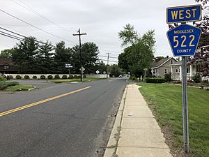
No Interstate, U.S. or state highways serve Jamesburg directly. The only major roads that pass through are county routes, including County Route 522, County Route 612, County Route 615 and County Route 625 (Perrineville Road).
The closest limited access road is the New Jersey Turnpike (Interstate 95) at Exit 8A in surrounding Monroe Township. Route 612 provides a connection between the Turnpike/Route 32 and CR 520.
Public transportation
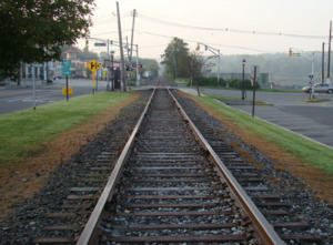
In the 19th & 20th centuries, Jamesburg Borough and Monroe Township had a major railway in the area, which was the Freehold and Jamesburg Agricultural Railroad. This railway was owned and operated by the Camden & Amboy Railroad Company (C&A), in which surveying for the line began on September 8, 1851, grading began on October 19, 1852, and the first track was laid on April 4, 1853. The first section of line was opened on July 18, 1853. The establishment of the Freehold & Jamesburg Agricultural Railroad caused this region to become a transportation hub. The Freehold and Jamesburg Railroad was abandoned by the early 1930s. A 2.8-mile long (4.5 km) portion of the former railroad's right-of-way was later approved to be sold by the New Jersey Board of Public Utility Commissioners (PUC) to Jersey Central Power & Light Company in 1966, with occasional freight service still being utilized through the Freehold Industrial Track.
Middlesex County Area Transit (MCAT) shuttles provide service to and from Jamesburg on routes operating across the county. The M1 route operates between Jamesburg and the New Brunswick train station and the M2 Route connects Jamesburg, Helmetta, and Spotswood with East Brunswick including the Brunswick Square Mall.
Notable people
People who were born in, residents of, or otherwise closely associated with Jamesburg include:
- Harrison Woodhull Crosby (1814–1892), in 1847 became the first to can tomatoes
- Reed Gusciora (born 1960), politician who previously served in the General Assembly from 1996 to 2018 representing the 15th Legislative District. and is currently the mayor of Trenton
- Frankie Hayes (1914–1955), catcher in Major League Baseball from 1933 to 1947 who played for the Philadelphia Athletics for most of his career
- George Edward Pendray (1901–1987), space flight proponent
See also
 In Spanish: Jamesburg (Nueva Jersey) para niños


