Hurricane Hugo facts for kids
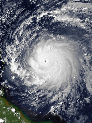
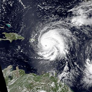
Hugo at peak intensity east of the Lesser Antilles on September 15
|
|
| Meteorological history | |
|---|---|
| Formed | September 10, 1989 |
| Extratropical | September 23, 1989 |
| Dissipated | September 25, 1989 |
| Category 5 tropical cyclone | |
| 1-minute sustained (SSHWS/NWS) | |
| Highest winds | 160 mph (260 km/h) |
| Lowest pressure | 918 mbar (hPa); 27.11 inHg |
| Overall effects | |
| Fatalities | 67 direct, 40 indirect (107 total) |
| Damage | $11 billion (1989 USD) |
| Areas affected |
|
|
Part of the 1989 Atlantic hurricane season |
|
Hurricane Hugo was a powerful tropical cyclone that inflicted widespread destruction across the northeastern Caribbean and the Southeastern United States in September 1989. The eleventh tropical cyclone, eighth named storm, sixth hurricane, and second major hurricane of the 1989 Atlantic hurricane season, Hugo arose from a cluster of thunderstorms near Cape Verde on September 10, 1989. This cluster coalesced into a tropical depression and strengthened into Tropical Storm Hugo as it tracked west across the Atlantic Ocean for several days. On September 13, Hugo became a hurricane and continued to intensify through September 15 when its sustained winds peaked at 160 mph (260 km/h), making it a Category 5 hurricane on the Saffir–Simpson scale. Between September 17 and 21, Hugo made landfall on Guadeloupe, Saint Croix, Puerto Rico, and lastly South Carolina, with major hurricane strength winds. The storm weakened inland and accelerated north over the Eastern United States, transitioning into an extratropical cyclone on September 23 before it was last noted in the far northern Atlantic on September 25.
Hugo left extensive damage in its wake, causing 67 deaths and $11 billion (equivalent to $26 billion in 2022) in damage, which at the time, made it the costliest hurricane on record. Guadeloupe bore the brunt of the storm in the Leeward Islands. Three thousand houses were unroofed, contributing to the displacement of 35,000 people from their homes. Hugo was Montserrat's costliest hurricane on record and brought down the island's entire power grid. Ninety percent of homes on the island suffered significant to total roof loss after the island was struck by the eyewall. The hurricane's impacts continued into the Virgin Islands and Puerto Rico, causing over $1 billion in damage. Wind gusts up to 168 mph (270 km/h) were measured in Saint Croix, where property damage exceeded $500 million with over 90 percent of buildings damaged; three people were killed on the island. Widespread damage occurred in Puerto Rico and much of the island suffered power and water service failures. Eight people were killed in Puerto Rico and nearly 28,000 people were left homeless. In the mainland United States, coastal South Carolina was hit by record setting storm surge heights, reaching 20.2 ft (6.2 m) near McClellanville. The surge and strong winds wrought extensive damage to buildings and infrastructure across South Carolina, and caused 13 deaths. Flood and wind impacts followed Hugo across much of the Eastern United States into Eastern Canada.
There were widespread and significant agricultural impacts from Hugo. Guadeloupe sustained damage to the entirety of its banana crop and most of its coconut palms and sugar cane crop. Habitat loss caused bat populations in Montserrat to fall 20-fold, while the populations of several endemic bird species declined or were disrupted across the eastern Caribbean. Coastal bird populations in South Carolina were forced 200 mi (320 km) inland. Additionally, forests between South Carolina and Virginia were heavily damaged; in South Carolina alone the loss of timber was estimated at $1.04 billion.
Hugo was the strongest hurricane to strike the northeastern Caribbean since Hurricane David in 1979, and the strongest to make landfall on the continental U.S. since Hurricane Camille in 1969. The scale of the hurricane's impacts led to the retirement of the name Hugo from the Atlantic tropical cyclone name list.
Contents
Impact
| Country | Deaths | Damage |
|---|---|---|
| Antigua and Barbuda | 2 | $200 million |
| British Virgin Islands | — | $50 million |
| Dominica | — | $20 million |
| Guadeloupe | 11 | $880 million |
| Montserrat | 10 | $260 million |
| Netherlands Antilles | 11 | $50 million |
| Puerto Rico | 8 | $2 billion |
| St. Kitts and Nevis | 1 | $46 million |
| Contiguous United States | 21 | $7 billion |
| U.S. Virgin Islands | 3 | $500 million |
Caribbean
Hugo was the strongest storm to traverse the northeastern Caribbean since Hurricane David in 1979. The Sea, Lake, and Overland Surge from Hurricanes (SLOSH) model estimated that storm surge from Hugo led to coastal water levels 3–4 ft (0.91–1.22 m) above normal tidal heights along Saint Croix and the eastern end of Puerto Rico. These equated to storm surge heights of around 7–8 ft (2.1–2.4 m). Water levels of 2–3 ft (0.61–0.91 m) above normal were estimated to have occurred along the northern coast of Puerto Rico. Rainfall on the Caribbean islands averaged between 5–10 in (130–250 mm). The NHC's preliminary report on the hurricane enumerated 28 fatalities in the eastern Caribbean while media reports tallied over 30. As many as 100,000 people may have been left homeless throughout the region as a result of Hugo.
Guadeloupe and Montserrat were hardest-hit among the Leeward Islands, and collectively suffered over $1 billion in damage and recorded 21 fatalities. Though less severe, widespread damage was also inflicted by Hugo across the remainder of the Leeward and Windward Islands. Extensive flooding occurred on Antigua, and power outages befell the island after utility poles were uprooted by the storm. The damage was heaviest towards the southern portions of the island as the center of Hugo passed 50 mi (80 km) south. There were 2 deaths and 181 injuries. Another 509 people were left homeless following damage wrought to 15 percent of homes. Partial damage was documented on 1,500 homes and total loss was documented on 106. Thirty percent of fishing vessels were also damaged by the hurricane, equating to thousands of boats. The total cost of damage reached nearly EC$200 million. Hugo's damage toll in Saint Kitts and Nevis amounted to $46 million, largely sustained by shoreline structures and crops. This equated to 32 percent of the country's gross domestic product. Homes, government buildings, and trees were damaged by the storm. A fifth of the country was rendered homeless and the entire populace lost power and water. Ninety percent of the residents of Nevis lost their homes. One person was killed.
Dominica was most affected among the Windward Islands. Hugo ruined 80 percent of the island's banana crop and interrupted water supplies. Coastal roads were damaged by the hurricane's choppy seas; a washout along a primary thoroughfare isolated the village of Dubique. Bridges and storm drains also took heavy damage. Landslides isolated towns for many days. The damage toll in Dominica totaled $20 million. Winds in Martinique reached 60 mph (97 km/h) on the Caravelle peninsula. Some banana plantations near Macouba were damaged, though wind-related damage in Martinique was otherwise minimal. Moderate rains, peaking at 5.67 inches (144 mm) in La Médaille, led to some mudslides. Rough seas flooded parts of Fort-de-France and damaged piers along the Alfassa Boulevard. Beach erosion also occurred along Martinique beaches.
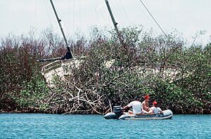
The hurricane moved near the Virgin Islands and made two landfalls in Puerto Rico as it egressed the Caribbean, causing considerable destruction. Estimates of the damage toll in this region vary but include over $50 million each for the British Virgin Islands and Netherlands Antilles, $2 billion for Puerto Rico, and $500 million for Saint Croix. Hugo's center was 85 mi (137 km) southwest of Sint Maarten at its closest approach; a station there reported a maximum sustained wind 46 mph (74 km/h) and a peak gust of 78 mph (126 km/h). These winds unroofed homes and uprooted trees and power lines. Roughly 25 sailboats sustained severe damage and one boat with four people went missing. Sint Eustatius and Saba of the Netherlands Antilles lost much of their vegetation. Many homes, piers, and public buildings suffered severe damage on the two islands. Eleven people were killed in the Netherlands Antilles and caused $50 million in damage there. The damage toll in the British Virgin Islands exceeded $50 million, with the loss of at least half of the islands' agriculture. Around 30 percent of homes were unroofed. Power outages affected the British Virgin Islands. The Associated Press reported "numerous injuries" and "scores of homes destroyed" on Tortola, the largest island in the BVI. A third of the island's private homes were wrecked. The hurricane also caused widespread power outages in the Dominican Republic while tracking northwest towards the continental United States.
Guadeloupe
Guadeloupe sustained the heaviest impacts among the Leeward Islands from Hugo. The hurricane made landfall on the island at 05:00 UTC on September 17 (01:00 a.m. AST) as a Category 4 hurricane with sustained winds at 140 mph (230 km/h). This made Hugo the strongest hurricane to strike Guadeloupe since a hurricane each in 1899 and 1928. A minimum air pressure of 941.1 mbar (hPa; 27.79 inHg) was recorded at La Désirade and 943 mbar in Raizet, with a 97-mile-per-hour (156 km/h) wind gust documented in the last weather observation transmitted from Pointe-à-Pitre. A ship in the wharf at Pointe-à-Pitre estimated a gust of 184 mph (296 km/h). Though unmeasured, French meteorological service Météo-France estimates that wind gusts may have reached 200 mph (320 km/h). The effects of Hugo lasted for about 12 hours in Guadeloupe, with the strongest winds occurring within a 3-hour window. Rainfall totals ranged from 3.1 inches (79 mm) along the southern part of Guadeloupe to 13.8 inches (350 mm) in more mountainous areas. Hourly rainfall rates averaged roughly 2 inches (51 mm) per hour in the core of the hurricane. A station in Gardel documented 3.66 inches (93 mm) of rain in one hour. Along Grand Cul-de-Sac Marin, storm surge from Hugo elevated the seas from 8 to 10 ft (2.4 to 3.0 m) above mean sea level.
Telecommunications were knocked out by the storm throughout Guadeloupe as winds brought down power and telephone lines. The island of La Désirade completely lost radio contact with the outside world. Three thousand houses, predominantly wooden shanties, were unroofed. Approximately half of Pointe-a-Pitre, Guadeloupe's largest city, was destroyed. Part of the control tower at Pointe-à-Pitre International Airport was wrecked and the airport's radio antenna was knocked down. Lower sections of Sainte-Rose were inundated by storm surge, resulting in considerable damage. However, the storm's trajectory relative to Guadeloupe prevented a more damaging surge event from occurring. Saint-François was largely destroyed, with nearly half of houses remaining. Several tourist hotels there sustained heavy damage. Two people were killed in Le Moule, that been damaged at nearly 80 percent. The entirety of Guadeloupe's banana crop and most of its coconut palms and sugar cane crops were ruined by Hugo. The storm also wiped out most of the island's fishing fleet, and many ships were grounded by 24-foot (7.3 m) waves. Debris blocked 70 percent of roads. There were 11 fatalities attributed to Hugo in Guadeloupe. Another 107 people were injured and 35,000 were rendered homeless. The damage toll in Guadeloupe amounted to $880 million.
Montserrat
Although Montserrat was struck by many significant storms in the 18th and 19th centuries, the last major hurricane to strike the island before Hugo occurred in 1928. The right-front quadrant of Hugo's eyewall moved over Montserrat on September 17, raking the island with sustained winds of 140 mph (230 km/h). The island may have also experienced wind gusts up to 240 mph (390 km/h). The hurricane exacted a heavy toll over the course of 14 hours. Hugo was the costliest hurricane in Montserrat's history, inflicting $260 million in damage. Entire villages were destroyed by the storm and vegetation was stripped bare. Most houses on the island were razed or seriously damaged, displacing 11,000 of Montserrat's 12,000 residents. At least minor damage was dealt to nearly every building on the island, with severe damage inflicted on half of all buildings. Approximately ninety percent of homes suffered either major to total roof loss, with the most severe damage occurring in the Kinsale and St. Patrick's areas. Impacts on upscale hotels contributed to the overall loss of 88 percent of hotel rooms on the island. Structural and water damage was sustained by hotels.
All government buildings and schools in Montserrat were impacted. The headquarters of the Montserrat government lost much of its roof. Air traffic control facilities at W. H. Bramble Airport were destroyed and the airport terminal was seriously damaged. The 180-foot (55 m) stone jetty at Plymouth was destroyed by Hugo's 20-foot (6.1 m) waves. Livingstone's port was destroyed. Damage to the fishing sector, including ships, buildings, and equipment, totaled US$5.1 million. The island's power grid was left entirely dysfunctional following the storm across both high and low voltage distribution networks. All supply lines and the generator operated by Molec, Montserrat's electricity company, were incapacitated. All major communications facilities were destroyed. Heavy rainfall with accumulations of up to 7 in (180 mm) triggered mudslides; one at the foot of Chances Peak wrecked 21 homes. Radio and microwave transmission towers atop the mountain were toppled and twisted by the hurricane. Strong winds also downed thousands of trees and utility poles. Ten people were killed in Montserrat and 89 others were injured.
United States
Hugo was the costliest hurricane in U.S. history at the time and one of its costliest disasters overall, with a damage toll of $8 billion estimated by the NHC. This total was over three times higher than that inflicted by Hurricane Frederic, the previous costliest hurricane. The State, a South Carolina newspaper, estimated that the U.S. incurred $8.671 billion in damage from Hugo, with $7.071 billion in the contiguous U.S. and $1.6 billion in Puerto Rico and the U.S. Virgin Islands. The San Juan Star, a Puerto Rican newspaper, calculated that losses in Puerto Rico amounted to $2 billion. Insured property damage in the contiguous U.S. reached $3.042 billion according to the American Insurance Association, with another $1.881 billion in Puerto Rico and the U.S. Virgin Islands. Although the most heavily impacted areas had relatively low population, Hugo moved over heavily forested areas; this was unusual for a hurricane striking the United States, and led to significant secondary damage from falling trees. Hugo was also the most powerful storm to strike the country since Hurricane Camille in 1969.
In addition to the rain, surge, and wind associated with Hugo, the National Severe Storms Forecast Center received unconfirmed reports of tornadoes produced by Hugo in South Carolina and west-central North Carolina, though it was difficult to differentiate tornadic damage from the broader-swaths of wind damage caused by the hurricane. There were 26 fatalities in the United States attributed directly to the weather conditions produced by Hugo; among the country's states and territories, South Carolina had the highest death toll with 13 direct fatalities. The American Red Cross enumerated 70 fatalities in the Carolinas, Puerto Rico, and the U.S. Virgin Islands both directly and indirectly caused by Hugo. The homes of more than 200,000 families nationwide were damaged or destroyed; 129,687 families were affected in the Carolinas and 87,700 families were affected in Puerto Rico and the U.S. Virgin Islands.
U.S. Virgin Islands
Hugo was the first significant hurricane to strike the Virgin Islands and Puerto Rico region since Hurricane Betsy in 1956. Hugo tracked through the Virgin Islands on September 18 and destroyed 30 percent of homes in the archipelago. Generally 6–9 in (150–230 mm) of rain fell across the Virgin Islands, peaking at 11.2 in (280 mm) at Hams Bluff Light in northwestern Saint Croix. However, most rain gauges in the Virgin Islands were destroyed by the hurricane.
The eye of Hugo passed over Saint Croix at 06:00 UTC on September 18 (02:00 a.m. AST). Hurricane-force winds lasted for an unusually long time, battering the island from the late evening of September 17 to the morning of September 18. Peak sustained winds in Hugo at the time were estimated at 140 mph (230 km/h), making it a Category 4 hurricane. The winds unroofed homes and knocked out power in Saint Croix and Saint Thomas. No official wind measurements were taken on Saint Croix as weather observers evacuated their post at Alexander Hamilton International Airport (now known as Henry E. Rholsen International Airport); the extent of the damage suggested that the entire island was within the envelope of the hurricane's strongest winds. Anemometers on two U.S. Navy workboats recorded peak gusts of 161 and 168 mph (259 and 270 km/h). Unofficial reports alleged that Saint Croix experienced gusts in excess of 200 mph (320 km/h), but these were inconsistent with the severity of damage or were otherwise unsubstantiated.
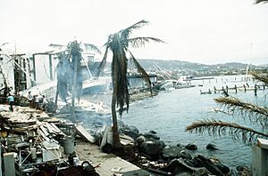
Hugo killed 3 people and left 3,500 homeless on Saint Croix. Private and government property damage exceeded $500 million. Electricity, power, and water services were cut by Hugo across the island. More than 90 percent of buildings were damaged and vegetation was stripped bare throughout the island. Seventy percent of buildings were destroyed and as many as 75 percent of homes lost their roofs. Many neighborhoods were completely reduced to rubble. Surveys equated the severity of damage to that caused by an F1 or F2 tornado on the Fujita scale. In some areas, microbursts and the local topography may have amplified the winds, producing more extreme damage. The heaviest damage on Saint Croix was inflicted upon its northern coast from the mouth of the Salt River to the island's eastern end. These coastal extents were directly exposed to intense rainbands associated with Hugo. The sloping terrain near Christiansted accelerated winds near the surface by as much as 20 percent, enhancing the damage wrought. Stores were damaged in Christiansted. Power and water distillation facilities operated by the Virgin Islands Water & Power Authority west of the city were disabled by the storm. The rupture of a fuel oil tank on the facility grounds caused an oil spill in the Christiansted harbor. Severe damage occurred in south-central Saint Croix near the Hovensa oil refinery and Alexander Hamilton International Airport. Oil tanks at the refinery were damaged, leaving the entire facility incapacitated. The control tower, associated weather instrumentation, and aircraft at the airport were badly damaged. A loose steel fuel tank collided into and destroyed a U.S. Customs shed. A UH-1 helicopter and two heavy trucks belonging to the National Guard were destroyed by debris. Less severe damage occurred in southwestern Saint Croix near Frederiksted. Rough surf damaged the city pier, tearing away parts of its concrete decking.
Saint Thomas experienced hurricane-force winds and sustained widespread damage to property and vegetation; damage was less severe than on Saint Croix due to Saint Thomas's position farther away from the core of Hugo. A field survey conducted by the National Academy of Sciences estimated that gusts of up to 121 mph (195 km/h) occurred on the island. Homes were unroofed and boats were heavily damaged or set adrift. The antenna, tower, and transmitter of television station WBNB-TV in Charlotte Amalie were destroyed; the station would not return to the air because of the damage and the owner's inability to afford repairs.
Puerto Rico
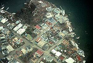
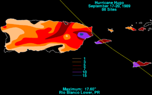
Two people drowned in Puerto Rico during Hugo's passage according to reports from the National Research Council and NHC. Another six were killed in Guayama. The San Juan Star estimated losses in the territory amounted to $2 billion while Storm Data, a monthly publication from the National Centers for Environmental Information, estimated that damage reached $1 billion; property damage accounted for $900 million while crop damage accounted for $100 million. The outer rainbands of Hugo began moving across Puerto Rico at 5:00 p.m. AST (21:00 UTC) on September 17. Hugo made two landfalls in the Puerto Rico territory on September 18—on Vieques and Fajardo—as a high-end Category 3 hurricane with maximum sustained winds estimated at 125 mph (201 km/h). An anemometer on the ship Night Cap registered a wind gust of 170 mph (270 km/h) while harbored at Culebra. The strongest wind recorded on Puerto Rico's main island was documented at Roosevelt Roads Naval Station, which reported a peak sustained wind of 104 mph (167 km/h) punctuated by a 120 mph (190 km/h) wind gust. At Luis Muñoz Marín International Airport, sustained winds reached 77 mph (124 km/h), gusting to 92 mph (148 km/h). The heaviest rain from Hugo in Puerto Rico occurred in the northeastern part of the island due to the hurricane's trajectory and orographic lifting induced by El Yunque. A peak rainfall total of 17.60 in (447 mm) was recorded along the lower Río Blanco. Flooding was mostly limited to the northeastern corner of Puerto Rico and in San Juan where rainfall was heaviest. In these areas, over 10 in (250 mm) of rain fell in 48 hours. The heavy rainfall drained into the Fajardo River and Mameyes River, causing them to set new records for discharge rates; three other rivers reached discharge rates within 10–15 percent of their highest on record. Flash floods occurred near the Pitahaya and Espíritu Santo rivers. Floods impacted areas near Luqillo and low-lying portions of San Juan after water pumps lost power. Two hundred landslides occurred in Puerto Rico, with the largest of these transporting 40,000 m3 (1,400,000 cu ft) of debris into a river.
Culebra and Vieques, two small islands east of Puerto Rico, experienced harsher impacts than the main island; between the two, Culebra experienced stronger winds and heavier damage. The devastation in both islands was nonetheless thorough and widespread. Hurricane reconnaissance observations and the resulting damage in Culebra suggested that the island was struck by 150-mph (240 km/h) wind gusts. Southeasterly winds were accelerated by the hills on the sides of Ensenada Honda. The homes of 80 percent of Culebra residents were wrecked. A housing development near the Benjamín Rivera Noriega Airport was completely destroyed. Many boats in Culebra were damaged, including those that sought refuge in Ensenada Honda. On Vieques, a peak gust of 98 mph (158 km/h) was registered, though the damage suggested that gusts of up to 132 mph (212 km/h) may have impacted the island. The roof of a baseball stadium was pried off by the winds. A thousand families in Vieques were left homeless.
The worst damage on the principal island of Puerto Rico occurred along its northeast coast at Fajardo and Luquillo, where the angle of attack of Hugo's winds was most favorable for high storm surge. At Luquillo, the storm surge reached 8 ft (2.4 m), with waves atop the elevated waters reaching at least 10 ft (3.0 m). Two ferries were grounded at Fajardo by the storm surge; boats sustained over $50 million in losses while marinas sustained $25 million in damage. An aerial survey from the U.S. Coast Guard found that winds unroofed 80 percent of homes between San Juan and Fajardo. Roosevelt Roads Naval Station took heavy damage and lost power and water service. Practically every building was damaged, though only minor injuries occurred. High waves along the coast of the San Juan metropolitan area destroyed walls and sidewalks. Condado suffered widespread damage and debris bestrewed its streets. A mobile home park in Loíza, one of the few in Puerto Rico, was wiped out by the storm surge and strong winds. The winds overturned cars and toppled trees and streetlights around the city. Buildings in downtown San Juan suffered partial wall and window failures, though overall damage to buildings in the city was light. Fifty airplanes were destroyed at Luis Muñoz Marín International Airport; repairs to the airport would cost $20 million.
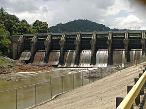
Power outages affected 80 percent of Puerto Rico. Power and water supplies in San Juan were cut for more than a week in some areas. At Carraízo Dam, San Juan's primary supplier of water, five electric motors in the pumping station were inundated, disrupting water distribution; replacement of these motors cost $200,000. The lake formed by the dam had begun to rise, and floodgates were rendered inoperable by power outages. Poor maintenance had left the dam vulnerable to a larger catastrophe; however, Hugo's rainfall was ultimately less than forecast. Power distribution systems in San Juan and other communities were severely crippled, leading to power outages affecting thirty-five municipalities. Many power poles in Puerto Rico held a disproportionate number of electrical conductors, resulting in greater power loss than would otherwise be expected for the conditions experienced. A destroyed communications antenna in El Yunque National Forest cut off communication to Vieques and Culebra. Debris in the forest blocked Puerto Rico Highway 191 and strong winds unroofed the local headquarters of the United States Forest Service. Fallen power lines and damage to over 120 homes marooned the mayor of Arroyo and several others; the municipality had been struck by waves 35 ft (11 m) high. Damage to highways in Puerto Rico amounted to $40 million, though only one bridge required closure for repairs. Crops on the island including banana and coffee sustained widespread losses.
South Carolina
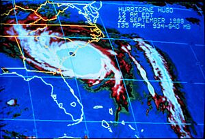
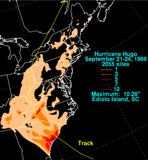
The eye of Hugo moved ashore South Carolina at Sullivan's Island at 04:00 UTC on September 22 (12:00 a.m. EDT). The storm's maximum sustained winds were estimated by the NHC to have reached 140 mph (230 km/h) during landfall, making Hugo a Category 4 hurricane. This estimate was derived from an aircraft reconnaissance flight into the storm shortly before landfall; no weather stations were positioned along Bulls Bay, where Hugo's strongest winds likely occurred. This intensity made Hugo the strongest hurricane to strike the United States in 20 years. The ship Snow Goose, anchored in the Sampit River 5 mi (8.0 km) west of Georgetown, clocked a 120-mile-per-hour (193 km/h) sustained wind using an anemometer mounted on the ship's mast. In downtown Charleston, a sustained wind of 87 mph (140 km/h) and a gust of 108 mph (174 km/h) were reported. Hugo produced an 8-foot (2.4 m) storm surge at Charleston, indicating that water levels rose 12.9 ft (3.9 m) above mean lower low water as Hugo made landfall. Elsewhere along the South Carolina coast, Hugo produced storm tides as high as 20 ft (6.1 m). The maximum recorded storm surge was 20.2 ft (6.2 m) along Seewee Bay south of McClellanville. This rise in water induced by Hugo resulted in the highest storm tides ever recorded along the U.S. East Coast. Between 3–8 in (76–203 mm) of rain fell across a swath 150 mi (240 km) wide over South Carolina. The maximum rainfall in the state (and the continental United States) was 10.28 in (261 mm) as measured in Edisto Island. Totals between 4–6 in (100–150 mm) were commonplace along the coast of South Carolina.
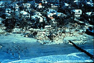
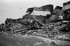
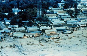
The South Carolina Electric and Gas Company (SCE&G) called Hugo "the single greatest natural disaster ever to strike the state", inflicting $5.9 billion in property damage. The hurricane's trajectory swept across three major South Carolina cities. According to the National Oceanic and Atmospheric Administration's Storm Data publication, there were 35 deaths associated with Hugo in South Carolina. The hurricane's forces killed 13 people while another 22 fatalities were considered "indirectly-related". Across eight counties, manufacturers incurred $158 million in damage to factories and $750 million in inventory and income losses. Much of the South Carolina coast was subject to the ferocity of the hurricane's forces. Hugo's storm surge wrecked the barrier islands, thoroughly razing many structures. Many homes on Wadmalaw Island and Johns Island were crushed by fallen trees. The Ben Sawyer Bridge connecting the South Carolina mainland to Sullivan's Island was heavily damaged and became stuck in an open position. Rows of beachfront homes on Sullivan's Island were razed by the surge. Ships at the marina in Isle of Palms were crumpled into a heap on the mainland shore. Beach homes on Isle of Palms were moved 150 ft (46 m) off their foundations by an 11-foot (3.4 m) storm surge; in total, 60 homes were destroyed on the island. The damage in Sullivan's Island and Isle of Palms combined was estimated to be approximately $270 million. Every building on the two islands took damage from the hurricane. Storm surge tore off the pavement from coastal roads and destroyed 80 percent at Folly Beach. All coastal state parks with the exception of Hunting Island and Edisto Beach sustained significant damage.
Charleston County was at the epicenter of Hugo's devastation. At McClellanville, near the point of maximum storm surge, shrimp boats were pushed as far as 0.5 mi (0.80 km) inland. Commercial and recreational craft damaged other structures as they were carried ashore. A high school used as a shelter for 1,125 local residents was inundated by the ocean's advance; documentation had listed its elevation 11 ft (3.4 m) too high, leading to its mistaken selection as a shelter. The storm surge accumulated within the Ashley, Cooper, and Santee rivers, forcing them over their banks and submerging low-lying areas 10 mi (16 km) upstream. One person was killed by the rise of the Cooper River at Mount Pleasant. Seven to eight hundred boats were left in derelict condition, and many in Shem Creek capsized. Hugo's surge spilled over The Battery and overtook the first floors of homes in downtown Charleston. Eighty percent of roofs in the city were damaged, with many already susceptible to strong winds due to poor maintenance and weak structural integrity. At least 3,200 historic structures in Charleston were damaged and 95 percent of urban trees were lost. Naval Weapons Station Charleston sustained $95–$100 million in damage. Two people were killed in Charleston by the collapse of their homes. The U.S. Route 17 bridge across Awendaw Creek in Awendaw was destroyed by a 19.4 ft (5.9 m) storm tide. Extensive losses to timber occurred at Francis Marion National Forest, where 75 percent of marketable trees were felled. Most trees were truncated 10–25 ft (3.0–7.6 m) above the ground, with others snapped or uprooted; the cost of damage was estimated by the U.S. Forest Service at between $95–115 million. Animals, including some from endangered species, were killed at Cape Romain National Wildlife Refuge. However, the lack of infrastructure near the refuge significantly reduced the damage wrought by Hugo's strongest winds.
Coastal impacts in South Carolina were extensive beyond Charleston County. The waterfront in Georgetown suffered heavily, with the destruction of 150 homes. Major damage was inflicted upon 350 homes and minor damage was inflicted upon another 500 homes, with their aggregate losses amounting to $87 million. Farms and businesses around Georgetown sustained $10 million in damage. Only a few beachfront homes withstood the hurricane in Pawleys Island. Debris from destroyed homes piled atop streets along the island's south end. Hugo caused about $944 million in damage in Horry County. As protective sand dunes were whittled down by the hurricane, beaches along 150 mi (240 km) of the coastal Carolinas recessed 50–200 ft (15–61 m) inland. Beaches were eroded by a 13-foot (4.0 m) surge up to the most outward row of homes in Garden City. These coastal homes were razed or washed inland, dealing damage to additional homes. M. L. Love, the administrator for Horry County, said that the city "for all practical purposes is gone." Severe beach erosion also occurred in Myrtle Beach and North Myrtle Beach. Piers along the coast of Horry County were heavily damaged by storm surge. The pier at Sunset Beach was reduced to its pilings. Myrtle Beach Air Force Base sustained $2 million in damage from buildings and equipment. With the Grand Strand and Myrtle Beach areas experiencing only low-end hurricane-force winds, the widespread wind damage in those areas was attributed to "widespread underdesign and marginal building practices." Lesser damage occurred along the southern South Carolina coast between Charleston, South Carolina, and Savannah, Georgia, with winds there remaining below 65 mph (105 km/h).
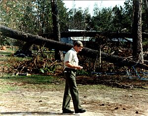
Hugo's acceleration at landfall allowed strong winds to penetrate well inland, causing widespread wind damage across the eastern two-thirds of the state. The NOAA classified wind damage as "extensive" in 15 counties. Devastated groves of pine trees were characteristic of the hurricane's impacts, in addition to numerous unroofed homes and cotton crops injured by the winds and rain. Over one-third of all timber in the state was damaged, with the damage most extensive near the coast and locations that were northeast of Hugo's eye as it moved across the state. This quantity of timber was enough to build 660,000 homes. The total stock of growing softwood was cut by 21 percent while the total stock of growing hardwood fell by 6 percent. Hugo was widely considered the most significant forest disaster in South Carolina history. Across 23 counties, 4.4 million acres (1.8 million hectares) experienced the loss of 6.6 million board feet (15,600 m3) of timber, equivalent to three to four times the annual timber harvest; this was a greater loss of timber than observed in Hurricane Camille, the 1980 eruption of Mount St. Helens, and the Yellowstone fires of 1988, combined. Berkeley, Clarendon, Florence, Lee, Sumter, and Williamsburg counties each experienced damage to more than 90 percent of timberland. A conservative estimate valued the lost timber statewide at $1.04 billion. Downed trees and wind-blown debris severed power lines, cutting power for most areas. Three power plants were also disabled by the storm. SCE&G reported that 300,000 of its electricity customers lost power, with a complete loss of power east of Interstate 95. Utility services from the South Carolina Public Service Authority were crippled for 99 percent of the utility's customers. At Shaw Air Force Base near Sumter, 200 homes were destroyed and 1,000 sustained heavy damage; the property damage toll for Sumter County was $237 million. The effects of Hugo in the Carolinas were most fatal in Berkeley County, where eight people were killed. Over a thousand homes and apartments were destroyed and 70–80 percent of the county's trees were blown down. Up to a quarter of York County's cotton crop was lost, with additional losses suffered by peach, sorghum, and soybean crops.
North Carolina
Across North Carolina, Hugo damaged 2,638 structures and destroyed 205; the damage toll was $1 billion. Losses to crops and livestock amounted to nearly $97 million. There were seven fatalities in the state. Storm surge along the coast of North Carolina west of Cape Fear reached 9 ft (2.7 m) above mean sea level. Three beach communities in Brunswick County, North Carolina, incurred a total of $55 million in damage; with at least 25 beachfront homes battered by the storm; another 100 structures were threatened by coastal erosion. Along parts of the coast, 50 ft (15 m) of beach eroded, including sand dunes that once stood 7–8 ft (2.1–2.4 m) tall. Sixty percent of the sand dunes in Long Beach were eliminated by the hurricane, further exposing areas inland to the storm's fury. Several piers were wrecked by Hugo: the pier at Yaupon Beach was destroyed while a fourth of the pier at Long Beach was lost; the end of the pier at Holden Beach also succumbed to the storm.
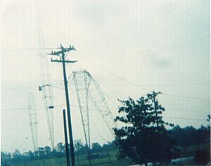
With the aid of Hugo's rapid forward motion, the swath of damaging winds produced by Hugo in interior South Carolina penetrated into western North Carolina while still a category 1 hurricane and brought extensive damage to areas that rarely experienced impacts from tropical cyclones. Hugo produced a nearly 50-mile-wide (80 km) corridor of downed trees and power lines west of Charlotte, and hurricane-force wind gusts extended 200 mi (320 km) inland. The control tower at Charlotte Douglas International Airport clocked a 99 mph (159 km/h) gust, forcing personnel in the airport's control tower to evacuate. Windows were blown out of skyscrapers in Downtown Charlotte. The 400-foot (120 m) tall WSOC-TV antenna collapsed onto the television station below. Numerous trees in Charlotte were also blown down atop homes and power lines, triggering long-lasting power outages that affected 85 percent of Charlotte homes and businesses. The winds piled boats together and destroyed or damaged thousands of them in Lake Norman, located north of Charlotte. Wind damage in Mecklenburg County amounted to over $500 million. Millions of trees were felled across the Foothills and Piedmont of North Carolina; some areas endured the resulting power outages for weeks. The National Weather Service office in Wilmington described Hugo's winds as a "unique event in weather history for this portion of inland North Carolina."
Virginia
Parts of Southwest Virginia were also impacted by the core of strong winds associated with Hugo, which passed through the state as a tropical storm. Bath and Bland counties registered 81-mph (130 km/h) gusts; these were the fastest gusts measured in Virginia in connection with the passing storm. As was the case in North Carolina, the winds downed numerous trees, causing widespread power outages and structural damage. Their arboreal debris obstructed hundreds of roads. Sporadic damage from Hugo occurred as far east as Interstate 95. The damage toll in Virginia was approximately $60 million, with over $40 million incurred in Carroll and Grayson County, Virginia counties; six people were killed statewide.
While Hugo's quick traversal of the Southeastern U.S. enlarged the area of inland wind damage, it also attenuated rainfall totals; rainfall was relatively light for a storm of Hugo's size. In southwestern Virginia and western North Carolina, the topography of the Appalachian Mountains led to a localized area of heavier rainfalls, resulting in 6 in (150 mm) rainfall totals. While Hugo's rainfall was not sufficient to cause major river flooding in North Carolina, minor flooding impacted mountainous areas north and east of Asheville and highways in seven counties. A nursing home in Boone, North Carolina, was evacuated following a flash flood. In Burnsville, North Carolina, flooding prompted the evacuation of 79 prisoners. Rainfall totals of 1–4 in (25–102 mm) occurred throughout southwestern Virginia, with a maximum of 6.5 in (170 mm) in Hillsville, Virginia. Some low-lying areas and streams flooded, including the New and Roanoke rivers; flooding along the South Fork of the Roanoke forced about 60 people to evacuate.
Elsewhere in the United States
Strong winds in Georgia downed trees in four counties, damaging homes and power lines. About 50–75 trees were toppled around Savannah, where wind gusts reached 54 mph (87 km/h). The city's weather service office recorded 6.10 in (155 mm) of rain. Winds of 45–50 mph (72–80 km/h) downed trees in Mercer County, West Virginia. Flooding forced the evacuation of the Oakdale area in Harrison County, West Virginia. Widespread flash flooding occurred across eastern Tennessee, forcing the evacuation of people from affected areas; some of the evacuees had fled South Carolina for the Great Smoky Mountains. Three hundred people were driven out of Carter County. Floods there swamped homes and the downtown area of Roan Mountain. Bridges and roads were washed out in Greene and Johnson counties. Numerous creeks overflowed their banks in northeastern Ohio following heavy rainfall from the remnants of Hugo on the afternoon of September 22. In both Chardon and Medina, 4.3 in (110 mm) of rain fell in two hours. Floodwaters inundated urban areas and basements. In the eastern suburbs of Cleveland, flooding overtook cars and buses. High water and washouts forced the closure of U.S. Route 42 and Ohio State Route 94 in Medina County.
The juxtaposition of Hugo's extratropical remnants (a low-pressure system) over the eastern Great Lakes region and a strong high-pressure system off the U.S. East Coast generated a sharp contrast in pressure. This led to strong winds over the Mid-Atlantic states and New England. Nearly 85,000 homes and businesses lost power on Long Island. One person was killed in Norwich, New York. Fifteen counties in Pennsylvania reported high winds in connection with Hugo, with some sustaining damage to trees. Connecticut was buffeted with winds of 40–50 mph (64–80 km/h), blowing down some trees and branches. This led to scattered and brief power outages that affected 30,000 electricity customers. Total property and crop damage in Connecticut amounted to at least $50,000. Power outages also affected thousands of electricity customers in Massachusetts. Fallen trees and broken limbs caused scattered property damage throughout the state. In western parts of Massachusetts, some apple orchards reported damage to as much as 30 percent of their crops. In Vermont, the high winds generated swells several feet high on Lake Champlain, freeing some boats from their moorings. Trees and power lines were also brought down by the winds statewide.
Canada
After becoming extratropical, the remnants of Hugo entered Canada into the province of Ontario. In the Niagara Falls area, winds between 37 and 43 mph (60 and 69 km/h) were reported. Winds near 47 mph (76 km/h) were also reported in Toronto. Heavy rainfall also occurred in Ontario, with precipitation in Ontario peaking at 4.5 in (110 mm), while a maximum amount of 1.85 in (47 mm) was reported in Toronto. As a result of the storm, blackouts and car accidents were reported in Toronto. Furthermore, heavy rains and high winds also occurred across the southern portions of Ontario.
The remnants of Hugo tracked northeastward and entered the Canadian province of Quebec. In Montreal, rainfall reached only 0.43 in (11 mm), while precipitation amounts in the province peaked at 3.73 in (95 mm). In addition to light rain, high winds were reported in the province. Winds in Montreal gusted up to 59 mph (95 km/h), leaving 13,400 homes without electricity. 7,400 residence in Verdun and West Island also lost electricity when tree fell on power lines; it was restored about 12 hours later. While in Brossard and Chambly, power was lost to 5,000 homes and 1,000 homes in Valleyfield. In addition, high winds and heavy rainfall also occurred in the St. Lawrence River Valley.
Similar effects were reported in New Brunswick, though little rainfall occurred in the province. Winds gusting to 77 mph (124 km/h) was reported in Moncton. As a result of high winds, power poles were toppled and tree branches fell, which caused most of New Brunswick's 15,000 power failures. In addition, several tree and signs were blown over in Saint John and Moncton. The storm also significantly affected the apple crop in New Brunswick. Strong winds were also reported in Newfoundland, with gusts recorded up to 43 mph (69 km/h).
Aftermath
Lesser Antilles
A plane bearing 60 rescue workers and emergency supplies was sent to Guadeloupe from Paris on September 19, with two more relief aircraft held on standby. The crews were tasked with sheltering the homeless, restoring electricity service, and clearing roads. Doctors were also sent to Guadeloupe from La Meynard Hospital in Martinique. Emergency supplies from Paris were gathered by Catholic Air and Red Cross. Military aircraft delivered 50 tons (45 tonnes) of supplies and over 500 emergency workers to Guadeloupe, along with Minister of Overseas France Louis Le Pensec; 3,000 soldiers also accompanied the transport. The total cost of repairs on the island was estimated at over €610 million. Two days after Hugo's passage, an Aérospatiale SA 330 Puma rescue helicopter crashed in La Désirade, killing nine people. The Guadeloupe government held a competition to design homes that would be quickly built to house the island's homeless population; five of thirty models were selected, and the first homes were built five months after Hugo. The banana industry in Guadeloupe required FF466 million to recover, while the island's hotel industry suffered FF152 million in losses.
The emergency operations center in Montserrat was formally activated on September 18 to effectively deal with the aftermath of Hugo. As more robust communication systems were destroyed by the storm, communications between the island and the outside world were primarily handled by amateur radio. Urgent requests for aid were forwarded by ham radio operators to all embassies and foreign missions in Barbados. The island's reduced radio capabilities were augmented by HMS Alacrity when she arrived in Plymouth on September 18. The ship also brought a helicopter and a crew of 100 sailors that aided in cleaning up roads between Plymouth and W. H. Bramble Airport. Extensive effort was required to clean up Montserrat's roads due to the prevalence of debris. Along with the crew of the Alacrity, the Barbados Defence Force and Jamaica Defence Force also assisted in road cleanup operations in Montserrat. The International Rescue Corps maintained a satellite communications link and provided support for 21 national and international organizations in recovery efforts. Rationing on petroleum was enforced, with a limit of four gallons (15 liters) per person. Waterborne illnesses in Hugo's aftermath proved fatal in Montserrat. A temporary hospital was established at the Montserrat Government House following the destruction of a recently completed hospital.
Virgin Islands
President Bush declared the U.S. Virgin Islands a disaster area. A temporary air traffic control tower was erected at Alexander Hamilton Airport in Saint Croix six days after the storm. Cyril E. King Airport in Saint Thomas, having suffered less damage, resumed operations within 24 hours. Power was restored in most of Saint Croix and Saint Thomas within three months. The islands' telephone systems were badly crippled by the storm, and only limited service was restored to businesses in December 1989. Some private residences in Saint Croix remained without telephone service until March 1990. Between 300–500 prisoners were freed from prison in Saint Croix after the storm, either by escaping or by release due to food and water shortages in the prison. The Federal Emergency Management Agency (FEMA) dispatched a C-141 airlifter with government relief workers and communications equipment to Saint Croix. The demographics of the Virgin Islands a year after Hugo reflected the hurricane's impact: roughly 10% of Saint Croix's populace did not return to the island within a year of Hugo. A smaller exodus occurred at Saint Thomas and Saint John.
Three days after the storm hit, the Governor of the United States Virgin Islands Alexander Farrelly asked President Bush for federal assistance in restoring order to the island. On the island of Saint Croix, looting and lawlessness reigned in the aftermath of Hugo. FBI agents, U.S. marshals, and local police initially maintained a patrol of Frederiksted and Christiansted while the U.S. Coast Guard evacuated tourists from the island; the USCGC Bear evacuated 40 people and sent personnel onshore to monitor the situation. However, local law enforcement in Saint Croix was unable to stop widespread looting, with armed gangs reportedly taking root the streets of Christiansted. The Atlanta Constitution reported that some members of the local police and National Guard also took part in looting. For the first time since the Baltimore riot of 1968, American troops were deployed in response to a domestic civil disturbance; with the authorization of U.S. President George H. W. Bush under the Insurrection Act of 1807, the Pentagon sent 1,100 troops and federal marshals to augment the security presence as local police and the National Guard lost control of the situation. Among the deployments were 470 troops from the 16th Military Police Brigade, 560 troops from the 503rd Military Police Battalion, and three helicopters and medical support. Dubbed Operation Hawkeye, the operation involved elements of the Army, Navy and the Coast Guard, along with a contingent from the U.S. Marshals Service and the FBI, forming Joint Task Force (JTF) 40 for Operation Hawkeye. It also resulted in the first operational deployment of the National Disaster Medical System (NDMS), when the New Mexico-1 Disaster Medical Assistance Team (DMAT) was deployed to assist in medical care needs of the stricken island. The first contingent arrived in Saint Croix on the morning of September 21 to secure an airfield and devise the command structure for the other arriving troops.
National Basketball Association player Tim Duncan, born in Christiansted and a two-time NBA MVP, of the San Antonio Spurs attributed his basketball career to Hurricane Hugo's destruction. When Tim was 13 years old, he was a competitive swimmer who was considered one of the top United States competitors for the 400-meter freestyle. However, in the aftermath of Hugo, every swimming pool on Saint Croix was destroyed, including the Olympic-size swimming pool. With no pool to practice in, Duncan turned to basketball. Tim Duncan said, "I'm very fortunate to be where I am today. Without Hugo, I might still be swimming." On April 4, 2020, it was announced that Duncan would be inducted into the Naismith Memorial Basketball Hall of Fame on August 29.
Puerto Rico
Puerto Rican Governor Hernandez Colón solicited a disaster declaration for Puerto Rico from President Bush after surveying the damage wrought by Hugo. The U.S. Department of the Interior allocated $500,000 in aid to Puerto Rico and the U.S. Virgin Islands. Police were dispatched to retail areas, offices of political parties, and the main San Juan post office to avert looting. An emergency clinic served in place of the destroyed hospital in Culebra. Governor Colón estimated that the number of those displaced by Hugo in Puerto Rico exceeded 50,000. Over 25,000 people in Culebra and Vieques remained in shelters after Hugo as their homes were destroyed. The Puerto Rican school system was hindered by the damage inflicted on the schools themselves, their use as shelters, and the loss of water and power service. Due to a lack of planning for housing shelter residents, 500 schools remained closed weeks after the storm, affecting at least 150,000 students. The loss of water caused two hospitals to refuse patient admission on September 20.
While power in San Juan was largely restored within 48 hours, many in Puerto Rico remained without power in the days following Hugo. On September 24, 47,500 businesses and homes in Puerto Rico were without power; the San Juan Star reported that a quarter of electricity customers in Fajardo remained without electric service on October 9, three weeks after Hugo struck the island. Residents of Puerto Rico's northeastern coast were encouraged to boil water to curtail the spread of food- and waterborne diseases, though power outages prevented most from doing so. Repair costs for Puerto Rico Electric Power Authority poles and wires amounted to $50 million; some repair efforts may have been undermined by the looting of copper wire in Hugo's aftermath. At least six workers were killed while repairing power lines. Equipment from the continental U.S. for the restoration of Puerto Rican water supplies arrived beginning on September 22, with the capacity to produce over 200,000 gallons (760,000 liters) of potable water daily. USAF sent power generators, plastic sheeting for repairs, and 200,000 The U.S. Army Corps of Engineers distributed over 2 million gallons (7.6 million liters) of water using 33 tank trucks, with the costs subsidized by the U.S. government. U.S. Coast Guard C-130s and two cutters were sent to San Juan to render aid and deliver supplies. From its supply centers in the continental U.S., the American Red Cross amassed supplies for victims in Puerto Rico and mounted its largest domestic relief effort in four years.
Continental United States
An overnight curfew was enacted by Charleston Mayor Joseph P. Riley Jr. on September 22 while martial law was declared for Sullivan's Island. A federal disaster area was declared for 24 counties in South Carolina. Federal resources for the aftermath in South Carolina were strained by earlier relief efforts for Hugo's impact in the Caribbean; they would be strained further by the 1989 Loma Prieta earthquake in October. The presence of debris on roads hampered relief efforts and increased recovery costs. In contrast with prior trends, more people were killed after the hurricane's passage rather than due to the hurricane's direct forces. Several members of repair crews were killed or injured in South Carolina and Puerto Rico from ungrounded portable generators. There were 24 deaths in the aftermath of Hugo in South Carolina. Five people died of heart attacks while surveying Hugo's aftermath in Dorchester County. SCE&G fully restored power to its customers in 18 days after deploying 4,703 personnel. The company also offered free bus service for a week and distributed dry ice to the public.
Between 15–20 thousand people were left homeless in Charleston County. Homes were primarily rebuilt and repaired by non-profit and ad-hoc groups. Churches and other private non-profit groups managed replacement housing for Hugo victims in at least four South Carolina counties whose governments lacked such capabilities. Temporary housing assistance was extended to 30,000 storm victims in the state by the FEMA at a cost of $31 million. In addition to those offered housing grants, 243 families were moved to FEMA mobile homes beginning a week after Hugo until April 1990. State and local governments together contributed $8.25 million to public assistance projects. After the storm, Governor Campbell said that the storm destroyed enough timber in South Carolina to "frame a home for every family in the state of West Virginia." An immense salvage effort was undertaken to harvest downed pine trees for pulpwood before they deteriorated to the point where they could not be used. Still standing timber that appeared usable for lumber and plywood frequently had annular separations of the rings that made them dangerous to saw and nearly impossible to cut into plies, so they were also downgraded into pulpwood, leading to such a drop in pulpwood prices that eventually much of the salvage effort ceased. United States Senator from South Carolina Fritz Hollings referred to FEMA as "a bunch of bureaucratic jackasses" during a speech on the floor of the United States Senate. An investigation was launched, which led to some reforms in FEMA procedures that helped the agency do a somewhat better job during Hurricane Andrew, the next catastrophic hurricane to strike the United States. The economy of South Carolina continued to grow after Hugo, though some sectors did not benefit from recovery efforts. There was a 14 percent increase in traffic accidents in Charleston in the wake of the hurricane. Delays in traffic in the city led to an estimated 35 percent increase in vehicular operating costs in the months following the hurricane.
Retirement
The devastation caused by Hugo led to the name being retired in the spring of 1990 by the World Meteorological Organization from the rotating lists of Atlantic hurricane names. It was replaced with the name Humberto when the 1989 naming list was used next in 1995.
Ecological aftermath
The defoliation of mangroves and the introduction of freshwater runoff into brackish waters created anoxic conditions that killed many fish in Guadeloupe's mangrove habitats; fish populations would recover by January 1990. The low species richness of mangrove forests was found to a contributing factor to Hugo's damage upon vegetation. Forests with a greater vertical extent and higher species richness were more protected from the hurricane's effects. Bat populations in Montserrat dropped 20-fold in response to extensive habitat loss and community composition transitioned from one dominated by small frugivores to one dominated by larger frugivores and omnivores. Extensive defoliation was documented in the forests of Dominica, Guadeloupe, Montserrat, and Puerto Rico, where vegetation was stripped bare of their flowers, fruits, and leaves.
A survey of bird populations in Saint Croix observed that Hugo's aftermath may have stressed birds more than the hurricane's immediate meteorological forces. Frugivorous, nectarivorous, and seminivorous bird populations declined most among avian diet groups as a result of vegetation loss. The bridled quail-dove (Geotrygon mystacea) was driven out of its traditional habitats on Saint Croix. Declines in the populations of certain bird species were also noted in Saint John. The destruction of habitats forced the relocation of some avian species such as the pearly-eyed thrasher (Margarops fuscatus) and northern waterthrush (Seiurus noveboracensis). The populations or habitats of three endangered Puerto Rican birds were affected by Hugo: the Puerto Rican amazon (Amazona vittata), the Yellow-shouldered blackbird (Agelaius xanthomus), and the Puerto Rican plain pigeon (Columba inornata wetmorei). El Yunque National Forest lost 15 percent of its trees, valued at $5.2 million. However, the increased exposure to sunlight following the loss of tree canopies led to increased diversity of plant species. In Montserrat, the endemic Montserrat oriole (Icterus oberi) was driven out of the South Soufriere Hills after losing much of its habitat.
Sewage contamination and poor water quality briefly impacted shellfish populations along the coast of South Carolina. The turbulent action generated by Hugo in streams lowered concentrations of dissolved oxygen and increased concentrations of toxic phenols. Nekton communities suffered increased mortality in river channels and marsh creeks near the Charleston harbor due to hypoxia and lowered salinity in the water, though their populations recovered within two months. Increased salinization of coastal soil led to increased tree mortality and discoloration or defoliation of trees. These surge-battered forests were devoid of insects and terrestrial vertebrates for six months, though their populations were well-below pre-storm levels. Benthic invertebrates experienced a 97% decrease in population density but recovered to pre-storm levels in three months. At least 25 coastal species of birds were displaced as far as 200 mi (320 km) inland by the storm. Across the Carolinas, Hugo's winds increased the quantity of downed brush, timber, and debris by up to 15 times their normal amounts, significantly increasing the risk of wildfires throughout the region. FEMA designated $7 million towards forest fire mitigation in Hugo's aftermath.
See also
 In Spanish: Huracán Hugo para niños
- List of North Carolina hurricanes (1980–1999)
- Hurricane Hazel (1954) – quickly moved ashore the Carolinas, causing widespread damage into eastern Canada
- Hurricane Gracie (1959) – made landfall on the south end of Edisto Island in South Carolina as a Category 4 hurricane
- Hurricane Georges (1998) – impacted much of the Lesser and Greater Antilles at a similar strength
- Hurricane Maria (2017) – wrought devastation across parts of the Lesser Antilles and Puerto Rico, leading to a significant humanitarian crisis
- Hurricane Lee (2023) – also achieved Category 5 status at a very easterly position


