Windsor County, Vermont facts for kids
Quick facts for kids
Windsor County
|
|
|---|---|

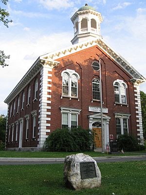
Windsor County courthouse in Woodstock
|
|

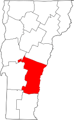
Location within the U.S. state of Vermont
|
|
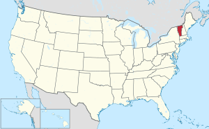
 Vermont's location within the U.S. |
|
| Country | |
| State | |
| Founded | 1781 |
| Named for | Windsor, Vermont, which was named for Windsor, Connecticut |
| Shire Town | Woodstock |
| Largest town | Hartford |
| Area | |
| • Total | 977 sq mi (2,530 km2) |
| • Land | 969 sq mi (2,510 km2) |
| • Water | 7.4 sq mi (19 km2) 0.8%% |
| Population
(2020)
|
|
| • Total | 57,753 |
| • Density | 59.113/sq mi (22.823/km2) |
| Time zone | UTC−5 (Eastern) |
| • Summer (DST) | UTC−4 (EDT) |
| Congressional district | At-large |
Windsor County is a county located in the U.S. state of Vermont. As of the 2020 census, the population was 57,753. The shire town (county seat) is the town of Woodstock. The county's largest municipality is the town of Hartford.
Contents
History
Windsor County is one of several Vermont counties created from land ceded by the State of New York on January 15, 1777, when Vermont declared itself to be a distinct state from New York. The land originally was contested by Massachusetts, New Hampshire, and New Netherland, but it remained undelineated until July 20, 1764, when King George III established the boundary between Province of New Hampshire and Province of New York along the west bank of the Connecticut River, north of Massachusetts and south of the parallel of 45 degrees north latitude. New York assigned the land gained to Albany County. On March 12, 1772, Albany County was partitioned to create Charlotte County, and this situation remained until Vermont's independence from New York and Britain.
Windsor County was established on February 16, 1781, from parts of Cumberland County and organized the same year.
Windsor County is notable for being the birthplace and burial site of Calvin Coolidge, the 30th U.S. President and one of two Presidents born in the state (the other being Chester A. Arthur). Joseph Smith, Jr., founder of the Latter Day Saint movement, was also born in Windsor County.
Geography
According to the U.S. Census Bureau, the county has a total area of 977 square miles (2,530 km2), of which 969 square miles (2,510 km2) is land and 7.4 square miles (19 km2) (0.8%) is water. It is the largest county by area in Vermont.
Adjacent counties
- Orange County - north
- Grafton County, New Hampshire - northeast
- Sullivan County, New Hampshire - east
- Windham County - south
- Bennington County - southwest
- Rutland County - west
- Addison County - northwest
National parks
- Green Mountain National Forest (part)
- Marsh-Billings-Rockefeller National Historical Park
- White Rocks National Recreation Area (part)
Major highways
Demographics
| Historical population | |||
|---|---|---|---|
| Census | Pop. | %± | |
| 1790 | 15,740 | — | |
| 1800 | 26,944 | 71.2% | |
| 1810 | 34,877 | 29.4% | |
| 1820 | 38,233 | 9.6% | |
| 1830 | 40,625 | 6.3% | |
| 1840 | 40,356 | −0.7% | |
| 1850 | 38,504 | −4.6% | |
| 1860 | 37,193 | −3.4% | |
| 1870 | 36,063 | −3.0% | |
| 1880 | 35,196 | −2.4% | |
| 1890 | 31,706 | −9.9% | |
| 1900 | 32,225 | 1.6% | |
| 1910 | 33,681 | 4.5% | |
| 1920 | 36,984 | 9.8% | |
| 1930 | 37,416 | 1.2% | |
| 1940 | 37,862 | 1.2% | |
| 1950 | 40,885 | 8.0% | |
| 1960 | 42,483 | 3.9% | |
| 1970 | 44,082 | 3.8% | |
| 1980 | 51,030 | 15.8% | |
| 1990 | 54,055 | 5.9% | |
| 2000 | 57,418 | 6.2% | |
| 2010 | 56,670 | −1.3% | |
| 2020 | 57,753 | 1.9% | |
| U.S. Decennial Census 1790–1960 1900–1990 1990–2000 2010–2018 |
|||
2010 census
As of the 2010 United States Census, there were 56,670 people, 24,753 households, and 15,420 families living in the county. The population density was 58.5 inhabitants per square mile (22.6/km2). There were 34,118 housing units at an average density of 35.2 units per square mile (13.6 units/km2). The racial makeup of the county was 96.3% white, 0.9% Asian, 0.6% black or African American, 0.3% American Indian, 0.2% from other races, and 1.7% from two or more races. Those of Hispanic or Latino origin made up 1.2% of the population.
Of the 24,753 households, 25.9% had children under the age of 18 living with them, 49.1% were married couples living together, 9.0% had a female householder with no husband present, 37.7% were non-families, and 30.0% of all households were made up of individuals. The average household size was 2.25 and the average family size was 2.77. The median age was 45.8 years.
The median income for a household in the county was $50,893 and the median income for a family was $63,387. Males had a median income of $44,610 versus $34,150 for females. The per capita income for the county was $29,053. About 5.6% of families and 9.7% of the population were below the poverty line, including 12.5% of those under age 18 and 7.6% of those age 65 or over.
Transportation
In 2009, the United States Department of Transportation measured 113.6 miles (182.8 km) of "major arteries", the highest in the state.
Because US Route 4 had the "feel" of a freeway, motorists were inclined to speed. As a result, the Windsor County Sheriff's Department wrote 2,452 tickets in 2007.
Communities
Towns
Villages
Villages are census divisions, but have no separate corporate existence from the surrounding towns.
Census-designated places
- Ascutney
- Bethel
- Cavendish
- Chester
- Hartford Village
- Hartland
- North Hartland
- North Springfield
- Norwich
- Proctorsville
- Quechee
- Rochester
- South Royalton
- South Woodstock
- Springfield
- West Woodstock
- Weston
- White River Junction
- Wilder
- Windsor
Unincorporated communities
- Brownsville
- Felchville
- Gaysville
- Hartland Four Corners
- Lewiston
- North Pomfret
- Plymouth Notch
- Weathersfield Bow
- West Hartford
See also
 In Spanish: Condado de Windsor para niños

