Sullivan County, New Hampshire facts for kids
Quick facts for kids
Sullivan County
|
||
|---|---|---|

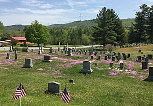
Lempster Mountain Wind Power Project overlooking cemetery in East Lempster, NH
|
||
|
||

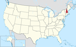
Location within the U.S. state of New Hampshire
|
||
 New Hampshire's location within the U.S. |
||
| Country | ||
| State | ||
| Founded | 1827 | |
| Named for | John Sullivan | |
| Seat | Newport | |
| Largest city | Claremont | |
| Area | ||
| • Total | 552.1 sq mi (1,430 km2) | |
| • Land | 537.5 sq mi (1,392 km2) | |
| • Water | 14.6 sq mi (38 km2) 2.6% | |
| Population
(2020)
|
||
| • Total | 43,063 | |
| • Density | 80.1/sq mi (30.9/km2) | |
| Time zone | UTC−5 (Eastern) | |
| • Summer (DST) | UTC−4 (EDT) | |
| Congressional district | 2nd | |
Sullivan County is a county in the U.S. state of New Hampshire. As of the 2020 census, the population was 43,063, making it the second-least populous county in New Hampshire. Its county seat is Newport.
Sullivan County is included in the Claremont-Lebanon, NH-VT Micropolitan Statistical Area.
Contents
History
Sullivan County was organized at Newport in 1827 from the northern portion of Cheshire County. It is named for John Sullivan (1740–1795), the Revolutionary War hero and a former governor.
Geography
According to the U.S. Census Bureau, the county has a total area of 552 square miles (1,430 km2), of which 537 square miles (1,390 km2) is land and 15 square miles (39 km2) (2.7%) is water. It is the third-smallest county in New Hampshire by area.
Adjacent counties
- Grafton County (north)
- Merrimack County (east)
- Hillsborough County (southeast)
- Cheshire County (south)
- Windham County, Vermont (southwest)
- Windsor County, Vermont (west)
National protected area
- Saint-Gaudens National Historic Site
Demographics
| Historical population | |||
|---|---|---|---|
| Census | Pop. | %± | |
| 1830 | 19,669 | — | |
| 1840 | 20,340 | 3.4% | |
| 1850 | 19,375 | −4.7% | |
| 1860 | 19,041 | −1.7% | |
| 1870 | 18,058 | −5.2% | |
| 1880 | 18,161 | 0.6% | |
| 1890 | 17,304 | −4.7% | |
| 1900 | 18,009 | 4.1% | |
| 1910 | 19,337 | 7.4% | |
| 1920 | 20,922 | 8.2% | |
| 1930 | 24,286 | 16.1% | |
| 1940 | 25,442 | 4.8% | |
| 1950 | 26,441 | 3.9% | |
| 1960 | 28,067 | 6.1% | |
| 1970 | 30,949 | 10.3% | |
| 1980 | 36,063 | 16.5% | |
| 1990 | 38,592 | 7.0% | |
| 2000 | 40,458 | 4.8% | |
| 2010 | 43,742 | 8.1% | |
| 2020 | 43,063 | −1.6% | |
| U.S. Decennial Census 1790-1960 1900-1990 1990-2000 2010-2018 |
|||
2010 census
As of the 2010 United States census, there were 43,742 people, 18,126 households, and 12,025 families living in the county. The population density was 81.4 inhabitants per square mile (31.4/km2). There were 22,341 housing units at an average density of 41.6 per square mile (16.1/km2). The racial makeup of the county was 97.0% white, 0.6% Asian, 0.4% black or African American, 0.3% American Indian, 0.3% from other races, and 1.4% from two or more races. Those of Hispanic or Latino origin made up 1.1% of the population. In terms of ancestry, 23.9% were English, 16.3% were Irish, 9.2% were German, 7.1% were Italian, 6.0% were French Canadian, 5.2% were Scottish, 5.1% were Polish, and 4.4% were American.
Of the 18,126 households, 28.5% had children under the age of 18 living with them, 51.3% were married couples living together, 9.9% had a female householder with no husband present, 33.7% were non-families, and 26.1% of all households were made up of individuals. The average household size was 2.37 and the average family size was 2.82. The median age was 43.9 years.
The median income for a household in the county was $50,689 and the median income for a family was $61,959. Males had a median income of $44,408 versus $34,233 for females. The per capita income for the county was $26,322. About 7.5% of families and 10.0% of the population were below the poverty line, including 12.6% of those under age 18 and 7.9% of those age 65 or over.
Communities
City
Towns
Census-designated places
Other populated places
Geographical features
Lakes
Mountains
County services
The Sullivan County Department of Corrections operates the county prison in the town of Unity.
See also
 In Spanish: Condado de Sullivan (Nuevo Hampshire) para niños


