South Fork Spring River facts for kids
Quick facts for kids South Fork of the Spring River |
|
|---|---|

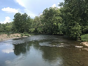
South Fork at Kia Kima Scout Reservation
|
|
| Country | United States |
| States | Arkansas, Missouri |
| Cities | Sturkie, Salem, Saddle, Cherokee Village, Hardy |
| Physical characteristics | |
| Main source | Howell County, Missouri near South Fork, Missouri 36°40′36″N 91°56′55″W / 36.67667°N 91.94861°W |
| River mouth | Spring River Hardy, Arkansas 354 ft (108 m) 36°19′06″N 91°29′42″W / 36.31833°N 91.49500°W |
| Length | 75 mi (121 km) |
| Basin features | |
| River system | Spring River Tributaries Watershed |
| Basin size | 93.8 sq mi (243 km2) |
| Landmarks | Kia Kima Scout Reservation |
The South Fork Spring River (commonly South Fork of the Spring River or simply South Fork River) is a tributary of the Spring River, roughly 75 mi (121 km) long, in southern Missouri and northern Arkansas in the United States. The river flows through the Salem Plateau of the Ozarks and it is part of the Spring River Tributaries Watershed.
The South Fork rises in Howell County northeast of the unincorporated community of South Fork and southwest of West Plains. The river flows generally southeast from Howell County through Fulton County before joining with the Spring River in Sharp County west of Hardy.

All content from Kiddle encyclopedia articles (including the article images and facts) can be freely used under Attribution-ShareAlike license, unless stated otherwise. Cite this article:
South Fork Spring River Facts for Kids. Kiddle Encyclopedia.
