Sharp County, Arkansas facts for kids
Quick facts for kids
Sharp County
|
|
|---|---|

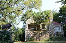
Sherman Bates House in Hardy, Arkansas.
|
|

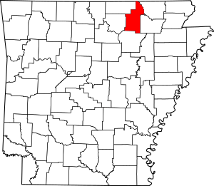
Location within the U.S. state of Arkansas
|
|
 Arkansas's location within the U.S. |
|
| Country | |
| State | |
| Founded | July 18, 1868 |
| Named for | Ephraim Sharp |
| Seat | Ash Flat |
| Largest city | Cherokee Village |
| Area | |
| • Total | 606 sq mi (1,570 km2) |
| • Land | 604 sq mi (1,560 km2) |
| • Water | 2.0 sq mi (5 km2) 0.3%% |
| Population
(2020)
|
|
| • Total | 17,271 |
| • Density | 28.500/sq mi (11.004/km2) |
| Time zone | UTC−6 (Central) |
| • Summer (DST) | UTC−5 (CDT) |
| Congressional district | 1st |
Sharp County is a county located in the U.S. state of Arkansas. As of the 2020 census, the population was 17,271. The county seat is Ash Flat. The county was formed on July 18, 1868, and named for Ephraim Sharp, a state legislator from the area.
Contents
Geography
According to the U.S. Census Bureau, the county has a total area of 606 square miles (1,570 km2), of which 604 square miles (1,560 km2) is land and 2.0 square miles (5.2 km2) (0.3%) is water.
Major highways
Adjacent counties
- Oregon County, Missouri (north)
- Randolph County (northeast)
- Lawrence County (southeast)
- Independence County (south)
- Izard County (southwest)
- Fulton County (northwest)
Demographics
| Historical population | |||
|---|---|---|---|
| Census | Pop. | %± | |
| 1870 | 5,400 | — | |
| 1880 | 9,047 | 67.5% | |
| 1890 | 10,418 | 15.2% | |
| 1900 | 12,199 | 17.1% | |
| 1910 | 11,688 | −4.2% | |
| 1920 | 11,132 | −4.8% | |
| 1930 | 10,715 | −3.7% | |
| 1940 | 11,497 | 7.3% | |
| 1950 | 8,999 | −21.7% | |
| 1960 | 6,319 | −29.8% | |
| 1970 | 8,233 | 30.3% | |
| 1980 | 14,607 | 77.4% | |
| 1990 | 14,109 | −3.4% | |
| 2000 | 17,119 | 21.3% | |
| 2010 | 17,264 | 0.8% | |
| 2020 | 17,271 | 0.0% | |
| 2023 (est.) | 17,968 | 4.1% | |
| U.S. Decennial Census 1790–1960 1900–1990 1990–2000 2010 |
|||
2020 census
| Race | Number | Percentage |
|---|---|---|
| White (non-Hispanic) | 15,729 | 91.07% |
| Black or African American (non-Hispanic) | 114 | 0.66% |
| Native American | 121 | 0.7% |
| Asian | 57 | 0.33% |
| Pacific Islander | 20 | 0.12% |
| Other/Mixed | 868 | 5.03% |
| Hispanic or Latino | 362 | 2.1% |
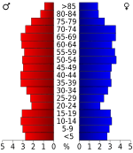
As of the 2020 United States census, there were 17,271 people, 7,447 households, and 4,420 families residing in the county.
Communities
Cities
- Ash Flat (county seat)
- Cave City
- Cherokee Village
- Hardy
- Highland
- Horseshoe Bend
Towns
Unincorporated communities
Townships
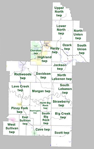
Townships in Arkansas are the divisions of a county. Each township includes unincorporated areas; some may have incorporated cities or towns within part of their boundaries. Arkansas townships have limited purposes in modern times. However, the United States Census does list Arkansas population based on townships (sometimes referred to as "county subdivisions" or "minor civil divisions"). Townships are also of value for historical purposes in terms of genealogical research. Each town or city is within one or more townships in an Arkansas county based on census maps and publications. The townships of Sharp County are listed below; listed in parentheses are the cities, towns, and/or census-designated places that are fully or partially inside the township.
- Big Creek
- Cave (Cave City)
- Cherokee (most of Cherokee Village, small part of Highland)
- Davidson
- East Sullivan
- Hardy (most of Hardy)
- Highland (most of Highland)
- Jackson (Williford)
- Lave Creek
- Lower North
- Morgan
- North Big Rock
- North Lebanon
- Ozark
- Piney Fork (Evening Shade)
- Richwoods (part of Ash Flat, small part of Horseshoe Bend)
- Scott
- South Big Rock
- South Union
- Strawberry
- Upper North
- Washington
- West Sullivan (most of Sideny)
Sharp County was featured on the PBS program Independent Lens for its 1906 "banishment" of all of its Black residents."
See also
 In Spanish: Condado de Sharp para niños


