Somers Point, New Jersey facts for kids
Quick facts for kids
Somers Point, New Jersey
|
||
|---|---|---|
|
City
|
||

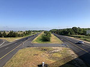
The site of the former Somers Point Circle at Route 52, CR 559, and CR 585
|
||
|
||
| Motto(s):
"The Shore Starts Here"
|
||
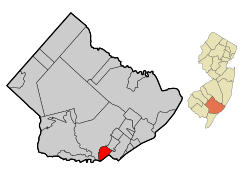
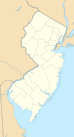
Map of Somers Point in Atlantic County. Inset: Location of Atlantic County highlighted in the State of New Jersey.
|
||
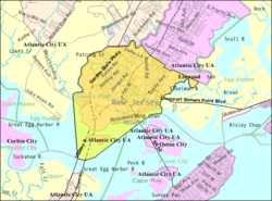
Census Bureau map of Somers Point, New Jersey
|
||
| Country | ||
| State | ||
| County | Atlantic | |
| European settlement | 1693 | |
| Incorporated | April 24, 1886 (as Borough) | |
| Reincorporated | April 2, 1890 | |
| Reincorporated | April 9, 1902 (as city) | |
| Government | ||
| • Type | City | |
| • Body | City Council | |
| Area | ||
| • Total | 5.23 sq mi (13.55 km2) | |
| • Land | 4.01 sq mi (10.39 km2) | |
| • Water | 1.22 sq mi (3.17 km2) 23.37% | |
| Area rank | 270th of 565 in state 18th of 23 in county |
|
| Elevation | 16 ft (5 m) | |
| Population
(2020)
|
||
| • Total | 10,469 | |
| • Estimate
(2023)
|
10,465 | |
| • Rank | 235th of 565 in state 7th of 23 in county |
|
| • Density | 2,610.7/sq mi (1,008.0/km2) | |
| • Density rank | 243rd of 565 in state 5th of 23 in county |
|
| Time zone | UTC−05:00 (Eastern (EST)) | |
| • Summer (DST) | UTC−04:00 (Eastern (EDT)) | |
| ZIP Code |
08244
|
|
| Area code | 609 exchanges: 601, 653, 926, 927 | |
| FIPS code | 34001684307 | |
| GNIS feature ID | 0885397 | |
| Website | ||
Somers Point is a city situated on the Jersey Shore that is the oldest settlement in Atlantic County, in the U.S. state of New Jersey. It was settled by Europeans in 1693 and was incorporated as a borough in 1886. Somers Point was incorporated as a city in 1902. The city is located in eastern Atlantic County, southwest of Atlantic City, in the South Jersey region of the state.
As of the 2020 United States census, the city's population was 10,469, a decrease of 326 (−3.0%) from the 2010 census count of 10,795, which in turn reflected a decline of 819 (−7.1%) from the 11,614 counted in the 2000 census. Somers Point and all of Atlantic County lie within the Atlantic City-Hammonton metropolitan statistical area, which in turn constitutes part of the Philadelphia-Reading-Camden combined statistical area.
Contents
History
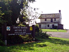
The earliest residents of the area were the Lenape Native Americans. John Somers was the first European settler in what is now Somers Point. Somers purchased the land along the northern periphery of the Great Egg Harbor Bay from Thomas Budd in 1693, making it the oldest European settlement in what is now Atlantic County. Great Egg Harbour Township was designated in 1693 from the eastern portions of Gloucester County, which included Somers Point. Somers named the area Somerset Plantation. In 1695, John Somers operated the first ferry service across the Great Egg Harbor Bay to Cape May County. His son Richard built Somers Mansion overlooking the harbor sometime between 1720 and 1726, which remains the county's oldest existing home. Early names for the area were Somerset Plantation, Somers Ferry, and Somers Plantation, until the name Somers Point was established in 1750. Somers Point was designated as a port of entry in 1791 and remained one until it was abolished in 1915. By the 1830s, when Somers Point became part of Atlantic County, it was a popular summer resort with several boarding houses.
Somers Point was originally incorporated as a borough by an act of the New Jersey Legislature on April 24, 1886, from portions of Egg Harbor Township, based on the results of a referendum held five days earlier. At that time, there were 48 people registered to vote in the borough. Somers Point was subsequently reincorporated as a borough on April 2, 1890 based on the previous day's referendum, and was finally incorporated as a city on April 9, 1902, from all of Somers Point borough and additional portions of Egg Harbor Township. All were named for John Somers.
Geography
According to the United States Census Bureau, the city had a total area of 5.23 square miles (13.55 km2), including 4.01 square miles (10.39 km2) of land and 1.22 square miles (3.17 km2) of water (23.37%).
Unincorporated communities, localities and place names located partially or completely within the township include Ocean Heights.
The city borders Egg Harbor Township, Longport and Linwood in Atlantic County; and both Ocean City and Upper Township in Cape May County.
Demographics
| Historical population | |||
|---|---|---|---|
| Census | Pop. | %± | |
| 1890 | 191 | — | |
| 1900 | 308 | 61.3% | |
| 1910 | 604 | 96.1% | |
| 1920 | 843 | 39.6% | |
| 1930 | 2,073 | 145.9% | |
| 1940 | 1,992 | −3.9% | |
| 1950 | 2,480 | 24.5% | |
| 1960 | 4,504 | 81.6% | |
| 1970 | 7,919 | 75.8% | |
| 1980 | 10,330 | 30.4% | |
| 1990 | 11,216 | 8.6% | |
| 2000 | 11,614 | 3.5% | |
| 2010 | 10,795 | −7.1% | |
| 2020 | 10,469 | −3.0% | |
| 2023 (est.) | 10,465 | −3.1% | |
| Population sources: 1890–2000 1890–1920 1890–1920 1890–1910 1910–1930 1940–2000 2000 2010 2020 |
|||
2010 census
The 2010 United States census counted 10,795 people, 4,655 households, and 2,826 families in the city. The population density was 2,678.8 per square mile (1,034.3/km2). There were 5,556 housing units at an average density of 1,378.7 per square mile (532.3/km2). The racial makeup was 78.75% (8,501) White, 10.68% (1,153) Black or African American, 0.25% (27) Native American, 3.08% (332) Asian, 0.06% (6) Pacific Islander, 4.17% (450) from other races, and 3.02% (326) from two or more races. Hispanic or Latino of any race were 9.49% (1,024) of the population.
Of the 4,655 households, 26.2% had children under the age of 18; 36.8% were married couples living together; 18.2% had a female householder with no husband present and 39.3% were non-families. Of all households, 31.9% were made up of individuals and 11.1% had someone living alone who was 65 years of age or older. The average household size was 2.32 and the average family size was 2.90.
21.3% of the population were under the age of 18, 9.0% from 18 to 24, 24.0% from 25 to 44, 31.1% from 45 to 64, and 14.6% who were 65 years of age or older. The median age was 41.4 years. For every 100 females, the population had 88.5 males. For every 100 females ages 18 and older there were 84.5 males.
The Census Bureau's 2006–2010 American Community Survey showed that (in 2010 inflation-adjusted dollars) median household income was $47,312 (with a margin of error of +/− $4,646) and the median family income was $51,489 (+/− $7,704). Males had a median income of $45,385 (+/− $6,862) versus $37,536 (+/− $3,731) for females. The per capita income for the city was $29,626 (+/− $1,822). About 11.9% of families and 12.7% of the population were below the poverty line, including 25.6% of those under age 18 and 6.6% of those age 65 or over.
Economy
The largest employer in Somers Point is Shore Medical Center, with 1,500 employees, 370 physicians, and 296 beds.
Somers Point is the home to the largest crabbing tournament in the United States, the Assault on Patcong Creek. Founded in 2010, the tournament takes place annually in June and attracts participants from over a dozen states.
Parks and recreation
Portions of the Right-of-way of the Atlantic City and Shore Railroad, running for 6 miles (9.7 km) between Pleasantville and Somers Point have been repurposed as the Somers Point Bike Path. Along the Somers Point bay lays a 6.18 acre park named after 35th United .States President John F. Kennedy.
Historic district
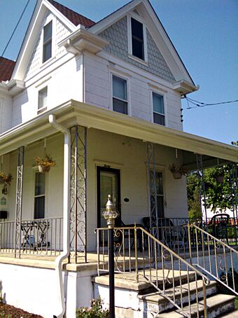
The Bay Front Historic District is a 82-acre (33 ha) historic district encompassing an area roughly bounded by Decatur Avenue, Egg Harbor Bay, George Avenue, and Shore Road in the community. It was added to the National Register of Historic Places on March 22, 1989 for its significance in architecture, entertainment/recreation, and social history. The district includes 189 contributing buildings.
Education
Students in pre-kindergarten through eighth grade are served by the Somers Point Public Schools. As of the 2018–19 school year, the district, comprised of three schools, had an enrollment of 894 students and 95.5 classroom teachers (on an FTE basis), for a student–teacher ratio of 9.4:1. Schools in the district (with 2018–19 enrollment data from the National Center for Education Statistics) are New York Avenue School with 70 students in pre-kindergarten, Dawes Avenue School with 387 students in grades Kindergarten through 3rd grade and Jordan Road Middle School with 425 students in 4th through 8th grade.
Students in public school for ninth through twelfth grades attend Mainland Regional High School, which also serves students from Linwood and Northfield. The high school is located in Linwood. For the 1997–1998 school year, Mainland Regional High School was recognized by the United States Department of Education as a National Blue Ribbon School. As of the 2018–2019 school year, the high school had an enrollment of 1,226 students and 112.0 classroom teachers (on an FTE basis), for a student–teacher ratio of 10.9:1.
City public school students are also eligible to attend the Atlantic County Institute of Technology in the Mays Landing section of Hamilton Township or the Charter-Tech High School for the Performing Arts, located in Somers Point.
St. Joseph Regional School is an elementary school serving students in kindergarten through eighth grade, operated under the jurisdiction of the Roman Catholic Diocese of Camden.
Transportation
Roads and highways
As of May 2010[update], the city had a total of 55.39 miles (89.14 km) of roadways, of which 43.19 miles (69.51 km) were maintained by the municipality, 5.45 miles (8.77 km) by Atlantic County and 3.73 miles (6.00 km) by the New Jersey Department of Transportation and 3.02 miles (4.86 km) by the New Jersey Turnpike Authority.
The Garden State Parkway passes through the city, connecting Egg Harbor Township on either side of the city. Interchange 30 for the Parkway is located in the city, signed for Somers Point and Downtown Ocean City.
On the city's southern border, bridges connect to Cape May County via the Garden State Parkway to Upper Township, into Ocean City via Route 52 and over the Beesley's Point Bridge, which has been demolished. As part of a $400 million project completed by the New Jersey Department of Transportation in 2012, a new causeway for Route 52 was completed over Great Egg Harbor Bay, replacing the Howard S. Stainton Memorial Causeway that had been completed in 1933. the Beesley's Point Bridge was demolished in 2013 as part of a project adding a new bridge for traffic on the Parkway.
Public transportation
NJ Transit offers bus transportation in the city between Ocean City and Atlantic City on the 507 and 509 routes.
Notable people
People who were born in, residents of, or otherwise closely associated with Somers Point include:
- Joe Bastardi (born 1955), meteorologist
- Matt Broomall (born 1994), soccer player who plays as a goalkeeper for the Richmond Kickers in USL League One
- Joshua Cohen (born 1980), novelist and story writer, known for his works Witz and Book of Numbers
- Doug Colman (born 1973), former NFL linebacker
- Peter Erskine (born 1954), jazz drummer
- John H. Hamilton Jr. (1919–1986), member of the Pennsylvania House of Representatives
- Joe Maloy (born 1985), triathlete who was chosen to represent the United States in triathlon at the Rio 2016 Summer Olympics
- Osun Osunniyi (born 1998), college basketball player for the St. Bonaventure Bonnies of the Atlantic 10 Conference
- Cody Stashak (born 1994), professional baseball pitcher for the Minnesota Twins
- John Stone (born 1979), wide receiver who played in the NFL for the Oakland Raiders
- Gregory L. Verdine (born 1959), chemical biologist, university professor, entrepreneur, venture capitalist and business executive
See also
 In Spanish: Somers Point para niños


