National Register of Historic Places listings in Fulton County, Arkansas facts for kids
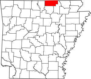
This is a list of the National Register of Historic Places listings in Fulton County, Arkansas.
This is intended to be a complete list of the properties on the National Register of Historic Places in Fulton County, Arkansas, United States. The locations of National Register properties for which the latitude and longitude coordinates are included below, may be seen in a map.
There are 11 properties listed on the National Register in the county.
Current listings
| Name on the Register | Image | Date listed | Location | City or town | Description | |
|---|---|---|---|---|---|---|
| 1 | AR 289 Bridge Over English Creek |
(#08001338) |
Highway 289 over English Creek 36°26′48″N 91°34′01″W / 36.4467°N 91.5669°W |
Mammoth Spring | ||
| 2 | Camp Methodist Church |
(#97000402) |
Highway 9, approximately 6 miles east of Salem 36°24′44″N 91°44′16″W / 36.412222°N 91.737778°W |
Camp | ||
| 3 | County Line School and Lodge |
(#75000386) |
Northwest of Gepp on the eastern side of the Baxter-Fulton county line, 2 miles south of the state line 36°29′13″N 92°09′00″W / 36.486944°N 92.15°W |
Gepp | ||
| 4 | Kansas City, Fort Scott and Memphis Railroad Depot |
(#92000617) |
Southeast of the BNSF railroad tracks on an access road for Mammoth Spring State Park 36°29′45″N 91°31′54″W / 36.495833°N 91.531667°W |
Mammoth Spring | ||
| 5 | Mammoth Spring Dam and Lake |
(#09000512) |
17 U.S. Route 63, N. 36°29′43″N 91°32′12″W / 36.495414°N 91.536531°W |
Mammoth Spring | ||
| 6 | T.H. Morris House |
(#90001462) |
Junction of 6th and Bethel Sts. 36°29′41″N 91°32′37″W / 36.494722°N 91.543611°W |
Mammoth Spring | ||
| 7 | Saddle Store |
(#00001366) |
Highway 289 36°21′19″N 91°38′14″W / 36.3554°N 91.6372°W |
Saddle | ||
| 8 | Saint Andrew's Episcopal Church |
(#86002944) |
Highway 9 36°29′42″N 91°31′58″W / 36.495°N 91.532778°W |
Mammoth Spring | ||
| 9 | Spring River Bridge |
(#13001104) |
Riverview Dr. over Spring River 36°28′38″N 91°31′28″W / 36.477193°N 91.524573°W |
Mammoth Spring |

All content from Kiddle encyclopedia articles (including the article images and facts) can be freely used under Attribution-ShareAlike license, unless stated otherwise. Cite this article:
National Register of Historic Places listings in Fulton County, Arkansas Facts for Kids. Kiddle Encyclopedia.


