National Register of Historic Places listings in Bayfield County, Wisconsin facts for kids
This is a list of the National Register of Historic Places listings in Bayfield County, Wisconsin. It is intended to provide a comprehensive listing of entries in the National Register of Historic Places that are located in Bayfield County, Wisconsin. The locations of National Register properties for which the latitude and longitude coordinates are included below may be seen in a map.
There are 26 properties and districts listed on the National Register in the county. Another 2 properties were once listed but have been removed.
Current listings
| Name on the Register | Image | Date listed | Location | City or town | Description | |
|---|---|---|---|---|---|---|
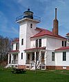
| 1 | Apostle Islands Lighthouses |
(#77000145) |
N and E of Bayfield on Michigan, Raspberry, Outer, Sand and Devils Islands 46°59′38″N 90°36′06″W / 46.993889°N 90.601667°W |
Bayfield | Six lighthouses built on various islands as early as 1856, to guide ships through and around the islands. | |
| 2 | Bank of Washburn |
(#80000105) |
Bayfield St. and Central Ave. 46°40′24″N 90°53′29″W / 46.673333°N 90.891389°W |
Washburn | Monumental building designed by Conover and Porter in Romanesque style and built in 1890, of brownstone quarried north of Washburn. Now houses historical museum and cultural center. | |
| 3 | Bayfield County Courthouse |
(#75000060) |
117 E. 5th St. 46°40′37″N 90°53′33″W / 46.676944°N 90.8925°W |
Washburn | Courthouse designed by James Nader of Madison in Neoclassical revival style and built in 1894 of locally quarried brownstone. | |
| 4 | Bayfield Fish Hatchery |
(#81000033) |
WI State Highway 13 46°47′10″N 90°51′49″W / 46.786111°N 90.863611°W |
Salmo | R. D. Pike operated a private fish hatchery on this site from the 1860s to 1895, when he donated the land to the state. The state built a new hatchery, with the gambrel-roofed Victorian building holding an office, living quarters, and a fish egg propagation area washed by the waters of Birch Run Creek. | |
| 5 | Bayfield Historic District |
(#80000106) |
WI J and WI 13 46°48′43″N 90°49′07″W / 46.811944°N 90.818611°W |
Bayfield | A 60-block area in the city of Bayfield, encompassing commercial buildings from wooden false front to brownstone, and residences from modest to Queen Anne. | |
| 6 | Booth Cooperage |
(#76000049) |
1 East Washington St. 46°48′45″N 90°48′45″W / 46.8125°N 90.8125°W |
Bayfield | Built as a fish storehouse around 1900, partly on cribbing. In 1914, Booth Fisheries converted part of the building to a factory in which five coopers hand-made wooden barrels - up to 75,000 a year - for packing locally caught salted fish. | |
| 7 | Frank Boutin, Jr. House |
(#74000056) |
7 Rice St. 46°48′50″N 90°48′49″W / 46.813889°N 90.813611°W |
Bayfield | Queen Anne home built in 1908 with exterior of sandstone, brick and clapboard. Boutin's father was an early lumberman and fisherman in Bayfield. | |
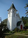
| 8 | Christ Episcopal Church |
(#74000057) |
121-125 North 3rd. St. 46°48′46″N 90°49′07″W / 46.812778°N 90.818611°W |
Bayfield | The chapel was built in 1870, the first Episcopal church in northern Wisconsin. The whole is in Carpenter Gothic style, with board and batten exterior. | |
| 9 | East Third Street Residential Historic District |
(#14000430) |
E. 3rd St. from Central Ave. to 4th Ave. E. 46°40′32″N 90°53′22″W / 46.6755°N 90.8895°W |
Washburn | 31 contributing homes built from 1885 through 1950 including Colonial Revival style, Queen Anne, Prairie School, and Craftsman. Some were constructed by DuPont for employees who worked at its Barksdale explosives plant. | |
| 10 | Forest Lodge |
(#02000031) |
Garmisch Rd. 46°12′17″N 91°06′32″W / 46.204722°N 91.108889°W |
Namakagon | Rustic retreat of the Livingston/Griggs family of St. Paul on Namekagon Lake, on the site of a logging camp. Buildings constructed from 1893 to 1950 include the lodge, two-story boathouse, and maid's cabin. | |
| 11 | Forest Lodge Library |
(#01000735) |
13450 Cty Hwy M 46°12′28″N 91°17′29″W / 46.207778°N 91.291389°W |
Cable | St. Paul socialite Mary Livingston Griggs built this Rustic log building in 1925-26 for the community of Cable, in honor of her mother and their family lodge on Namekagon Lake. | |
| 12 | Herbster Community Center |
(#97000888) |
Lenawee Rd., S of jct. of Lenawee Rd. and WI 13 46°49′51″N 91°15′43″W / 46.830833°N 91.261944°W |
Herbster | Town hall/gymnasium/community center constructed in Rustic style in 1939-40, a WPA project. | |
| 13 | Hokenson Fishing Dock |
(#76000050) |
N of Bayfield at Little Sand Bay 46°56′48″N 90°53′29″W / 46.946667°N 90.891389°W |
Bayfield | Dock built on crib piers in 1927 by the three Hokensen brothers, who ran an independent fishing boat and packing operation out of Sand Island from the 1920s to the 1950s. | |
| 14 | Island Lake Camp |
(#82000629) |
Island Lake Rd. 46°23′11″N 91°31′50″W / 46.386389°N 91.530556°W |
Drummond | Rustic log cabin built in 1888, summer retreat of the McCormick family and Dr. William Gray, newspaperman and editor of "The Interior," a Presbyterian publication. | |
| 15 | Lake Owen Archeological District |
(#12000333) |
Address Restricted |
Drummond vicinity | ||
| 16 | Old Bayfield County Courthouse |
(#74000058) |
Washington St. between 4th and 5th Sts. 46°48′47″N 90°49′13″W / 46.813056°N 90.820278°W |
Bayfield | Built in 1884 of local brownstone with elements of Neoclassical and Romanesque Revival styles, served as county courthouse until 1892, when Washburn snatched the county seat. Later used as school, German POW camp, community center, and warehouse. Now headquarters for the Apostle Islands National Lakeshore. | |
| 17 | OTTAWA (Tug) Shipwreck Site |
(#92000594) |
northern edge of Red Cliff Bay 46°53′08″N 90°45′39″W / 46.885556°N 90.760833°W |
Russell | 151 foot tugboat built in Chicago in 1881 that first towed rafts of logs across Lake Michigan. In November 1909, after helping free a grounded steamship, she mysteriously caught fire in the night, burned and sank. | |
| 18 | John and Justina Palo Homestead |
(#02001007) |
71055 Muskeg Rd. 46°36′19″N 91°28′12″W / 46.605278°N 91.47°W |
Oulu | Log house and outbuildings, including sauna, built from 1910 to 1949 by Finnish immigrant farmers. | |
| 19 | Pureair Sanatorium |
(#81000034) |
S of Bayfield 46°47′27″N 90°50′50″W / 46.790833°N 90.847222°W |
Bayfield | Tuberculosis sanatorium, built from 1918 to 1923 before antibiotics, when TB was called consumption and treatment consisted of isolation, rest, and fresh air. Also called the Tri-County Sanatorium because it was shared by Bayfield, Ashland and Iron counties. | |
| 20 | SEVONA (Bulk Carrier) Shipwreck Site |
(#93000229) |
north of Sand Island 47°00′24″N 90°54′32″W / 47.0066°N 90.9089°W |
Bayfield | 372 foot steel steamer, built 1890 in Bay City, Michigan. Caught by a nor-easter on Sept 2, 1905, running from West Superior for Erie with 6000 tons of iron ore. Tried to shelter in Apostle Islands but ran aground on shoals north of Sand Island. Seven died - 16 escaped in lifeboats. | |
| 21 | Sevona Cabin |
(#76000051) |
N of Bayfield on Sand Island 46°57′49″N 90°56′14″W / 46.963611°N 90.937222°W |
Bayfield | Cottage built partly from salvage from the nearby Sevona shipwreck in its memory by Samuel Fifield, an Ashland businessman and lieutenant governor of Wisconsin. | |
| 22 | Shaw Farm |
(#76000052) |
Sand Island 46°57′47″N 90°56′03″W / 46.963056°N 90.934167°W |
Bayfield | Francis Shaw received land on Sand Island for his Civil War service and built a cabin in 1871, the first permanent home on the island. For 50 years he and the next generation fished and farmed, and later ran a workshop and a store, serving as the social center of the island. | |
| 23 | Washburn Public Library |
(#84003621) |
Washington Ave. and W. 3rd St. 46°40′22″N 90°53′43″W / 46.672778°N 90.895278°W |
Washburn | Carnegie library, designed by Henry Wildhagen and built in Neoclassical style in 1904. Still in use! | |
| 24 | West Bay Club |
(#14000385) |
Sand Island 46°58′19″N 90°58′35″W / 46.971993°N 90.976478°W |
Bayfield | Rustic-styled clubhouse designed by Buechner & Orth and built in 1913 for hay fever sufferers from St. Paul. |
Former listings
| Name on the Register | Image | Date listed | Date removed | Location | City or town | Summary | |
|---|---|---|---|---|---|---|---|
| 1 | Reiten Boatyard |
(#82000630) |
|
Broad St. on The Waterfront |
Bayfield | Boneyard of lake-going wooden boats, docks and engines, demolished in 1984. | |
| 2 | South Shore Public School |
(#78003443) |
|
Grand Ave. and WI 13 |
Port Wing | Known as the "Big White School" |

All content from Kiddle encyclopedia articles (including the article images and facts) can be freely used under Attribution-ShareAlike license, unless stated otherwise. Cite this article:
National Register of Historic Places listings in Bayfield County, Wisconsin Facts for Kids. Kiddle Encyclopedia.


