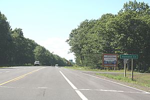
Ashland County, Wisconsin facts for kids
Quick facts for kids
Ashland County
|
|
|---|---|

Ashland County Courthouse
|
|

Location within the U.S. state of Wisconsin
|
|
 Wisconsin's location within the U.S. |
|
| Country | |
| State | |
| Founded | March 27, 1860 |
| Named for | Henry Clay's farm Ashland |
| Seat | Ashland |
| Largest city | Ashland |
| Area | |
| • Total | 2,292 sq mi (5,940 km2) |
| • Land | 1,045 sq mi (2,710 km2) |
| • Water | 1,247 sq mi (3,230 km2) 54% |
| Population
(2020)
|
|
| • Total | 16,027 |
| • Estimate
(2023)
|
16,079 |
| • Density | 15.3/sq mi (5.9/km2) |
| Time zone | UTC−6 (Central) |
| • Summer (DST) | UTC−5 (CDT) |
| Congressional district | 7th |
Ashland County is a county located in the U.S. state of Wisconsin. As of the 2020 census, the population was 16,027. Its county seat is Ashland. The county was formed on March 27, 1860, from La Pointe County. The county partly overlaps with the reservation of the Bad River Band of the Lake Superior Tribe of Chippewa Indians.
Contents
History
Ashland County was named in honor of the Lexington estate of Kentucky statesman Henry Clay, as one of the founders of the city of Ashland was an admirer of Clay.
Geography
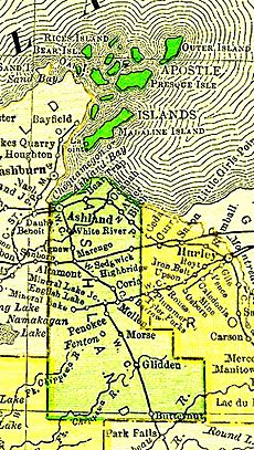
According to the U.S. Census Bureau, the county has a total area of 2,292 square miles (5,940 km2), of which 1,045 square miles (2,710 km2) is land and 1,247 square miles (3,230 km2) (54%) is water. It is the second-largest county in Wisconsin by total area. The Apostle Islands are a small group of islands in Lake Superior, off the Bayfield Peninsula with the majority of the islands located in Ashland County — only Eagle, Sand, York and Raspberry Islands are in Bayfield County.
Adjacent counties
- Iron County – east
- Price County – southeast
- Sawyer County – southwest
- Bayfield County – northwest
- Lake County, Minnesota – northwest
- Cook County, Minnesota – north
- Ontonagon County, Michigan – northeast
- Gogebic County, Michigan – northeast
Major highways
Railroads
- Watco
Buses
- Bay Area Rural Transit
- Indian Trails
Airports
- John F. Kennedy Memorial Airport (KASX) serves the county and surrounding communities.
- Major Gilbert Field Airport (4R5) enhances county service.
National protected area
- Apostle Islands National Lakeshore (part)
- Chequamegon National Forest (part)
Demographics
| Historical population | |||
|---|---|---|---|
| Census | Pop. | %± | |
| 1860 | 515 | — | |
| 1870 | 221 | −57.1% | |
| 1880 | 1,559 | 605.4% | |
| 1890 | 20,063 | 1,186.9% | |
| 1900 | 20,176 | 0.6% | |
| 1910 | 21,965 | 8.9% | |
| 1920 | 24,538 | 11.7% | |
| 1930 | 21,054 | −14.2% | |
| 1940 | 21,801 | 3.5% | |
| 1950 | 19,461 | −10.7% | |
| 1960 | 17,375 | −10.7% | |
| 1970 | 16,743 | −3.6% | |
| 1980 | 16,783 | 0.2% | |
| 1990 | 16,307 | −2.8% | |
| 2000 | 16,866 | 3.4% | |
| 2010 | 16,157 | −4.2% | |
| 2020 | 16,027 | −0.8% | |
| U.S. Decennial Census 1790–1960 1900–1990 1990–2000 2010 2020 |
|||
2020 census
As of the census of 2020, the population was 16,027. The population density was 15.3 inhabitants per square mile (5.9/km2). There were 9,407 housing units at an average density of 9.0 units per square mile (3.5 units/km2). The racial makeup of the county was 79.8% White, 13.0% Native American, 0.7% Black or African American, 0.5% Asian, 0.1% Pacific Islander, 0.3% from other races, and 5.6% from two or more races. Ethnically, the population was 2.4% Hispanic or Latino of any race.
2010 census
As of the 2010 United States Census, there were 16,157 people living in the county. 84.6% were White, 11.1% Native American, 0.4% Asian, 0.3% Black or African American, 0.3% of some other race and 3.3% of two or more races. 1.9% were Hispanic or Latino (of any race). 25.6% were of German, 7.6% Finnish, 6.8% American, 6.5% Irish and 5.3% Norwegian ancestry.
Communities

Cities
- Ashland (county seat; partly in Bayfield County)
- Mellen
Village
Towns
Census-designated places
- Bayfront
- Birch Hill
- Clam Lake
- Diaperville
- Franks Field
- Glidden
- Jolmaville
- Marengo
- New Odanah
- Odanah
Unincorporated communities
See also
 In Spanish: Condado de Ashland (Wisconsin) para niños


