Lightning facts for kids
- For the NHL team, see Tampa Bay Lightning
- For the World War II fighter, see P-38 Lightning
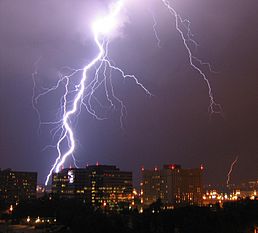
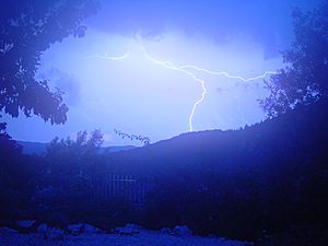
Lightning is a powerful electrical discharge made during a thunderstorm. The electric current is very hot and causes the air around it to expand very quickly, which in turn makes thunder. Sometimes it happens between clouds. Sometimes (in the rain) it goes from cloud to ground. If it goes from cloud to ground, it can strike a person. Around 2000 people are struck by lightning each year. About 50 to 100 lightning bolts strike the Earth every second. Lightning has hit the Empire State Building as many as 500 times a year.
Contents
Discovery of Lightning
Benjamin Franklin was interested in lightning. He discovered many things about it, and in 1772, he was the first to show that a thunderstorm lets out electricity. In his book he suggested an experiment to test it. Franklin did not really go out in a thunder storm and fly a kite in an attempt to prove the presence of electricity in the storm. If that had happened Franklin may have been killed, though it is possible to conduct electricity through the kite, and down the string.
Electrification
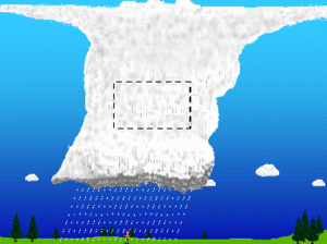
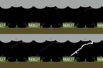
The details of the charging process are still being studied by scientists, but there is general agreement on some of the basic concepts of thunderstorm electrification. The main charging area in a thunderstorm occurs in the central part of the storm where air is moving upward rapidly (updraft) and temperatures range from −15 to −25 Celsius, see figure to the right. At that place, the combination of temperature and rapid upward air movement produces a mixture of super-cooled cloud droplets (small water droplets below freezing), small ice crystals, and graupel (soft hail). The updraft carries the super-cooled cloud droplets and very small ice crystals upward. At the same time, the graupel, which is considerably larger and denser, tends to fall or be suspended in the rising air.
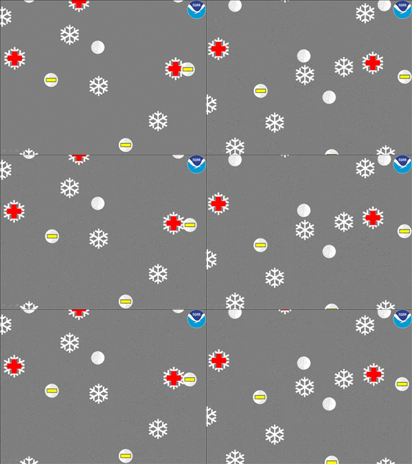
The differences in the movement of the precipitation cause collisions to occur. When the rising ice crystals collide with graupel, the ice crystals become positively charged and the graupel becomes negatively charged. See figure to the left. The updraft carries the positively charged ice crystals upward toward the top of the storm cloud. The larger and denser graupel is either suspended in the middle of the thunderstorm cloud or falls toward the lower part of the storm.
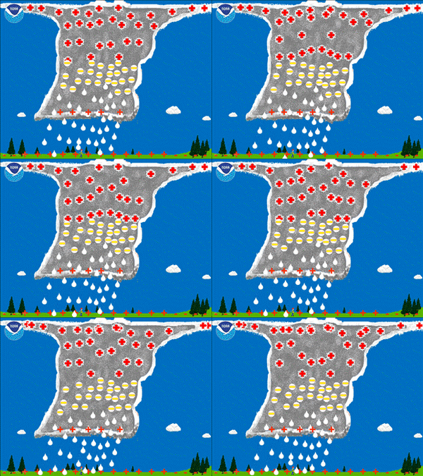
The result is that the upper part of the thunderstorm cloud becomes positively charged while the middle to lower part of the thunderstorm cloud becomes negatively charged.
The upward motions within the storm and winds at higher levels in the atmosphere tend to cause the small ice crystals (and positive charge) in the upper part of the thunderstorm cloud to spread out horizontally some distance from thunderstorm cloud base. This part of the thunderstorm cloud is called the anvil. While this is the main charging process for the thunderstorm cloud, some of these charges can be redistributed by air movements within the storm (updrafts and downdrafts). In addition, there is a small but important positive charge buildup near the bottom of the thunderstorm cloud due to the precipitation and warmer temperatures.
Types
There are three primary types of lightning, defined by what is at the "ends" of a flash channel.
- Intracloud (IC), which occurs within a single thundercloud unit
- Cloud to cloud (CC) or intercloud, which starts and ends between two different "functional" thundercloud units
- Cloud to ground (CG), that primarily originates in the thundercloud and terminates on an Earth surface, but may also occur in the reverse direction, that is ground to cloud
There are variations of each type, such as "positive" versus "negative" CG flashes, that have different physical characteristics common to each which can be measured. Different common names used to describe a particular lightning event may be attributed to the same or different events.
Cloud to ground (CG)
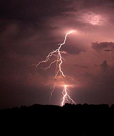
Cloud-to-ground (CG) lightning is a lightning discharge between a thundercloud and the ground. It is initiated by a stepped leader moving down from the cloud, which is met by a streamer moving up from the ground.
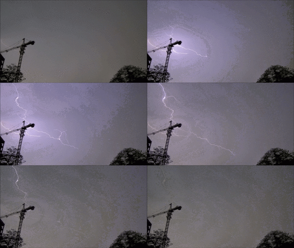
CG is the least common, but best understood of all types of lightning. It is easier to study scientifically, because it terminates on a physical object, namely the Earth, and lends itself to being measured by instruments on the ground. Of the three primary types of lightning, it poses the greatest threat to life and property since it terminates or "strikes" the Earth. The overall discharge, termed a flash, is composed of a number of processes such as preliminary breakdown, stepped leaders, connecting leaders, return strokes, dart leaders and subsequent return strokes.
Positive and negative lightning
Cloud-to-ground (CG) lightning is either positive or negative, as defined by the direction of the conventional electric current from cloud to ground. Most CG lightning is negative, meaning that a negative charge is transferred to ground and electrons travel downward along the lightning channel. The reverse happens in a positive CG flash, where electrons travel upward along the lightning channel and a positive charge is transferred to the ground. Positive lightning is less common than negative lightning, and on average makes up less than 5% of all lightning strikes.
There are six different mechanisms theorized to result in the formation of downward positive lightning.
- Vertical wind shear displacing the upper positive charge region of a thundercloud, exposing it to the ground below.
- The loss of lower charge regions in the dissipating stage of a thunderstorm, leaving the primary positive charge region.
- A complex arrangement of charge regions in a thundercloud, effectively resulting in an inverted dipole or inverted tripole in which the main negative charge region is above the main positive charge region instead of beneath it.
- An unusually large lower positive charge region in the thundercloud.
- Cutoff of an extended negative leader from its origin which creates a new bidirectional leader in which the positive end strikes the ground, commonly seen in anvil-crawler spider flashes.
- The initiation of a downward positive branch from an intracloud lightning flash.
Contrary to popular belief, positive lightning flashes do not necessarily originate from the anvil or the upper positive charge region and strike a rain-free area outside of the thunderstorm. This belief is based on the outdated idea that lightning leaders are unipolar in nature and originating from their respective charge region.
Positive lightning strikes tend to be much more intense than their negative counterparts. An average bolt of negative lightning carries an electric current of 30,000 amperes (30 kA), and transfers 15 coulombs of electric charge and 500 megajoules of energy. Large bolts of negative lightning can carry up to 120 kA and 350 coulombs. The average positive ground flash has roughly double the peak current of a typical negative flash, and can produce peak currents up to 400,000 amperes (400 kA) and charges of several hundred coulombs. Furthermore, positive ground flashes with high peak currents are commonly followed by long continuing currents, a correlation not seen in negative ground flashes.
As a result of their greater power, as well as lack of warning, positive lightning strikes are considerably more dangerous. Due to the aforementioned tendency for positive ground flashes to produce both high peak currents and long continuing current, they are capable of heating surfaces to much higher levels which increases the likelihood of a fire being ignited.
Positive lightning has also been shown to trigger the occurrence of upward lightning flashes from the tops of tall structures and is largely responsible for the initiation of sprites several tens of kilometers above ground level. Positive lightning tends to occur more frequently in winter storms, as with thundersnow, during intense tornadoes and in the dissipation stage of a thunderstorm. Huge quantities of extremely low frequency (ELF) and very low frequency (VLF) radio waves are also generated.
A unique form of cloud-to-ground lightning exists where lightning appears to exit from the cumulonimbus cloud and propagate a considerable distance through clear air before veering towards, and striking, the ground. For this reason, they are known as "bolts from the blue". Despite the popular misconception that these are positive lightning strikes due to them seemingly originating from the positive charge region, observations have shown that these are in fact negative flashes. They begin as intracloud flashes within the cloud, the negative leader then exits the cloud from the positive charge region before propagating through clear air and striking the ground some distance away.
Cloud to cloud (CC) and intra-cloud (IC)
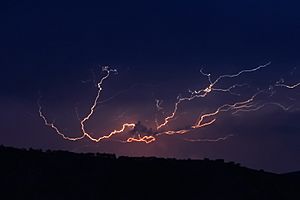
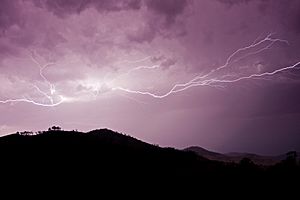
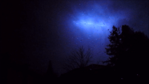
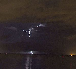
Lightning discharges may occur between areas of cloud without contacting the ground. When it occurs between two separate clouds it is known as inter-cloud lightning, and when it occurs between areas of differing electric potential within a single cloud it is known as intra-cloud lightning. Intra-cloud lightning is the most frequently occurring type.
Intra-cloud lightning most commonly occurs between the upper anvil portion and lower reaches of a given thunderstorm. This lightning can sometimes be observed at great distances at night as so-called "sheet lightning". In such instances, the observer may see only a flash of light without hearing any thunder.
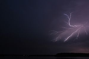
Another term used for cloud–cloud or cloud–cloud–ground lightning is "Anvil Crawler", due to the habit of charge, typically originating beneath or within the anvil and scrambling through the upper cloud layers of a thunderstorm, often generating dramatic multiple branch strokes. These are usually seen as a thunderstorm passes over the observer or begins to decay. The most vivid crawler behavior occurs in well developed thunderstorms that feature extensive rear anvil shearing.
Observational variations
- Anvil crawler lightning, sometimes called Spider lightning is created when leaders propagate through horizontally-extensive charge regions in mature thunderstorms, usually the stratiform regions of mesoscale convective systems. These discharges usually begin as intracloud discharges originating within the convective region; the negative leader end then propagates well into the aforementioned charge regions in the stratiform area. If the leader becomes too long, it may separate into multiple bidirectional leaders. When this happens, the positive end of the separated leader may strike the ground as a positive CG flash or crawl on the underside of the cloud, creating a spectacular display of lightning crawling across the sky. Ground flashes produced in this manner tend to transfer high amounts of charge, and this can trigger upward lightning flashes and upper-atmospheric lightning.
- Ball lightning may be an atmospheric electrical phenomenon, the physical nature of which is still controversial. The term refers to reports of luminous, usually spherical objects which vary from pea-sized to several meters in diameter. It is sometimes associated with thunderstorms, but unlike lightning flashes, which last only a fraction of a second, ball lightning reportedly lasts many seconds. Ball lightning has been described by eyewitnesses but rarely recorded by meteorologists. Scientific data on natural ball lightning is scarce owing to its infrequency and unpredictability. The presumption of its existence is based on reported public sightings, and has therefore produced somewhat inconsistent findings. Brett Porter, wildlife ranger, reported having taken a photo at Queensland of Australia in 1987.
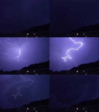
- Bead lightning is the decaying stage of a lightning channel in which the luminosity of the channel breaks up into segments. Nearly every lightning discharge will exhibit beading as the channel cools immediately after a return stroke, sometimes referred to as the lightning's 'bead-out' stage. 'Bead lightning' is more properly a stage of a normal lightning discharge rather than a type of lightning in itself. Beading of a lightning channel is usually a small-scale feature, and therefore is often only apparent when the observer/camera is close to the lightning.
- Cloud-to-air lightning is a lightning flash in which one end of a bidirectional leader exits the cloud, but does not result in a ground flash. Such flashes can sometimes be thought of as failed ground flashes. Blue jets and gigantic jets are a form of cloud-to-air or cloud-to-ionosphere lightning where a leader is launched from the top of a thunderstorm.
- Dry lightning is used in Australia, Canada and the United States for lightning that occurs with no precipitation at the surface. This type of lightning is the most common natural cause of wildfires. Pyrocumulus clouds produce lightning for the same reason that it is produced by cumulonimbus clouds.
- Forked lightning is cloud-to-ground lightning that exhibits branching of its path.
- Heat lightning is a lightning flash that appears to produce no discernible thunder because it occurs too far away for the thunder to be heard. The sound waves dissipate before they reach the observer.
- Ribbon lightning occurs in thunderstorms with high cross winds and multiple return strokes. The wind will blow each successive return stroke slightly to one side of the previous return stroke, causing a ribbon effect.
- Rocket lightning is a form of cloud discharge, generally horizontal and at cloud base, with a luminous channel appearing to advance through the air with visually resolvable speed, often intermittently.
- Sheet lightning is cloud-to-cloud lightning that exhibits a diffuse brightening of the surface of a cloud, caused by the actual discharge path being hidden or too far away. The lightning itself cannot be seen by the spectator, so it appears as only a flash, or a sheet of light. The lightning may be too far away to discern individual flashes.
- Smooth channel lightning is an informal term referring to a type of cloud-to-ground lightning strike that has no visible branching and appears like a line with smooth curves as opposed to the jagged appearance of most lightning channels. They are a form of positive lightning generally observed in or near the convective regions of severe thunderstorms in the north central United States. It is theorized that severe thunderstorms in this region obtain an "inverted tripole" charge structure in which the main positive charge region is located below the main negative charge region instead of above it, and as a result these thunderstorms generate predominantly positive cloud-to-ground lightning. The term "smooth channel lightning" is also sometimes attributed to upward ground-to-cloud lightning flashes, which are generally negative flashes initiated by upward positive leaders from tall structures.
- Staccato lightning is a cloud-to-ground lightning (CG) strike which is a short-duration stroke that (often but not always) appears as a single very bright flash and often has considerable branching. These are often found in the visual vault area near the mesocyclone of rotating thunderstorms and coincides with intensification of thunderstorm updrafts. A similar cloud-to-cloud strike consisting of a brief flash over a small area, appearing like a blip, also occurs in a similar area of rotating updrafts.
- Superbolts are bolts of lightning around a hundred times brighter than normal. On Earth, one in a million lightning strikes is a superbolt.
- Sympathetic lightning is the tendency of lightning to be loosely coordinated across long distances. Discharges can appear in clusters when viewed from space.
- Upward lightning or ground-to-cloud lightning is a lightning flash which originates from the top of a grounded object and propagates upward from this point. This type of lightning can be triggered by a preceding lightning flash, or it may initiate entirely on its own. The former is generally found in regions where spider lightning occurs, and may involve multiple grounded objects simultaneously. The latter usually occurs during the cold season and may be the dominant lightning type in thundersnow events.
- Clear-air lightning describes lightning that occurs with no apparent cloud close enough to have produced it. In the U.S. and Canadian Rockies, a thunderstorm can be in an adjacent valley and not observable from the valley where the lightning bolt strikes, either visually or audibly. European and Asian mountainous areas experience similar events. Also in areas such as sounds, large lakes or open plains, when the storm cell is on the near horizon (within 26 km (16 mi)) there may be some distant activity, a strike can occur and as the storm is so far away, the strike is referred to as a bolt from the blue. These flashes usually begin as normal intracloud lightning flashes before the negative leader exits the cloud and strikes the ground a considerable distance away. Positive clear-air strikes can occur in highly sheared environments where the upper positive charge region becomes horizontally displaced from the precipitation area.
Effects
Lightning strike
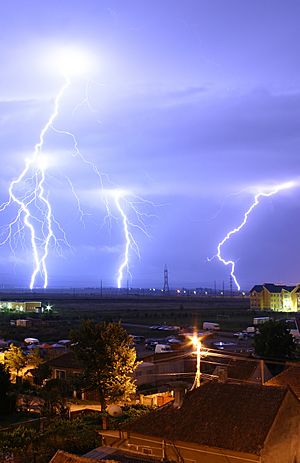
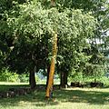
Objects struck by lightning experience heat and magnetic forces of great magnitude. The heat created by lightning currents traveling through a tree may vaporize its sap, causing a steam explosion that bursts the trunk. As lightning travels through sandy soil, the soil surrounding the plasma channel may melt, forming tubular structures called fulgurites. Even though roughly 90 percent of people struck by lightning survive, humans or animals struck by lightning may suffer severe injury due to internal organ and nervous system damage. Buildings or tall structures hit by lightning may be damaged as the lightning seeks unintended paths to ground. By safely conducting a lightning strike to ground, a lightning protection system can greatly reduce the probability of severe property damage. Lightning also serves an important role in the nitrogen cycle by oxidizing diatomic nitrogen in the air into nitrates which are deposited by rain and can fertilize the growth of plants and other organisms.
Thunder
Because the electrostatic discharge of terrestrial lightning superheats the air to plasma temperatures along the length of the discharge channel in a short duration, kinetic theory dictates gaseous molecules undergo a rapid increase in pressure and thus expand outward from the lightning creating a shock wave audible as thunder. Since the sound waves propagate not from a single point source but along the length of the lightning's path, the sound origin's varying distances from the observer can generate a rolling or rumbling effect. Perception of the sonic characteristics is further complicated by factors such as the irregular and possibly branching geometry of the lightning channel, by acoustic echoing from terrain, and by the typically multiple-stroke characteristic of the lightning strike.
Light travels at about 300,000,000 m/s, and sound travels through air at about 343 m/s. An observer can approximate the distance to the strike by timing the interval between the visible lightning and the audible thunder it generates. A lightning flash preceding its thunder by one second would be approximately 343 m (0.213 mi) in distance; a delay of three seconds would indicate a distance of about one kilometer (0.62 mi) (3×343 m). A flash preceding thunder by five seconds would indicate a distance of approximately one mile (1.6 km) (5×343 m). Consequently, a lightning strike observed at a very close distance will be accompanied by a sudden clap of thunder, with almost no perceptible time lapse, possibly accompanied by the smell of ozone (O3).
Lightning at a sufficient distance may be seen and not heard; there is data that a lightning storm can be seen at over 100 miles whereas the thunder travels about 20 miles. Anecdotally, there are many examples of people saying 'the storm was directly overhead or all-around and yet there was no thunder'. There is no coherent data available.
Artificial lightning
A Tesla coil is one way that people can make lightning to study electricity.
Related pages
Images for kids
-
Strokes of cloud-to-ground lightning strike the ocean off of Port-la-Nouvelle in southern France.
-
Lightning in Belfort, France
-
High-speed photography showing different parts of a lightning flash during the discharge process as seen in Toulouse, France.
-
Gigantic jet as seen from the summit of Mauna Kea, Hawaii.
-
Strike mark on trunk of an Oklahoma black walnut
-
Intra-clouds lightning over the Baltic Sea.
See also
 In Spanish: Rayo para niños


