Jhapa District facts for kids
Quick facts for kids
Jhapa
झापा जिल्ला
|
|
|---|---|

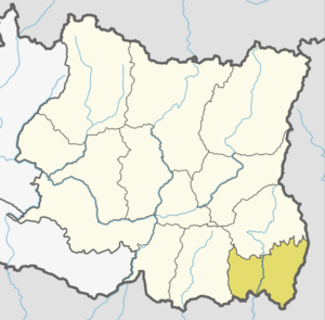
Location of Jhapa
|
|
| Country | Nepal |
| Region | {{{region}}} |
| Area | |
| • Total | 1,606 km2 (620 sq mi) |
| Elevation
(maximum)
|
506 m (1,660 ft) |
| Population
(2011)
|
|
| • Total | 812,650 |
| • Density | 506.01/km2 (1,310.6/sq mi) |
| Time zone | UTC+5:45 (NPT) |
| Website | www.ddcjhapa.gov.np |
Jhapa (Nepali: झापा जिल्ला) is an Eastern district in Nepal. It is in Mechi Zone of the Eastern Development Region. The district covers 1,606 square kilometres (620 square miles). Jhapa is considered to be one of the most educated and developed districts in Nepal. It is also popular for rice production and tourism.
Related pages

All content from Kiddle encyclopedia articles (including the article images and facts) can be freely used under Attribution-ShareAlike license, unless stated otherwise. Cite this article:
Jhapa District Facts for Kids. Kiddle Encyclopedia.