
Image: Pyrenees topographic map-en

Size of this PNG preview of this SVG file: 800 × 475 pixels. Other resolution: 320 × 190 pixels.
Original image (SVG file, nominally 3,200 × 1,900 pixels, file size: 6.3 MB)
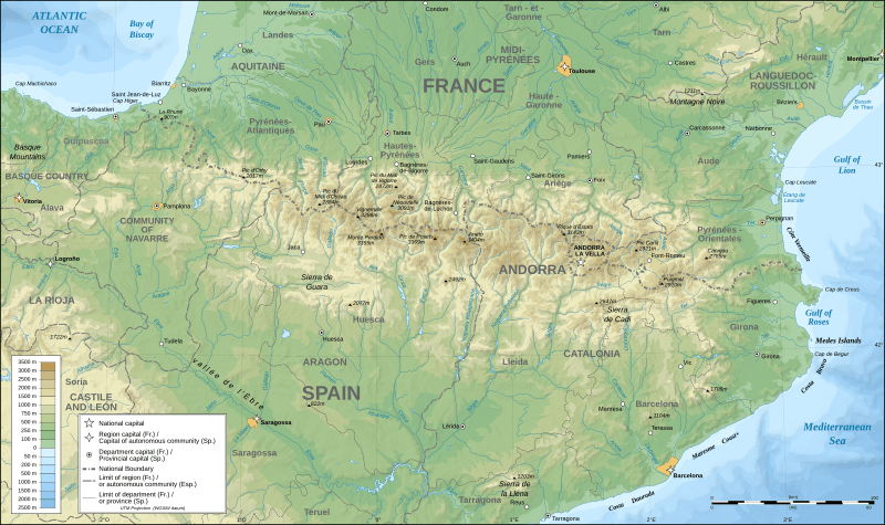
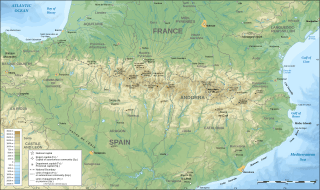
Description: Topographic map in English of the Pyrenees Mountains. Note: The shaded relief is a raster image embedded in the SVG file.
Title: Pyrenees topographic map-en
Credit: Pyrenees_topographic_map-fr.svg
Author: Pyrenees_topographic_map-fr.svg: Eric Gaba (Sting - fr:Sting) derivative work: RedWolf (talk)
Usage Terms: Creative Commons Attribution-Share Alike 3.0
License: CC-BY-SA-3.0
License Link: http://creativecommons.org/licenses/by-sa/3.0/
Attribution Required?: Yes
Image usage
The following 62 pages link to this image:
- Adarra
- Albera Massif
- Aneto
- Aspe peak
- Balaïtous
- Bastiments
- Bay of Txingudi
- Besiberri Sud
- Besiberri del Mig
- Bisaurin
- Cap de Boumort
- Casque du Marboré
- Cilindro de Marboré
- Col du Portillon
- Col du Pourtalet
- Collarada
- Còpia de Palomes
- El Turbón
- Espadas Peak
- Gaube Lake
- Gran Encantat
- Gran Tuc de Colomers
- Grande Fache
- La Hourquette d'Ancizan
- Lac d'Orédon
- Larrun
- Lo Corrunco
- Luz Ardiden
- Maladeta
- Mallos de Riglos
- Monte Perdido
- Montsec Range
- Mountains of Sis
- Perdiguero
- Peyragudes
- Pic Schrader
- Pic Verdaguer
- Pic d'Orhy
- Pic de Marboré
- Pic de Montferrat
- Pic de Sanfonts
- Pic de Sotllo
- Pic de Vallibierna
- Pic de la Munia
- Pic du Midi d'Ossau
- Pic du Taillon
- Pico Posets
- Port de Balès
- Port de Larrau
- Pre-Pyrenees
- Puigmal
- Puigpedrós
- Punta Gabarró
- Punta de Astorg
- Pyrenees
- Roca Entravessada
- Serra de Rubió
- Serra del Cadí
- Sierra de Guara
- Soum de Ramond
- Tour du Marboré
- Épaule du Marboré

All content from Kiddle encyclopedia articles (including the article images and facts) can be freely used under Attribution-ShareAlike license, unless stated otherwise.