Mountains of Sis facts for kids
Quick facts for kids Mountains of Sis |
|
|---|---|
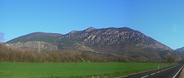
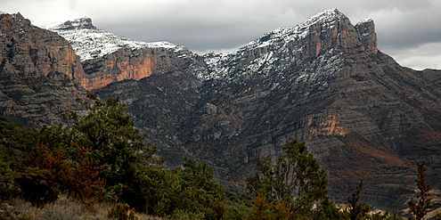
The Mountains of Sis seen from the south
|
|
| Highest point | |
| Elevation | 1,791 m (5,876 ft) |
| Listing | List of mountains in Aragon |
| Geography | |
| Location | Ribagorza (Aragon) |
| Parent range | Pre-Pyrenees |
| Geology | |
| Mountain type | Conglomerate |
| Climbing | |
| Easiest route | Drive from Beranui, Sopeira or Arén |
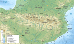
The Mountains of Sis (Catalan: Serra de Sis, or Serra del Cis) (Spanish: Sierra de Sis) is a 28 km (17 mi) long mountain range of the Pre-Pyrenees. They are located between the valleys of rivers Isábena and the Escales Reservoir, Noguera Ribagorzana, in the Ribagorza comarca, Aragon, Spain. The ridge's highest summits are Pico de l´Amorriador (1791 m) and Puialto (1782 m). Other important summits are 1765 m high La Creu de Bonansa, 1490 m high Altaió d'Aulet and 1066 m high Tossal de Cornudella.
Geography
This mountain chain rises abruptly from a plain and looks quite impressive from certain angles, therefore in ancient geographic works this range was also referred to as "the Great Mountains of Sis" (Spanish: la gran sierra de Sis) owing to the massive appearance of its mountains, abruptly rising as mighty foothills of the Pyrenees.
The summits of this mountain chain offer an excellent lookout point to have a view of some of the main peaks of the Pyrenees from the south, as well as of the magnificent El Turbón in the west. Some of the steep rocky cliffs of the range are popular with rock climbers.
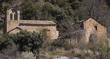
The 9th - 11th century Santa María de Obarra monastery is located at the foot of the western end of the Sierra de Sis range. There are also abandoned villages and church buildings, as well as many ancient cattle farmers' buildings known as borda in the area.
|
|
See also
 In Spanish: Sierra de Sis para niños
- Santa María de Obarra
- List of mountains in Aragon
- Ribagorça


