Ica Region facts for kids
Quick facts for kids
Ica Region
|
||
|---|---|---|

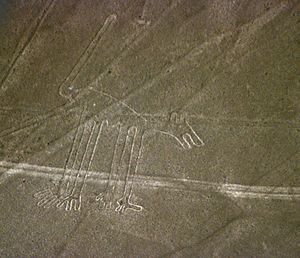
Nazca Lines: "Dog"
|
||
|
||

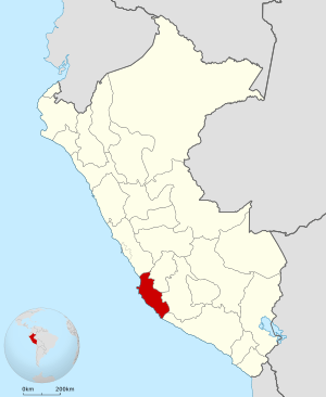
Location of the Ica Region in Peru
|
||
| Country | Peru | |
| Subdivisions | 5 provinces and 43 districts | |
| Capital | Ica | |
| Area | ||
| • Total | 21,327.83 km2 (8,234.72 sq mi) | |
| Elevation
(Capital)
|
406 m (1,332 ft) | |
| Highest elevation | 3,796 m (12,454 ft) | |
| Lowest elevation | 0 m (0 ft) | |
| Population
(2004 estimate)
|
||
| • Total | 709,556 | |
| • Density | 33.269020/km2 (86.16637/sq mi) | |
| Dialing code | 056 | |
| ISO 3166 code | PE-ICA | |
| Principal resources | Iron, cotton, grapevine, kidney beans. | |
| Poverty rate | 41.7% | |
| Percentage of Peru's GDP | 2.36% | |
| Website | www.regionica.gob.pe | |
Ica is a region (formerly known as a department) in Peru. It borders the Pacific Ocean on the west; the Lima Region on the north; the Huancavelica and Ayacucho regions on the east; and the Arequipa Region on the south. Its capital is the city of Ica.
Tourism
Ica has significant wine and pisco industries, annual fiestas, a museum and historic colonial churches. The climate is generally sunny and dry due to its elevation above coastal fog and mist.
Images for kids
-
Bay and harbor of San Nicolás in Marcona.
See also
 In Spanish: Departamento de Ica para niños

All content from Kiddle encyclopedia articles (including the article images and facts) can be freely used under Attribution-ShareAlike license, unless stated otherwise. Cite this article:
Ica Region Facts for Kids. Kiddle Encyclopedia.


