Heredia Province facts for kids
Quick facts for kids
Province of Heredia
Provincia de Heredia
|
|||
|---|---|---|---|
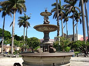
Town square of Heredia
|
|||
|
|||
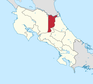
Location of the Province of Heredia
|
|||
| Country | Costa Rica | ||
| Capital city | Heredia | ||
| Area | |||
| • Total | 2,656.98 km2 (1,025.87 sq mi) | ||
| Population
(2011)
|
|||
| • Total | 433,677 | ||
| • Density | 163.2218/km2 (422.7425/sq mi) | ||
| Demonym(s) | Herediano | ||
| ISO 3166 code | CR-H | ||
Heredia is a province of Costa Rica. It is in the north-central part of the country. The provincial capital is the city of Heredia, in the Central Valley near the city of San José, Costa Rica, the national capital.
Contents
Location
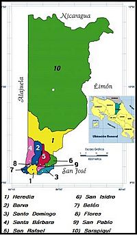
The Heredia province is a landlocked province (it does not border the ocean) and is bordered on the east by the Limón province, on the south by the San José province, on the west by the Alajuela province and to the north by Nicaragua
 |
Nicaragua |  |
||
| Alajuela | Limón | |||
| San José |
Geography
Heredia is the smallest province of Costa Rica. It has an area of 2,656.98 km2 (1,025.87 sq mi).
The northern part of the province is formed by plains but the southern part is in the Central Valley and the foothills of the Cordillera Central ("Central mountain range"), also known as Volcanic Central mountain range.
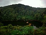
The highest mountain in the province is the Barva volcano, 2,906 m (9,534 ft) high..
The longest river in the province is the Sarapiquí river, 85 km (53 mi) long. Other rivers in the province are: Virilla, Chirripó, Río Sucio, Sardinal, Peje y San Juan.
Demographics
A person from the province is known as herediano (woman: herediana).
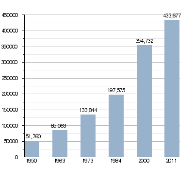
The Heredia province had a population, in 2011, of 433,677 for a population density of 163.2 inhabitants/km2. The canton of Heredia, with 123,616 inhabitants, is the canton with more inhabitants.
Evolution of the population in Heredia
Administrative divisions
The Heredia province is divided in 10 cantons, which are divided into 43 Districts.
| No. | Canton | Capital | Districts | Population (2011) |
Area (km²) |
Density (Inh./km²) |
|---|---|---|---|---|---|---|
| 1 | Heredia | Heredia | 5 | 123,616 | 282.60 | 437.4 |
| 2 | Barva | Barva | 6 | 40,660 | 53.80 | 755.8 |
| 3 | Santo Domingo | Santo Domingo | 8 | 40,072 | 24.84 | 1,613.2 |
| 4 | Santa Bárbara | Santa Bárbara | 6 | 36,243 | 53.21 | 681.1 |
| 5 | San Rafael | San Rafael | 5 | 45,965 | 48.39 | 949.9 |
| 6 | San Isidro | San Isidro | 4 | 20,633 | 26.96 | 765.3 |
| 7 | Belén | San Antonio | 3 | 21,633 | 12.15 | 1,780.5 |
| 8 | Flores | San Joaquín | 3 | 20,037 | 6.96 | 2,878.9 |
| 9 | San Pablo | San Pablo | 2 | 27,671 | 7.53 | 3,674.8 |
| 10 | Sarapiquí | Puerto Viejo | 5 | 57,147 | 2,140.54 | 26.7 |
Economy
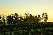
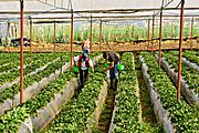
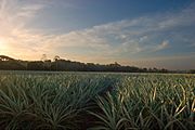
An important economic activity in the province is farming. Important crops in the province are coffee, strawberry, pineapple, plantain, among others.
-
Coffee plantation in Santa Bárbara
-
Strawberries in Vara Blanca
-
Pineapples in Sarapiquí
Gallery
-
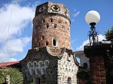
Fortín of Heredia
-
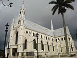
San Rafael's church, Heredia
-
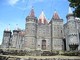
Castle in Santa Lucía, Heredia province
-
Barva volcano
Images for kids
See also
 In Spanish: Provincia de Heredia para niños


