Tumalo Mountain facts for kids
Quick facts for kids Tumalo Mountain |
|
|---|---|

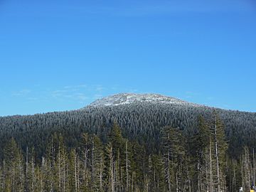
Tumalo Mountain seen from below Mount Bachelor
|
|
| Highest point | |
| Elevation | 7,779 ft (2,371 m) NAVD 88 |
| Prominence | 1,055 ft (322 m) |
| Geography | |
| Location | Deschutes County, Oregon, U.S. |
| Parent range | Cascade Range |
| Topo map | USGS Broken Top |
| Geology | |
| Mountain type | Shield volcano |
| Volcanic arc | Cascade Volcanic Arc |
| Climbing | |
| Easiest route | Trail hike |
Tumalo Mountain is a shield volcano in the Cascade Range of central Oregon, located just northeast of Mount Bachelor across the Cascade Lakes Scenic Byway. Ice age glaciers carved a large cirque into the northeast flank of the mountain, producing a bowl which is popular with local backcountry skiers. A United States Forest Service fire lookout tower was built on the summit in the 1930s, but abandoned in the 1970s and subsequently removed. A trail to the summit ascends the southwest flank of the volcano.

All content from Kiddle encyclopedia articles (including the article images and facts) can be freely used under Attribution-ShareAlike license, unless stated otherwise. Cite this article:
Tumalo Mountain Facts for Kids. Kiddle Encyclopedia.
