Tandel facts for kids
Quick facts for kids
Tandel
Tandel
|
||
|---|---|---|
|
Commune
|
||
 |
||
|
||

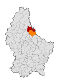
Map of Luxembourg with Tandel highlighted in orange, and the canton in dark red
|
||
| Country | ||
| Canton | Vianden | |
| Area rank | ? of 100 | |
| Highest elevation | 537 m (1,762 ft) | |
| • Rank | 7th of 100 | |
| Lowest elevation | 190 m (620 ft) | |
| • Rank | 21st of 100 | |
| Population
(1 January 2019)
|
||
| • Total | 2,083 | |
| • Rank | 76th of 100 | |
| • Density rank | 19th of 100 | |
| Time zone | UTC+1 (CET) | |
| • Summer (DST) | UTC+2 (CEST) | |
| LAU 2 | LU0000901 | |
| Website | tandel.lu | |
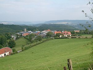
Tandel is a commune and village in eastern Luxembourg, in the canton of Vianden. It lies close to the border with Germany. As of 2024[update], the village of Tandel, which lies in the centre of the commune, has a population of 108.
History
The commune of Tandel was formed on 1 January 2006 from the former communes of Bastendorf (in the canton of Diekirch) and Fouhren (in the canton of Vianden). The law creating Tandel was passed on 21 December 2004.
Populated places
The commune consists of the following villages:
|
Population

All content from Kiddle encyclopedia articles (including the article images and facts) can be freely used under Attribution-ShareAlike license, unless stated otherwise. Cite this article:
Tandel Facts for Kids. Kiddle Encyclopedia.

