Snegamook lake facts for kids
Quick facts for kids Snegamook lake |
|
|---|---|
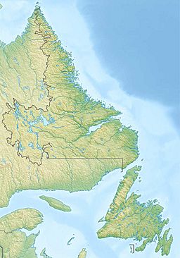
| Location | Labrador, Newfoundland and Labrador, Canada |
| Coordinates | 54°32′28″N 61°27′03″W / 54.54111°N 61.45083°W |
| Primary outflows | Kanairiktok River |
| Basin countries | Canada |
| Max. length | 22 km (14 mi) |
| Max. width | 7 km (4.3 mi) |
| Surface elevation | 130 m (430 ft) |
Snegamook Lake is a medium-sized lake in central Labrador (in the Canadian province of Newfoundland and Labrador). The lake lies within the easternmost part of the Canadian Shield and is about 22 km long, 7 km wide, at elevation 130 m AMSL and is located at 54°32′28″N 61°27′03″W / 54.54111°N 61.45083°W.
The lake drained by the Kanairiktok River, over a small waterfall at the lake's eastern end, to the Atlantic via Kanairiktok Bay.
Located within the Central Mineral Belt (of Labrador) the area has been prospected for minerals since the 1920s, with a current focus on copper-gold and uranium deposits. The region is mostly uninhabited and access to Snegamook Lake is by floatplane or helicopter (out of Goose Bay, Labrador). Some manage to travel by canoe or dogsled.
The name is derived from the Innu-aimun Ashtunekamiku, meaning Canoe Building Shelter.


