Rattlesnake Ridge facts for kids
Quick facts for kids Rattlesnake Mountain |
|
|---|---|

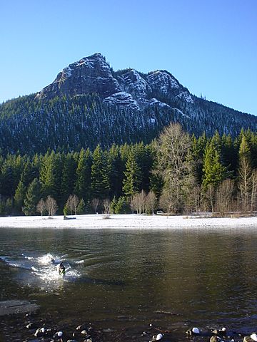
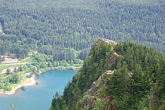
Rattlesnake Ledge with Rattlesnake Lake in the foreground
|
|
| Highest point | |
| Elevation | 3,480+ feet (1,061+ m) |
| Prominence | 2,520 ft (770 m) |
| Geography | |
| Location | King County, Washington state, U.S. |
| Parent range | Issaquah Alps, Cascades |
| Topo map | USGS North Bend |
| Climbing | |
| Easiest route | Hike |
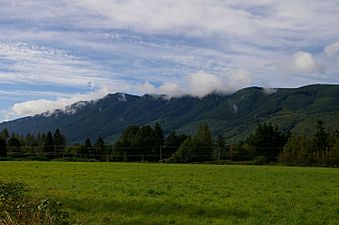
Rattlesnake Ridge is the ridge of Rattlesnake Mountain located south of North Bend, Washington, United States. The western end is near the intersection of State Route 18 and I-90 in Snoqualmie, Washington, and runs southeast about 7 miles (11 km) or 11 miles (18 km) by trail. It is the highest and easternmost of the Issaquah Alps (although Cedar Butte in the gap between Rattlesnake Mountain and the Cascade front at Mount Washington is considered by Harvey Manning to be a quasi-Alp). A maze of abandoned logging roads and constructed trails have been strung together to provide a 10.5-mile (16.9 km) footpath from the Snoqualmie Point trailhead at Exit 27 on I-90 all the way to the Rattlesnake Lake trailhead near Exit 32.
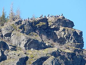
Rattlesnake Ledge is a rock outcropping and viewpoint 1160 feet above Rattlesnake Lake. Rattlesnake Ledge is a very popular hike destination. The Rattlesnake Ledge Trail makes up the eastern 2 mile segment of the Rattlesnake Ridge or Rattlesnake Mountain Trail.
Several recreational opportunities exist, including hiking and rock-climbing.
Legal status
Most of the mountain is owned by the state of Washington or King County, and is protected as Rattlesnake Mountain Scenic Area, managed jointly by the Washington State Department of Natural Resources and King County Park and Recreation Department. The eastern section of the mountain, including the ledges, is owned by Seattle Public Utilities, while large sections in the western part of the ridge are owned by Weyerhaeuser Corporation, which conducts substantial logging operations there.
Climate
Rattlesnake Ridge is located in the marine west coast climate zone of western North America. Most weather fronts originate in the Pacific Ocean, and travel northeast toward the Cascade Mountains. As fronts approach the North Cascades, they are forced upward by the peaks of the Cascade Range, causing them to drop their moisture in the form of rain or snowfall onto the Cascades (Orographic lift). As a result, the west side of the North Cascades experiences high precipitation, especially during the winter months in the form of snowfall. During winter months, weather is usually cloudy, but, due to high pressure systems over the Pacific Ocean that intensify during summer months, there is often little or no cloud cover during the summer.
Gallery


