Okinawa Islands facts for kids
|
Native name:
Okinawa Shotō (沖縄諸島)
|
|
|---|---|

Okinawa Islands
|
|
| Lua error in Module:Location_map at line 420: attempt to index field 'wikibase' (a nil value).
Okinawa Islands in Japan
|
|
| Geography | |
| Location | Pacific Ocean |
| Archipelago | Ryukyu Islands |
| Adjacent bodies of water | East China Sea |
| Total islands | 113 |
| Major islands | Okinawa Island, Kume Island, Kerama Islands |
| Area | 1,418.59 km2 (547.72 sq mi) |
| Administration | |
| Prefecture | Okinawa Prefecture |
| Largest settlement | Naha (pop. 312,393) |
| Demographics | |
| Population | 1,285,003 (October 1, 2010) |
| Pop. density | 908.8 /km2 (2,353.8 /sq mi) |
| Ethnic groups | Ryukyuan, Japanese |
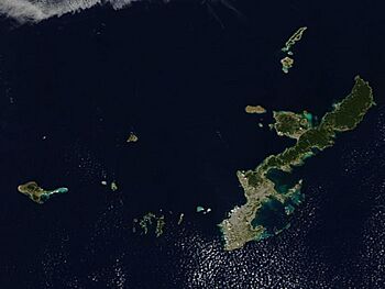
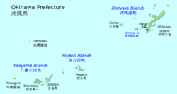
The Okinawa Islands (沖縄諸島, Okinawa Shotō, or 沖縄群島, Okinawa Guntō) are an island group in Okinawa Prefecture, Japan and are the principal island group of the prefecture. The Okinawa Islands are part of the larger Ryukyu Islands group and are located between the Amami Islands of Kagoshima Prefecture to the northeast and the Sakishima Islands of Okinawa Prefecture to the southwest.
The Okinawa Islands, apart from the main island, contain three smaller island groups: the Kerama, Yokatsu and Iheya-Izena island groups.
The Okinawa Islands are the political, cultural and population center of Okinawa Prefecture. The prefectural capital of Naha is within the island group. 90% of the population of the prefecture reside within the Okinawa Islands, primarily on the largest island of the group, Okinawa Island. Access to the various Okinawa Islands is primarily via small airports which connect to Naha Airport. Additionally, the islands are connected via ferry service to the Port of Naha in the prefectural capital.
The Okinawa Islands are within the subtropical climate zone, which supports the production of sugarcane, pineapples and cut flowers. The military bases of the United States in Okinawa Prefecture are located on the Okinawa Islands.
Historically the rule of the Ryukyu Kingdom, centered on Okinawa Island, consolidated the Okinawa Islands before spreading south to the Miyako and Yaeyama Islands and north to Amami Ōshima.
History

Okinawa is currently a part of Japan. However, it has its own history and culture distinguished from Japan. The history of Okinawa is usually divided into five eras as follows.
- Prehistoric era (Tens of thousands of years ago~12th century)
- Old Ryukyu era (12th century~1609)
- Early modern Ryukyu era (1609~1879)
- Modern Okinawa era (1879~1945)
- Post-war era (1945~)
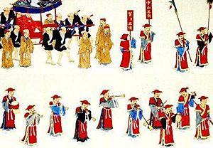
In the prehistoric era, hunting animals and collecting plants prevailed. A shift to farming advanced during the 10th to 12th centuries. Many communities were formed, and integrated into the three small countries of Hokuzan, Chūzan, and Nanzan. In 1372, Chūzan began paying tribute to the Chinese Ming Dynasty. This small country became strong by trade with the Ming dynasty, and attacked the other countries. It became the "Ryūkyū Kingdom". This kingdom flourished through trade throughout Asia during the 15th and 16th centuries.
In 1609, Shimazu Iehisa invaded the Ryūkyū Kingdom. He was the feudal lord of Satsuma Province. This invasion meant that the Ryūkyū Kingdom was forced to pay tribute to the Japanese shogunate regime. This domination continued until the end of the 19th century.
In 1867, the Japanese shogunate ended and power was returned to the Emperor Meiji. The new government had a policy to incorporate the Ryūkyū Kingdom into the Japanese Empire. The Ryūkyū Kingdom was reorganized. At first, in 1872, the Ryūkyū Kingdom was renamed Ryūkyū Domain, meaning that it was directly controlled by Japan instead of Satsuma Province. In 1879, it was reorganized as Okinawa Prefecture. The Ryūkyū Kingdom was ended at that time. Okinawa became a Japanese colony.
At first, Japan emphasized the differences between Okinawan and Japanese culture, to justify discriminatory policies in the colony. However, to justify the colonization to the West, the policies were changed to ones which emphasized similarities and which assimilated Okinawa into Japan. Thus, Okinawan society has been greatly influenced by Japan. The Japanese taught Okinawan children that the Okinawan language was a "dialect" of Japanese, and students were punished for speaking their native language. Okinawa was caught up in the Japanese war against U.S.A. and China. Okinawa was incorporated into the war system. At the end of World War II, Okinawa itself became the battlefield, the social infrastructure was completely destroyed, and many people died.
After the war, Okinawa was put under the U.S. military. The people expected freedom, but priority was given to U.S. military policy. Therefore, the movement for a return to Japan was strengthened, and it was carried out in 1972. However, the problem continues up to the present as the Japanese government continues to give priority to U.S. military policy. Many US military bases are still left.
Islands
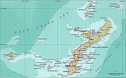
The Okinawa Guntō, defined by the Hydrographic and Oceanographic Department of the Japan Coast Guard, cover the following islands:
- Okinawa Island (Okinawa Hontō)
- Iheya-Izena Islands: Iheya Island, Izena Island
- Ie Island
- Sesoko Island
- Yokatsu Islands: Yabuchi Island, Henza Island, Miyagi Island, Ikei Island, Hamahiga Island, Tsuken Island, Ukibara Island, Minamiukibara Island, Kudaka Island
- Kume Island
- Kerama Islands: Tokashiki Island, Zamami Island, Aka Island, Geruma Island
- Aguni Islands: Aguni Island, Tonaki Island
The Geospatial Information Authority of Japan (GSI) defines the Okinawa Shotō. They are an administratively-oriented group of islands and include the outlying Iōtorishima, which is otherwise seen as part of the Amami Islands.
See also
 In Spanish: Islas Okinawa para niños


