National Register of Historic Places listings in Kingfisher County, Oklahoma facts for kids
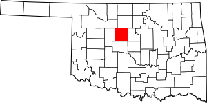
This is a list of the National Register of Historic Places listings in Kingfisher County, Oklahoma.
This is intended to be a complete list of the properties on the National Register of Historic Places in Kingfisher County, Oklahoma, United States. The locations of National Register properties for which the latitude and longitude coordinates are included below, may be seen in a map.
There are 10 properties listed on the National Register in the county.
Current listings
| Name on the Register | Image | Date listed | Location | City or town | Description | |
|---|---|---|---|---|---|---|
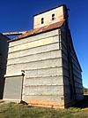
| 1 | Burrus Mills Elevator C |
(#00000621) |
Northeastern corner of the junction of Admire Ave. and 4th St. 35°51′48″N 97°55′41″W / 35.863333°N 97.928056°W |
Kingfisher | ||
| 2 | Dow Grain Company Elevator |
(#00001041) |
105 E. Oklahoma St. 35°43′33″N 97°58′22″W / 35.725833°N 97.972778°W |
Okarche | ||
| 3 | Farmers and Merchants National Bank |
(#84003085) |
197 S. Main St. 36°06′32″N 97°53′54″W / 36.108889°N 97.898333°W |
Hennessey | ||
| 4 | Farmers Co-op Elevator |
(#00001042) |
121 W. Kansas St. 36°06′39″N 97°54′00″W / 36.110833°N 97.9°W |
Hennessey | ||
| 5 | Kiel-Dover Farmers Elevator |
(#00001043) |
Junction of E. Chestnut St. and the railroad line 35°58′44″N 97°54′47″W / 35.978889°N 97.913056°W |
Dover | ||
| 6 | Kingfisher Armory |
(#94000279) |
301 N. 6th St. 35°51′48″N 97°55′50″W / 35.863333°N 97.930556°W |
Kingfisher | ||
| 7 | Kingfisher College Site |
(#76001566) |
1 mile east of Kingfisher 35°52′04″N 97°54′31″W / 35.867778°N 97.908611°W |
Kingfisher | ||
| 8 | Kingfisher Memorial Hall |
(#06000487) |
123 W. Miles Ave. 35°51′43″N 97°56′01″W / 35.861944°N 97.933611°W |
Kingfisher | ||
| 9 | Kingfisher Post Office |
(#78002239) |
Main and Robberts Sts. 35°51′51″N 97°55′58″W / 35.864167°N 97.932778°W |
Kingfisher | ||
| 10 | Seay Mansion |
(#71000664) |
11th St. and Zellers Ave. 35°51′15″N 97°56′08″W / 35.854167°N 97.935556°W |
Kingfisher |

All content from Kiddle encyclopedia articles (including the article images and facts) can be freely used under Attribution-ShareAlike license, unless stated otherwise. Cite this article:
National Register of Historic Places listings in Kingfisher County, Oklahoma Facts for Kids. Kiddle Encyclopedia.


