National Register of Historic Places listings in Ellis County, Oklahoma facts for kids
This is a list of the National Register of Historic Places listings in Ellis County, Oklahoma.
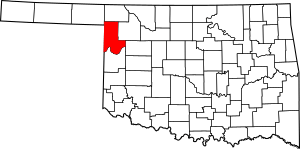
This is intended to be a complete list of the properties on the National Register of Historic Places in Ellis County, Oklahoma, United States. The locations of National Register properties for which the latitude and longitude coordinates are included below, may be seen in a map.
There are 10 properties listed on the National Register in the county.
Current listings
| Name on the Register | Image | Date listed | Location | City or town | Description | |
|---|---|---|---|---|---|---|
| 1 | Bank of Gage |
(#83004169) |
Corner of Main and Cedar 36°19′14″N 99°45′26″W / 36.320516°N 99.757150°W |
Gage | ||
| 2 | George Carr Ranch House |
(#85000788) |
Northwest of Camargo 36°02′31″N 99°23′06″W / 36.041944°N 99.385°W |
Camargo | ||
| 3 | Davison Silo |
(#78002234) |
20 miles (32 km) southeast of Arnett 35°59′46″N 99°35′23″W / 35.996111°N 99.589722°W |
Arnett | ||
| 4 | Eggleston Springs |
(#78002235) |
Address Restricted |
Arnett | ||
| 5 | Ellis County Courthouse |
(#85000681) |
Town Square 36°08′04″N 99°46′14″W / 36.134348°N 99.770553°W |
Arnett | ||
| 6 | Ingle Brothers Broomcorn Warehouse |
(#09000975) |
320 NW 1st St. 36°16′39″N 99°53′00″W / 36.277467°N 99.883269°W |
Shattuck | ||
| 7 | First State Bank |
(#83004170) |
239 S. Main St. 36°16′28″N 99°52′51″W / 36.274444°N 99.880833°W |
Shattuck | Apparently no longer extant | |
| 8 | Grand Town Site |
(#72001063) |
14 miles south of Arnett 35°58′56″N 99°47′43″W / 35.982222°N 99.795278°W |
Arnett | ||
| 9 | Shattuck National Bank Building |
(#83004171) |
101 S. Main St. 36°16′33″N 99°52′54″W / 36.275941°N 99.881775°W |
Shattuck | ||
| 10 | Stock Exchange Bank |
(#83004173) |
Main St. 36°22′34″N 99°37′25″W / 36.376036°N 99.623734°W |
Fargo |
Determined eligible
At least one property in Ellis County has been determined eligible but was not finally listed on the National Register.
| Name on the Register | Image | Date listed | Location | City or town | Description | |
|---|---|---|---|---|---|---|
| 1 | Harrel Bison Kill |
(#13000938) |
Address Restricted |
Camargo | Determined eligible on December 18, 2013. |

All content from Kiddle encyclopedia articles (including the article images and facts) can be freely used under Attribution-ShareAlike license, unless stated otherwise. Cite this article:
National Register of Historic Places listings in Ellis County, Oklahoma Facts for Kids. Kiddle Encyclopedia.


