National Register of Historic Places listings in Cocke County, Tennessee facts for kids
This is a list of the National Register of Historic Places listings in Cocke County, Tennessee.
This is intended to be a complete list of the properties and districts on the National Register of Historic Places in Cocke County, Tennessee, United States. Latitude and longitude coordinates are provided for many National Register properties and districts; these locations may be seen together in a map.
There are 16 properties and districts listed on the National Register in the county, and two former listings.
| Anderson – Bedford – Benton – Bledsoe – Blount – Bradley – Campbell – Cannon – Carroll – Carter – Cheatham – Chester – Claiborne – Clay – Cocke – Coffee – Crockett – Cumberland – Davidson – Decatur – DeKalb – Dickson – Dyer – Fayette – Fentress – Franklin – Gibson – Giles – Grainger – Greene – Grundy – Hamblen – Hamilton – Hancock – Hardeman – Hardin – Hawkins – Haywood – Henderson – Henry – Hickman – Houston – Humphreys – Jackson – Jefferson – Johnson – Knox – Lake – Lauderdale – Lawrence – Lewis – Lincoln – Loudon – Macon – Madison – Marion – Marshall – Maury – McMinn – McNairy – Meigs – Monroe – Montgomery – Moore – Morgan – Obion – Overton – Perry – Pickett – Polk – Putnam – Rhea – Roane – Robertson – Rutherford – Scott – Sequatchie – Sevier – Shelby – Smith – Stewart – Sullivan – Sumner – Tipton – Trousdale – Unicoi – Union – Van Buren – Warren – Washington – Wayne – Weakley – White – Williamson – Wilson |
Current listings
| Name on the Register | Image | Date listed | Location | City or town | Description | |
|---|---|---|---|---|---|---|
| 1 | Beechwood Hall |
(#75001741) |
North of Newport on Rankin Rd. 35°59′27″N 83°10′59″W / 35.990833°N 83.183056°W |
Newport | ||
| 2 | Cocke County Courthouse |
(#95000538) |
111 Court Ave. 35°58′00″N 83°11′05″W / 35.966667°N 83.184722°W |
Newport | ||
| 3 | Cocke County Memorial Building |
(#97001139) |
103 N. Cosby Highway 35°58′03″N 83°11′36″W / 35.9675°N 83.193333°W |
Newport | ||
| 4 | Conway Bridge |
(#09000948) |
Briar Thicket Rd./Knob Creek Rd. over the Nolichucky River 36°07′21″N 83°07′31″W / 36.1225°N 83.125278°W |
Briar Thicket | Extends into Greene County | |
| 5 | Walter C. Cureton House |
(#01001325) |
202 Lincoln Ave. 35°57′44″N 83°10′44″W / 35.962222°N 83.178889°W |
Newport | ||
| 6 | Elm Hill |
(#75001742) |
206 W. Riverview St. 35°57′56″N 83°11′27″W / 35.965556°N 83.190833°W |
Newport | ||
| 7 | English Mountain Fire Lookout Tower |
(#15000832) |
Carson Springs Rd. 35°54′21″N 83°17′46″W / 35.9057°N 83.296°W |
Chestnut Hill | ||
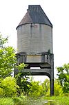
| 8 | Leadvale Coaling Station and Cut-off |
(#14000997) |
Rankin Bottoms Wildlife Management Area 36°04′45″N 83°14′24″W / 36.079167°N 83.240000°W |
Newport | Locally known as the "Rankin Coal Tipple"; includes two miles of abandoned Southern Railway lines, together with a bridge abutment and coal tipple | |
| 9 | Neas Farm |
(#04000152) |
3301 Sable Rd. 36°01′56″N 83°00′46″W / 36.032222°N 83.012778°W |
Parrottsville | ||
| 10 | O'Dell House |
(#75001744) |
Northeast of Newport on the Greeneville Highway 35°58′55″N 83°09′46″W / 35.981944°N 83.162778°W |
Newport | ||
| 11 | Rhea-Mims Hotel |
(#98000822) |
335 East Broadway 35°57′57″N 83°11′01″W / 35.965833°N 83.183611°W |
Newport | ||
| 12 | Swaggerty Blockhouse |
(#73001756) |
East of Parrottsville on Old Parrottsville Highway 36°00′47″N 83°04′17″W / 36.013056°N 83.071389°W |
Parrottsville | ||
| 13 | Vinson House |
(#75001745) |
4.5 miles south of Newport off Hartford Rd. 35°53′21″N 83°11′06″W / 35.889167°N 83.185°W |
Newport | ||
| 14 | Yett-Ellison House |
(#75001746) |
Main St. (Greeneville Highway) 36°00′29″N 83°05′19″W / 36.008056°N 83.088611°W |
Parrottsville |
Former listings
| Name on the Register | Image | Date listed | Date removed | Location | City or town | Summary | |
|---|---|---|---|---|---|---|---|
| 1 | Greenlawn |
(#75001743) |
|
NW of Newport on Old Rankin Rd. |
Newport vicinity |

All content from Kiddle encyclopedia articles (including the article images and facts) can be freely used under Attribution-ShareAlike license, unless stated otherwise. Cite this article:
National Register of Historic Places listings in Cocke County, Tennessee Facts for Kids. Kiddle Encyclopedia.


