National Register of Historic Places listings in Bradley County, Tennessee facts for kids
This is a list of the National Register of Historic Places listings in Bradley County, Tennessee.
This is intended to be a complete list of the properties and districts on the National Register of Historic Places in Bradley County, Tennessee, United States. Latitude and longitude coordinates are provided for many National Register properties and districts; these locations may be seen together in a map.
There are 24 properties and districts listed on the National Register in the county.
| Anderson – Bedford – Benton – Bledsoe – Blount – Bradley – Campbell – Cannon – Carroll – Carter – Cheatham – Chester – Claiborne – Clay – Cocke – Coffee – Crockett – Cumberland – Davidson – Decatur – DeKalb – Dickson – Dyer – Fayette – Fentress – Franklin – Gibson – Giles – Grainger – Greene – Grundy – Hamblen – Hamilton – Hancock – Hardeman – Hardin – Hawkins – Haywood – Henderson – Henry – Hickman – Houston – Humphreys – Jackson – Jefferson – Johnson – Knox – Lake – Lauderdale – Lawrence – Lewis – Lincoln – Loudon – Macon – Madison – Marion – Marshall – Maury – McMinn – McNairy – Meigs – Monroe – Montgomery – Moore – Morgan – Obion – Overton – Perry – Pickett – Polk – Putnam – Rhea – Roane – Robertson – Rutherford – Scott – Sequatchie – Sevier – Shelby – Smith – Stewart – Sullivan – Sumner – Tipton – Trousdale – Unicoi – Union – Van Buren – Warren – Washington – Wayne – Weakley – White – Williamson – Wilson |
Current listings
| Name on the Register | Image | Date listed | Location | City or town | Description | |
|---|---|---|---|---|---|---|
| 1 | Blue Springs Encampments and Fortifications |
(#99000427) |
West of Blue Springs off Lead Mine Valley Rd., SW. 35°05′27″N 84°55′14″W / 35.090833°N 84.920556°W |
Cleveland | ||
| 2 | Broad Street United Methodist Church |
(#84003263) |
263 Broad St., NW 35°09′41″N 84°52′33″W / 35.161389°N 84.875833°W |
Cleveland | ||
| 3 | C.C. Card Auto Company Building |
(#14000083) |
125 Inman & 162 1st Sts. 35°09′30″N 84°52′27″W / 35.1584°N 84.8741°W |
Cleveland | ||
| 4 | Centenary Avenue Historic District |
(#93000172) |
Roughly bounded by 8th, Harle, 13th, and Ocoee Sts. 35°10′03″N 84°52′29″W / 35.1675°N 84.874722°W |
Cleveland | ||
| 5 | Charleston Cumberland Presbyterian Church |
(#84003444) |
Railroad St. 35°17′05″N 84°45′14″W / 35.284722°N 84.753889°W |
Charleston | ||
| 6 | Cleveland Southern Railway Depot |
(#08000235) |
175 Edwards St. 35°09′24″N 84°52′23″W / 35.156667°N 84.873056°W |
Cleveland | ||
| 7 | Cleveland to Charleston Concrete Highway |
(#07001382) |
Market and Water Sts. 35°17′14″N 84°45′05″W / 35.287222°N 84.751389°W |
Charleston | ||
| 8 | Hair Conrad Cabin |
(#76001765) |
433 Blythewood Rd., SW. 35°09′47″N 84°54′37″W / 35.163056°N 84.910278°W |
Cleveland | ||
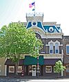
| 9 | Craigmiles Hall |
(#80003781) |
170 Ocoee St., NE. 35°09′37″N 84°52′30″W / 35.160278°N 84.875°W |
Cleveland | ||
| 10 | P.M. Craigmiles House |
(#75001733) |
833 Ocoee St., NW. 35°09′52″N 84°52′23″W / 35.164444°N 84.873056°W |
Cleveland | ||
| 11 | Fillauer Brothers Building |
(#89000507) |
Broad and 1st Sts. 35°09′35″N 84°52′34″W / 35.159722°N 84.876111°W |
Cleveland | ||
| 12 | First Presbyterian Church |
(#86000396) |
433 Ocoee St., NW. 35°09′44″N 84°52′27″W / 35.162222°N 84.874167°W |
Cleveland | ||
| 13 | Hardwick Woolen Mills |
(#01000380) |
445 Church St., SE. 35°09′21″N 84°52′38″W / 35.155833°N 84.877222°W |
Cleveland | ||
| 14 | Henegar House |
(#76001764) |
Market St. 35°17′12″N 84°45′17″W / 35.286667°N 84.754722°W |
Charleston | ||
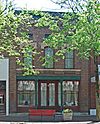
| 15 | W.J. Hughes Business House |
(#75001735) |
70 Ocoee St. 35°09′34″N 84°52′33″W / 35.159444°N 84.875833°W |
Cleveland | ||
| 16 | Ocoee Street Historic District |
(#95001447) |
1455-1981 N. Ocoee St. 35°10′12″N 84°52′16″W / 35.17°N 84.871111°W |
Cleveland | ||
| 17 | Rattlesnake Springs |
(#75001734) |
Northeast of Cleveland off Dry Valley Rd. 35°14′40″N 84°46′22″W / 35.244444°N 84.772778°W |
Cleveland | ||
| 18 | Red Clay Council Ground |
(#72001229) |
13 miles south of Cleveland on Blue Springs Rd. 34°59′31″N 84°56′54″W / 34.991944°N 84.948333°W |
Cleveland | Meeting ground for the Cherokee prior to the Cherokee Removal; now a state park | |
| 19 | St. Luke's Episcopal Church |
(#82003954) |
Ocoee and Central Sts., NW. 35°09′40″N 84°52′29″W / 35.161111°N 84.874722°W |
Cleveland | ||
| 20 | Tipton-Fillauer House |
(#80003782) |
63 Broad St., NW. 35°09′36″N 84°52′36″W / 35.16°N 84.876667°W |
Cleveland | ||
| 21 | U.S. Post Office |
(#83003023) |
155 Broad St., NW. 35°09′38″N 84°52′36″W / 35.160556°N 84.876667°W |
Cleveland |

All content from Kiddle encyclopedia articles (including the article images and facts) can be freely used under Attribution-ShareAlike license, unless stated otherwise. Cite this article:
National Register of Historic Places listings in Bradley County, Tennessee Facts for Kids. Kiddle Encyclopedia.


