Mannville, Alberta facts for kids
Quick facts for kids
Mannville
|
|
|---|---|
|
Village
|
|
| Village of Mannville | |

Grain elevators, circa 1980
|
|
| Motto(s):
All Trails Lead to Mannville
|
|
| Country | Canada |
| Province | Alberta |
| Region | Central Alberta |
| Census division | 10 |
| Municipal district | County of Minburn No. 27 |
| Incorporated | |
| • Village | December 26, 1906 |
| Area
(2021)
|
|
| • Land | 1.64 km2 (0.63 sq mi) |
| Elevation | 625 m (2,051 ft) |
| Population
(2021)
|
|
| • Total | 765 |
| • Density | 466.3/km2 (1,208/sq mi) |
| Time zone | UTC−7 (MST) |
| • Summer (DST) | UTC−6 (MDT) |
| Highways | Highway 16 Highway 881 |
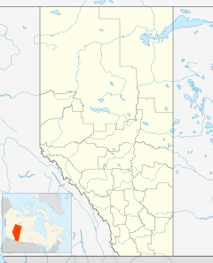
Mannville is a village in central Alberta, Canada. It is located at the intersection of the Yellowhead Highway and Highway 881, approximately 22 kilometres (14 mi) west of Vermilion and 170 kilometres (110 mi) east of Edmonton. Its primary industry is agriculture.
History
The settlement was named for Sir Donald Mann, vice-president of the Canadian Northern Railway.
The Mannville Group, an oil and gas bearing unit of the Western Canadian Sedimentary Basin, was named for the village by A.W. Nauss in 1945.
Demographics
In the 2021 Census of Population conducted by Statistics Canada, the Village of Mannville had a population of 765 living in 339 of its 397 total private dwellings, a change of -7.6% from its 2016 population of 828. With a land area of 1.64 km2 (0.63 sq mi), it had a population density of 466.5/km2 (1,208/sq mi) in 2021.
In the 2016 Census of Population conducted by Statistics Canada, the Village of Mannville recorded a population of 828 living in 341 of its 377 total private dwellings, a 3.1% change from its 2011 population of 803. With a land area of 1.64 km2 (0.63 sq mi), it had a population density of 504.9/km2 (1,308/sq mi) in 2016.
Notable people
- Frances Bay (1919–2011): actress
- Vernon Booher (1907–1929): mass murderer
- Kyle Calder (born 1979): professional hockey player
- Peter Gadsden (1929–2006): Lord Mayor of London
- Erving Goffman (1922–1982): sociologist
- Mike Rathje (born 1974): professional hockey player
- Miles Zaharko (born 1957): professional hockey player


