This is a list of waterways within the county of Lincolnshire.
A
| Name |
Alternative Name(s) |
Length (km) |
Basin (km2) |
Source |
Source Elevation (m) |
Mouth |
Mouth Elevation (m) |
Discharge at mouth m3/s (average) |
Discharge at mouth m3/s (maximum) |
Notes |
Image |
| All Hallows Drain |
|
4.4 |
|
Horsington |
|
Catchwater Drain, Stixwould |
|
|
|
|
|
| New River Ancholme |
River Ancholme |
27 |
|
Bishopbridge |
6 |
South Ferriby, Humber estuary |
0 |
|
|
The New River Ancholme is the artificial drainage channel. The Old River Ancholme is the natural water course, some of which has been completely superseded. |
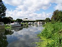
The old River Ancholme in Brigg
|
| Old River Ancholme |
River Ancholme |
|
|
West Firsby |
37 |
South Ferriby, Humber estuary |
0 |
|
|
The New River Ancholme is the artificial drainage channel. The Old River Ancholme is the natural water course, some of which has been completely superseded. |
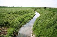
River Ancholme at Toft next Newton
|
B
C
| Name |
Alternative Name(s) |
Length (km) |
Basin (km2) |
Source |
Source Elevation (m) |
Mouth |
Mouth Elevation (m) |
Discharge at mouth m3/s (average) |
Discharge at mouth m3/s (maximum) |
Notes |
Image |
| Catchwater Drain |
Great Drain, Minting Beck |
|
|
Great Sturton |
|
River Witham, Stixwould |
|
|
|
|
|
| Crofts Drain |
|
|
|
Woodhall Spa |
|
Kirkstead Engine Drain, Kirkstead |
|
|
|
Runs parallel to The Sewer |
|
D
| Name |
Alternative Name(s) |
Length (km) |
Basin (km2) |
Source |
Source Elevation (m) |
Mouth |
Mouth Elevation (m) |
Discharge at mouth m3/s (average) |
Discharge at mouth m3/s (maximum) |
Notes |
Image |
| Daubeney's Beck |
|
|
|
Thimbleby |
|
Monk's Drain, Poolham |
|
|
|
|
|
| Dorrington Dike |
Digby Dam |
|
|
Dorrington |
|
Billinghay Skirth, Billinghay |
|
|
|
|
|
E
| Name |
Alternative Name(s) |
Length (km) |
Basin (km2) |
Source |
Source Elevation (m) |
Mouth |
Mouth Elevation (m) |
Discharge at mouth m3/s (average) |
Discharge at mouth m3/s (maximum) |
Notes |
Image |
|
|
|
|
|
|
|
|
|
|
|
|
F
| Name |
Alternative Name(s) |
Length (km) |
Basin (km2) |
Source |
Source Elevation (m) |
Mouth |
Mouth Elevation (m) |
Discharge at mouth m3/s (average) |
Discharge at mouth m3/s (maximum) |
Notes |
Image |
| Foss Dyke |
Fossdyke |
|
|
Brayford Pool, Lincoln |
|
River Trent, Torksey |
|
|
|
Roman Canal |
|
| River Freshney |
|
|
|
Beelsby |
|
North Sea, Grimsby Docks |
0 |
|
|
|
|
G
| Name |
Alternative Name(s) |
Length (km) |
Basin (km2) |
Source |
Source Elevation (m) |
Mouth |
Mouth Elevation (m) |
Discharge at mouth m3/s (average) |
Discharge at mouth m3/s (maximum) |
Notes |
Image |
| River Glen |
|
|
|
Boothby Pagnall and Ropsley |
|
River Welland, Surfleet |
0 |
|
|
Splits into the East and West Glen Rivers |
|
| River Gwash |
|
|
|
Knossington, Leicestershire |
|
River Welland, Stamford |
|
|
|
|
|
H
| Name |
Alternative Name(s) |
Length (km) |
Basin (km2) |
Source |
Source Elevation (m) |
Mouth |
Mouth Elevation (m) |
Discharge at mouth m3/s (average) |
Discharge at mouth m3/s (maximum) |
Notes |
Image |
| Haltham Beck |
|
|
|
Low Hammeringham |
|
River Bain, Kirkby on Bain |
|
|
|
|
|
| Hemingby Beck |
|
|
|
Asterby |
|
River Bain, Hemingby |
|
|
|
|
|
| Humber estuary |
The Humber, River Humber |
62 |
24,240 |
Trent Falls |
0 |
North Sea |
0 |
250 |
1500 |
|
|
I
| Name |
Alternative Name(s) |
Length (km) |
Basin (km2) |
Source |
Source Elevation (m) |
Mouth |
Mouth Elevation (m) |
Discharge at mouth m3/s (average) |
Discharge at mouth m3/s (maximum) |
Notes |
Image |
|
|
|
|
|
|
|
|
|
|
|
|
K
| Name |
Alternative Name(s) |
Length (km) |
Basin (km2) |
Source |
Source Elevation (m) |
Mouth |
Mouth Elevation (m) |
Discharge at mouth m3/s (average) |
Discharge at mouth m3/s (maximum) |
Notes |
Image |
| Kirkstead Abbey Drain |
|
|
|
Kirkstead |
|
Kirkstead Engine Drain, Kirkstead |
|
|
|
|
|
| Kirkstead Engine Drain |
|
|
|
Kirkstead |
|
Kirkstead Mill Beck, Kirkstead |
|
|
|
Runs parallel to River Witham. |
|
| Kirkstead Mill Beck |
|
|
|
Kirkstead |
|
River Witham, Kirkstead |
|
|
|
|
|
L
| Name |
Alternative Name(s) |
Length (km) |
Basin (km2) |
Source |
Source Elevation (m) |
Mouth |
Mouth Elevation (m) |
Discharge at mouth m3/s (average) |
Discharge at mouth m3/s (maximum) |
Notes |
Image |
| Long Eau |
|
|
22.3 |
Legbourne |
|
Great Eau, Theddlethorpe |
0 |
|
|
|
|
| River Lymn |
Steeping River, Wainfleet Relief Channel, Wainfleet Haven, Burgh Sluice Relief Channel |
|
|
Belchford |
91 |
North Sea, Gibraltar Point |
0 |
|
|
Thought to be the river written about in Alfred, Lord Tennyson's The Brook. |
|
M
| Name |
Alternative Name(s) |
Length (km) |
Basin (km2) |
Source |
Source Elevation (m) |
Mouth |
Mouth Elevation (m) |
Discharge at mouth m3/s (average) |
Discharge at mouth m3/s (maximum) |
Notes |
Image |
| Mill Drain |
|
|
|
Tattershall Thorpe Parish |
|
River Witham, Tattershall |
|
|
|
Runs parallel to River Witham. |
|
| Miningsby Beck |
|
|
|
Asgarby |
|
Haltham Beck, Wood Enderby |
|
|
|
|
|
| Monk's Drain |
Poolham Beck |
|
|
Thimbleby |
|
Catchwater Drain, Stixwould |
|
|
|
|
|
N
O
| Name |
Alternative Name(s) |
Length (km) |
Basin (km2) |
Source |
Source Elevation (m) |
Mouth |
Mouth Elevation (m) |
Discharge at mouth m3/s (average) |
Discharge at mouth m3/s (maximum) |
Notes |
Image |
| Odd's Beck |
|
|
|
Martin |
|
Monk's Drain, Halstead |
|
|
|
|
|
P
| Name |
Alternative Name(s) |
Length (km) |
Basin (km2) |
Source |
Source Elevation (m) |
Mouth |
Mouth Elevation (m) |
Discharge at mouth m3/s (average) |
Discharge at mouth m3/s (maximum) |
Notes |
Image |
| Pauper's Drain |
|
9 |
42 |
Crowle |
|
River Trent, Amcotts |
0 |
|
|
|
|
R
| Name |
Alternative Name(s) |
Length (km) |
Basin (km2) |
Source |
Source Elevation (m) |
Mouth |
Mouth Elevation (m) |
Discharge at mouth m3/s (average) |
Discharge at mouth m3/s (maximum) |
Notes |
Image |
| Reeds Beck |
Old Reeds Beck |
9.7 |
|
Highhall Wood, Old Woodhall |
|
Catchwater Drain, Stixwould |
|
|
|
|
|
| River Rase |
|
25 |
67 |
Tealby |
118 |
River Ancholme, Bishopbridge |
4 |
0.48 |
|
|
|
S
T
U
| Name |
Alternative Name(s) |
Length (km) |
Basin (km2) |
Source |
Source Elevation (m) |
Mouth |
Mouth Elevation (m) |
Discharge at mouth m3/s (average) |
Discharge at mouth m3/s (maximum) |
Notes |
Image |
|
|
|
|
|
|
|
|
|
|
|
|
V
| Name |
Alternative Name(s) |
Length (km) |
Basin (km2) |
Source |
Source Elevation (m) |
Mouth |
Mouth Elevation (m) |
Discharge at mouth m3/s (average) |
Discharge at mouth m3/s (maximum) |
Notes |
Image |
| Vernatt's Drain |
|
|
|
Pode Hole |
|
River Welland, Surfleet |
0 |
|
|
|
|
W
| Name |
Alternative Name(s) |
Length (km) |
Basin (km2) |
Source |
Source Elevation (m) |
Mouth |
Mouth Elevation (m) |
Discharge at mouth m3/s (average) |
Discharge at mouth m3/s (maximum) |
Notes |
Image |
| River Waring |
|
|
|
Belchford |
100 |
River Bain, Horncastle |
29 |
|
|
|
|
| River Welland |
|
105 |
1,580 |
Sibbertoft, Northamptonshire |
157 |
North Sea, The Wash, Fosdyke |
0 |
|
|
Tidal below Spalding |
|
| West Ashby Beck |
|
|
|
Farthorpe, West Ashby |
|
River Bain, Furzehills |
|
|
|
|
|
| Wispington Beck |
|
|
|
Baumber |
|
Catchwater Drain, Bucknall |
|
|
|
|
|
| River Witham |
|
132 |
3,817 |
South Witham |
130 |
North Sea
(The Wash)
|
0 |
|
|
The tidal stretch below Grand Sluice is known as The Haven. |
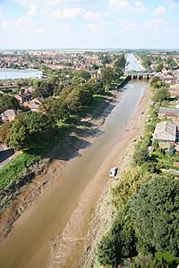
Grand Sluice, Boston. The point when the Witham becomes the tidal Haven.
|
Y
| Name |
Alternative Name(s) |
Length (km) |
Basin (km2) |
Source |
Source Elevation (m) |
Mouth |
Mouth Elevation (m) |
Discharge at mouth m3/s (average) |
Discharge at mouth m3/s (maximum) |
Notes |
Image |
|
|
|
|
|
|
|
|
|
|
|
|


