Limes (Roman Empire) facts for kids
| UNESCO World Heritage Site | |
|---|---|

The limes Germanicus, 2nd century
|
|
| Location | The valleys of the Rhine and the Danube; Britain. |
| Includes | Hadrian's Wall, Roman defenses along the Cumbrian coast, and the Limes Germanicus; the Antonine Wall is a later addition to this site |
| Criteria | Cultural ii, iii, iv |
| Inscription | 1987 (11th Session) |
| Extensions | 2005, 2008 |
| Area | 526.9 ha |
| Buffer zone | 5,225.7 ha |
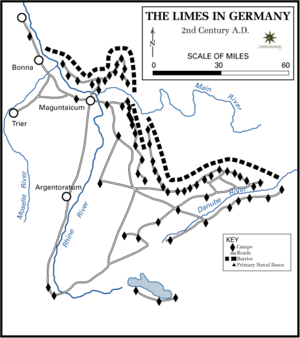
Limes (plural limites) is a modern term used for the Roman border defence in Germany. It marks the borders of the Roman Empire, though it was not used by the Romans for this purpose.
The term has been extended to refer to the frontier defences in other parts of the empire, such as in the east and in Africa. It is used by the World Heritage site bureaucracy to include the two walls in Britain, the Antonine Wall and Hadrian's Wall.
The Limes is often associated with Roman forts, but it could apply to any area near the walls where the Romans exercised loose control with military forces.
Images for kids
-
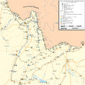
Map of fortifications and castles in North Britain around 155 AD (most forts on and south of Hadrian's Wall have been omitted).
-
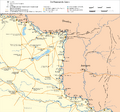
Limes Africanus under Septimius Severus (The frontier of Roman Africa (dark tan) in the late 2nd century AD: Septimius Severus expanded the Limes Tripolitanus dramatically (medium tan), even briefly holding a military presence (light tan) in the Garamantian capital Garama in 203)
See also
 In Spanish: Limes para niños


