Kalama River facts for kids
Quick facts for kids Kalama River |
|
|---|---|

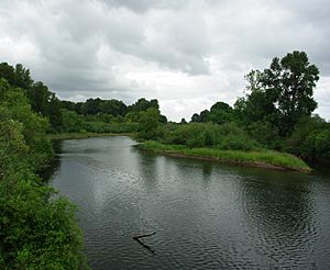
Near the mouth at Kalama
|
|
|
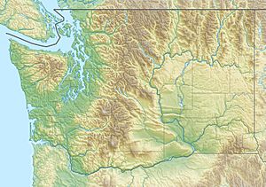
Location of the mouth of Kalama River in Washington
|
|
| Country | United States |
| State | Washington |
| County | Cowlitz |
| Physical characteristics | |
| Main source | Kalama Spring Mount St. Helens National Volcanic Monument 2,890 ft (880 m) 46°08′44″N 122°15′05″W / 46.14556°N 122.25139°W |
| River mouth | Columbia River near Kalama 10 ft (3.0 m) 46°02′01″N 122°52′13″W / 46.03361°N 122.87028°W |
| Length | 45 mi (72 km) |
| Basin features | |
| Basin size | 205 sq mi (530 km2) |
The Kalama River is a 45-mile (72 km) tributary of the Columbia River, in the U.S. state of Washington. It flows entirely within Cowlitz County, Washington. Calama River is an old variant name.
Gabriel Franchere in 1811 wrote of the Indian village at the mouth of the Kalama River, adding that it was called Thlakalamah.
Course
The Kalama River originates in the Cascade Range just south of Mount St. Helens. It flows generally west, joining the Columbia River near Kalama, 73 miles (117 km) upstream of the larger river's mouth on the Pacific Ocean.

All content from Kiddle encyclopedia articles (including the article images and facts) can be freely used under Attribution-ShareAlike license, unless stated otherwise. Cite this article:
Kalama River Facts for Kids. Kiddle Encyclopedia.


