Juneau, Wisconsin facts for kids
Quick facts for kids
Juneau, Wisconsin
|
|
|---|---|

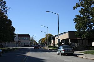
Downtown Juneau
|
|

Location of Juneau in Dodge County, Wisconsin.
|
|
| Country | |
| State | |
| County | Dodge |
| Area | |
| • Total | 1.65 sq mi (4.27 km2) |
| • Land | 1.65 sq mi (4.27 km2) |
| • Water | 0.00 sq mi (0.00 km2) |
| Elevation | 925 ft (282 m) |
| Population
(2020)
|
|
| • Total | 2,658 |
| • Density | 1,611.9/sq mi (622.5/km2) |
| Time zone | UTC-6 (Central (CST)) |
| • Summer (DST) | UTC-5 (CDT) |
| ZIP Code |
53039
|
| Area code(s) | 920 |
| FIPS code | 55-38675 |
| GNIS feature ID | 1567322 |
Juneau is a city in Dodge County, Wisconsin, United States. The population was 2,658 at the 2020 census. It is the county seat of Dodge County.
Contents
History
Juneau was founded in 1845 by settlers Martin Rich and William Dennis. It became the county seat of Dodge County in 1846. The founders originally named the settlement "Victory" and then "Dodge Center", from the German "Deutsch Center", but finding these names in conflict with other places, the town changed its name to Juneau in 1852. Most sources say that Juneau was named after French-Canadian trader Solomon Juneau, the founder of Milwaukee and of Theresa, Wisconsin. The city itself claims to be named for Paul Juneau, Solomon Juneau's part-Menominee son, a businessman and state legislator who made his home in the city and served as county register of deeds until his accidental shooting death outside the courthouse in Juneau in 1858. Juneau was incorporated as a village in 1865 and a city in 1879.
Geography
Juneau is located at 43°24′23″N 88°42′12″W / 43.40639°N 88.70333°W (43.406251, -88.703399).
According to the United States Census Bureau, the city has a total area of 1.65 square miles (4.27 km2), all of it land.
Demographics
| Historical population | |||
|---|---|---|---|
| Census | Pop. | %± | |
| 1870 | 300 | — | |
| 1880 | 454 | 51.3% | |
| 1890 | 701 | 54.4% | |
| 1900 | 891 | 27.1% | |
| 1910 | 1,003 | 12.6% | |
| 1920 | 1,159 | 15.6% | |
| 1930 | 1,154 | −0.4% | |
| 1940 | 1,301 | 12.7% | |
| 1950 | 1,444 | 11.0% | |
| 1960 | 1,718 | 19.0% | |
| 1970 | 2,043 | 18.9% | |
| 1980 | 2,045 | 0.1% | |
| 1990 | 2,157 | 5.5% | |
| 2000 | 2,485 | 15.2% | |
| 2010 | 2,814 | 13.2% | |
| 2020 | 2,658 | −5.5% | |
| U.S. Decennial Census | |||
2020 census
As of the census of 2020, the population was 2,658. The population density was 1,611.9 inhabitants per square mile (622.4/km2). There were 926 housing units at an average density of 561.6 per square mile (216.8/km2). The racial makeup of the city was 87.5% White, 2.4% Black or African American, 0.4% Native American, 0.2% Asian, 5.8% from other races, and 3.6% from two or more races. Ethnically, the population was 9.0% Hispanic or Latino of any race.
2010 census
As of the census of 2010, there were 2,814 people, 852 households, and 561 families living in the city. The population density was 1,675.0 inhabitants per square mile (646.7/km2). There were 924 housing units at an average density of 550.0 per square mile (212.4/km2). The racial makeup of the city was 93.2% White, 3.6% African American, 0.4% Native American, 0.9% Asian, 1.4% from other races, and 0.5% from two or more races. Hispanic or Latino of any race were 10.1% of the population.
There were 852 households, of which 34.9% had children under the age of 18 living with them, 51.1% were married couples living together, 9.6% had a female householder with no husband present, 5.2% had a male householder with no wife present, and 34.2% were non-families. 29.8% of all households were made up of individuals, and 11.3% had someone living alone who was 65 years of age or older. The average household size was 2.46 and the average family size was 3.03.
The median age in the city was 38 years. 19.9% of residents were under the age of 18; 9.5% were between the ages of 18 and 24; 31.1% were from 25 to 44; 25.3% were from 45 to 64; and 14.2% were 65 years of age or older. The gender makeup of the city was 56.1% male and 43.9% female.
Education
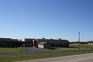
Dodgeland High School is the area's public high school. The school is part of the Dodgeland School District. St. Johns Lutheran School serves students through grade 8.
Transportation
Wisconsin Highway 26 runs through the city's downtown area.
General aviation in the area is served by the Dodge County Airport (KUNU), located just north of Juneau.
Juneau was served by the Chicago & North Western line between Janesville and Fond Du Lac. It was eventually abandoned south of Fort Atkinson and North of Clyman.
Notable people
- Hiram Barber, Jr., U.S. Representative from Illinois
- Byron Buffington, Wisconsin State Assemblyman
- Jesse A. Canniff, Wisconsin State Assemblyman
- Eugene A. Clifford, Wisconsin State Senator
- John W. DeGroff, Wisconsin State Senator
- Robert Goetsch, Wisconsin State Assemblyman
- Eli Hawks, Wisconsin State Assemblyman and mayor of Juneau
- Addie Joss, baseball Hall of Fame pitcher who grew up in Juneau
- Martin L. Lueck, politician and judge
See also
 In Spanish: Juneau (Wisconsin) para niños


