
Dodge County, Wisconsin facts for kids
Quick facts for kids
Dodge County
|
|
|---|---|

Dodge County Administration building
|
|

Location within the U.S. state of Wisconsin
|
|
 Wisconsin's location within the U.S. |
|
| Country | |
| State | |
| Founded | 1844 |
| Named for | Henry Dodge |
| Seat | Juneau |
| Largest city | Beaver Dam |
| Area | |
| • Total | 907 sq mi (2,350 km2) |
| • Land | 876 sq mi (2,270 km2) |
| • Water | 31 sq mi (80 km2) 3.5% |
| Population
(2020)
|
|
| • Total | 89,396 |
| • Estimate
(2023)
|
88,231 |
| • Density | 102.1/sq mi (39.4/km2) |
| Time zone | UTC−6 (Central) |
| • Summer (DST) | UTC−5 (CDT) |
| Congressional districts | 5th, 6th |
Dodge County is a county located in the U.S. state of Wisconsin. As of the 2020 census, the population was 89,396. Its county seat is Juneau. The county was created from the Wisconsin Territory in 1836 and organized in 1844.
Dodge County comprises the Beaver Dam, WI Micropolitan Statistical Area, which is included in the Milwaukee–Racine–Waukesha, WI Combined Statistical Area.
Contents
Geography
According to the U.S. Census Bureau, the county has a total area of 907 square miles (2,350 km2), of which 876 square miles (2,270 km2) is land and 31 square miles (80 km2) (3.5%) is water.
The 6,718 acre Beaver Dam Lake and the 2,713 acre Fox Lake are found within the county.
Adjacent counties
- Fond du Lac County – northeast
- Washington County – east
- Waukesha County – southeast
- Jefferson County – south
- Dane County – southwest
- Columbia County – west
- Green Lake County – northwest
National protected area
- Horicon National Wildlife Refuge (part)
Climate
|
||||||||||||||||||||||||||||||||||||||||||||||||||||||||||||||||||||||||||||||||||||||||||||||||
Demographics
| Historical population | |||
|---|---|---|---|
| Census | Pop. | %± | |
| 1840 | 67 | — | |
| 1850 | 19,138 | 28,464.2% | |
| 1860 | 42,818 | 123.7% | |
| 1870 | 47,035 | 9.8% | |
| 1880 | 45,931 | −2.3% | |
| 1890 | 44,984 | −2.1% | |
| 1900 | 46,631 | 3.7% | |
| 1910 | 47,436 | 1.7% | |
| 1920 | 49,742 | 4.9% | |
| 1930 | 52,092 | 4.7% | |
| 1940 | 54,280 | 4.2% | |
| 1950 | 57,611 | 6.1% | |
| 1960 | 63,170 | 9.6% | |
| 1970 | 69,004 | 9.2% | |
| 1980 | 75,064 | 8.8% | |
| 1990 | 76,559 | 2.0% | |
| 2000 | 85,897 | 12.2% | |
| 2010 | 88,759 | 3.3% | |
| 2020 | 89,396 | 0.7% | |
| U.S. Decennial Census 1790–1960 1900–1990 1990–2000 2010–2020 |
|||
2020 census
As of the census of 2020, the population was 89,396. The population density was 102.1 people per square mile (39.4 people/km2). There were 38,123 housing units at an average density of 43.5 units per square mile (16.8 units/km2). The racial makeup of the county was 88.8% White, 3.1% Black or African American, 0.6% Asian, 0.5% Native American, 2.4% from other races, and 4.6% from two or more races. Ethnically, the population was 6.1% Hispanic or Latino of any race.


Transportation
Major highways
 Interstate 41
 U.S. Highway 41
 U.S. Highway 151
 Highway 16
 Highway 19
 Highway 26
 Highway 28
 Highway 33
 Highway 49
 Highway 60
 Highway 67
 Highway 68
 Highway 73
 Highway 89
 Highway 175
Railroads
- Amtrak
- Canadian National
- Canadian Pacific
- Union Pacific
- Wisconsin and Southern Railroad
Airport
- Dodge County Airport (KUNU) serves the county and surrounding communities.
Communities
Cities
- Beaver Dam
- Columbus (mostly in Columbia County)
- Fox Lake
- Hartford (part; mostly in Washington County)
- Horicon
- Juneau (county seat)
- Mayville
- Watertown (mostly in Jefferson County)
- Waupun (partly in Fond du Lac County)
Villages
Towns
Census-designated places
Unincorporated communities
- Alderley
- Astico
- Atwater
- Beaver Edge
- Clyman Junction
- Danville
- Delbern Acres
- East Waupun
- Farmersville
- Fox Lake Junction
- Herman Center
- Hochheim
- Huilsburg
- Knowles
- LeRoy
- Leipsig
- Lost Lake
- Lyndon Dale
- Minnesota Junction
- Nasbro
- Neda
- North Lowell
- Oak Grove
- Old Ashippun
- Old Lebanon
- Portland (partial)
- Richwood
- Rolling Prairie
- Rubicon
- Saylesville
- South Beaver Dam
- South Randolph
- Sugar Island
- Sunset Beach
- Theresa Station
- Woodland
Ghost town
Gallery
-

Dodge County Fairgrounds
-

Dodge County Historical Society
-
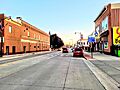
Downtown Beaver Dam, Wisconsin
-
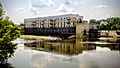
Watertown Riverwalk


See also
 In Spanish: Condado de Dodge (Wisconsin) para niños
