Ironbark, Queensland facts for kids
Quick facts for kids IronbarkIpswich, Queensland |
|||||||||||||||
|---|---|---|---|---|---|---|---|---|---|---|---|---|---|---|---|

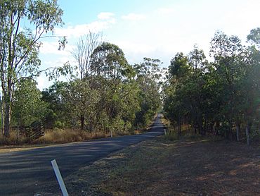
Beethams Road, 2014
|
|||||||||||||||
| Population | 1,173 (2021 census) | ||||||||||||||
| • Density | 77.68/km2 (201.2/sq mi) | ||||||||||||||
| Postcode(s) | 4306 | ||||||||||||||
| Area | 15.1 km2 (5.8 sq mi) | ||||||||||||||
| Time zone | AEST (UTC+10:00) | ||||||||||||||
| Location | |||||||||||||||
| LGA(s) | City of Ipswich | ||||||||||||||
| State electorate(s) | Ipswich West | ||||||||||||||
| Federal Division(s) | Blair | ||||||||||||||
|
|||||||||||||||
Ironbark is a rural locality in the City of Ipswich, Queensland, Australia. In the 2021 census, Ironbark had a population of 1,173 people.
Geography
The eastern boundary of Ironbark is marked by the Brisbane Valley Highway and the southern boundary follows the Warrego Highway. Haigslea–Amberley Road runs south through Walloon from the southwest corner.
Demographics
In the 2016 census, Ironbark had a population of 604 people.
In the 2021 census, Ironbark had a population of 1,173 people.

All content from Kiddle encyclopedia articles (including the article images and facts) can be freely used under Attribution-ShareAlike license, unless stated otherwise. Cite this article:
Ironbark, Queensland Facts for Kids. Kiddle Encyclopedia.

