Blacksoil, Queensland facts for kids
Quick facts for kids BlacksoilIpswich, Queensland |
|||||||||||||||
|---|---|---|---|---|---|---|---|---|---|---|---|---|---|---|---|

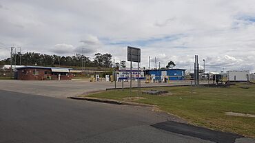
Eleazar Drive, 2023
|
|||||||||||||||
| Population | 106 (2021 census) | ||||||||||||||
| • Density | 58.9/km2 (153/sq mi) | ||||||||||||||
| Postcode(s) | 4306 | ||||||||||||||
| Area | 1.8 km2 (0.7 sq mi) | ||||||||||||||
| Time zone | AEST (UTC+10:00) | ||||||||||||||
| Location |
|
||||||||||||||
| LGA(s) | City of Ipswich | ||||||||||||||
| State electorate(s) | Ipswich West | ||||||||||||||
| Federal Division(s) | Blair | ||||||||||||||
|
|||||||||||||||
Blacksoil is a rural locality in the City of Ipswich, Queensland, Australia. In the 2021 census, Blacksoil had a population of 106 people.
History
Blacksoil was officially named as a locality by the Queensland Place Names Board on 1 July 1978. It was officially bounded on 8 September 2000.
Demographics
In the 2016 census, Blacksoil had a population of 104 people.
In the 2021 census, Blacksoil had a population of 106 people.
Education
There are no schools in Blacksoil. The nearest government primary schools are Brassall State School in neighbouring Brassall to the south-west and Walloon State School in Walloon to the south-west. The nearest governmenet secondary school is Ipswich State High School, also in Brassall.

All content from Kiddle encyclopedia articles (including the article images and facts) can be freely used under Attribution-ShareAlike license, unless stated otherwise. Cite this article:
Blacksoil, Queensland Facts for Kids. Kiddle Encyclopedia.

