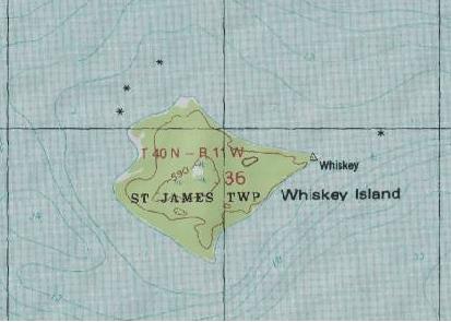
Image: Whiskey Island, Michigan, topo map
Whiskey_Island,_Michigan,_topo_map.jpg (413 × 295 pixels, file size: 20 KB, MIME type: image/jpeg)
Description: Topographical map of Whiskey Island in the Beaver Island group in Lake Michigan
Title: Whiskey Island, Michigan, topo map
Credit: http://www.topozone.com/map.asp?lon=-85.6098137&lat=45.8116629&datum=nad83
Author: US Geologic Survey
Usage Terms: Public domain
License: Public domain
Attribution Required?: No
Image usage
The following page links to this image:

All content from Kiddle encyclopedia articles (including the article images and facts) can be freely used under Attribution-ShareAlike license, unless stated otherwise.

